
| Birth | : | 1912 Okanogan County, Washington, USA |
| Death | : | Jul 2000 Okanogan County, Washington, USA |
| Burial | : | Oroville Riverview Cemetery, Oroville, Okanogan County, USA |
| Coordinate | : | 48.9202700, -119.4458500 |
| Plot | : | SW Row Q 309-4 |
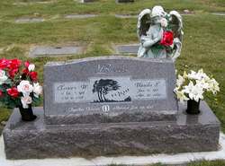
| Description | : | Mabel Bear Cook, age 88, passed away on Thursday, July 27, 2000, at the Life Care Center in Sand Point, ID. She was born on April 29, 1912, at Buckley, to John and Daisey (Burbank) Bear. The family moved to Pine Creek in 1918 and on July 3, 1930, she married William H. Cook. She is survived by three children, Les of Salem, OR, Lela Osborne of Sand Point, ID and Richard W. Cook of Tonasket; two brothers, Bill of Omak and Clarence of Port Angeles; two sisters, Vera Hobart and June Brantner, both of Okanogan; 11 grandchildren; 25 great-grandchildren; and one great-great-granddaughter. She... Read More |
frequently asked questions (FAQ):
-
Where is Mabel Bear Cook's memorial?
Mabel Bear Cook's memorial is located at: Oroville Riverview Cemetery, Oroville, Okanogan County, USA.
-
When did Mabel Bear Cook death?
Mabel Bear Cook death on Jul 2000 in Okanogan County, Washington, USA
-
Where are the coordinates of the Mabel Bear Cook's memorial?
Latitude: 48.9202700
Longitude: -119.4458500
Family Members:
Parent
Spouse

Siblings
Flowers:


Nearby Cemetories:
1. Oroville Riverview Cemetery
Oroville, Okanogan County, USA
Coordinate: 48.9202700, -119.4458500
2. Old Riverview Cemetery
Oroville, Okanogan County, USA
Coordinate: 48.9177800, -119.4466700
3. Old Oroville Cemetery
Okanogan County, USA
Coordinate: 48.8913360, -119.4456230
4. Golden Cemetery
Okanogan County, USA
Coordinate: 48.9014015, -119.5203018
5. Mountain View Memorial Cemetery
Ellisforde, Okanogan County, USA
Coordinate: 48.8328300, -119.4011300
6. Ellisforde Mission Cemetery
Ellisforde, Okanogan County, USA
Coordinate: 48.7908300, -119.3972300
7. Mountain View Cemetery
Loomis, Okanogan County, USA
Coordinate: 48.8152700, -119.6100100
8. Osoyoos Lakeview Cemetery
Osoyoos, Okanagan-Similkameen Regional District, Canada
Coordinate: 49.0638600, -119.5185500
9. Little Chopaka Cemetery
Okanogan County, USA
Coordinate: 48.8272200, -119.6430600
10. Molson Cemetery
Molson, Okanogan County, USA
Coordinate: 48.9657000, -119.2105000
11. Sidley-Lawless Cemetery
Sidley, Kootenay Boundary Regional District, Canada
Coordinate: 49.0153330, -119.2234330
12. Immanuel Lutheran Cemetery
Havillah, Okanogan County, USA
Coordinate: 48.8305500, -119.2033500
13. Kipling Cemetery
Okanogan County, USA
Coordinate: 48.9080500, -119.1652900
14. Tonasket Cemetery
Tonasket, Okanogan County, USA
Coordinate: 48.7284400, -119.4328200
15. Valley Congregational Church Memorial Rose Garden
Oliver, Okanagan-Similkameen Regional District, Canada
Coordinate: 49.1169070, -119.5575920
16. Bridesville Cemetery
Bridesville, Kootenay Boundary Regional District, Canada
Coordinate: 49.0370800, -119.1372300
17. Chesaw Cemetery
Okanogan County, USA
Coordinate: 48.9299900, -119.0541800
18. Oliver Cemetery
Oliver, Okanagan-Similkameen Regional District, Canada
Coordinate: 49.1767600, -119.5697000
19. Fairview Cemetery
Fairview, Okanagan-Similkameen Regional District, Canada
Coordinate: 49.1742600, -119.5998800
20. Thorp Cemetery
Chesaw, Okanogan County, USA
Coordinate: 48.9549900, -119.0316700
21. Anglin Cemetery
Okanogan County, USA
Coordinate: 48.6627700, -119.2783400
22. Phillip Raux Gravesite
Riverside, Okanogan County, USA
Coordinate: 48.6271800, -119.3308500
23. Wauconda Cemetery
Wauconda, Okanogan County, USA
Coordinate: 48.7408300, -119.0597300
24. Pine Creek Cemetery
Tonasket, Okanogan County, USA
Coordinate: 48.6330560, -119.6502780