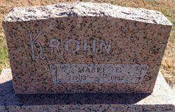
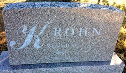
Mabel Ella Dodge Krohn
| Birth | : | 16 Mar 1902 Rydal, Republic County, Kansas, USA |
| Death | : | Feb 1982 Belleville, Republic County, Kansas, USA |
| Burial | : | Hollis Cemetery, Cloud County, USA |
| Coordinate | : | 39.6383018, -97.5361023 |
| Plot | : | B/6 |
| Description | : | Mrs. Mabel E. Krohn, daughter of George and Katherine (Little) Dodge, was born March 16, 1902, in Rydal, and died at Republic County Hospital in Belleville, February 27, 1982. She was 79. She was married to Wendell O. Krohn on August 16, 1923, at her parents home near Talmo. The newspaper account of their wedding describes it as beautiful yet simple. The home was decorated in lavender and white with cut flowers and potted plants. Her dress was made of white taffeta and Spanish lace. A luncheon was served to 75 guests. Mabel had graduated... Read More |
frequently asked questions (FAQ):
-
Where is Mabel Ella Dodge Krohn's memorial?
Mabel Ella Dodge Krohn's memorial is located at: Hollis Cemetery, Cloud County, USA.
-
When did Mabel Ella Dodge Krohn death?
Mabel Ella Dodge Krohn death on Feb 1982 in Belleville, Republic County, Kansas, USA
-
Where are the coordinates of the Mabel Ella Dodge Krohn's memorial?
Latitude: 39.6383018
Longitude: -97.5361023
Family Members:
Flowers:
Nearby Cemetories:
1. Hollis Cemetery
Cloud County, USA
Coordinate: 39.6383018, -97.5361023
2. Zion Cemetery
Agenda, Republic County, USA
Coordinate: 39.6749992, -97.5939026
3. Beck Family Cemetery
Agenda, Republic County, USA
Coordinate: 39.6818000, -97.4863000
4. Union Cemetery
Wayne, Republic County, USA
Coordinate: 39.6977997, -97.5457993
5. Gotland Cemetery
Sibley Township, Cloud County, USA
Coordinate: 39.6091995, -97.6125031
6. Minersville Cemetery
Talmo, Republic County, USA
Coordinate: 39.6568330, -97.6229250
7. Walnut Grove Cemetery
Cloud County, USA
Coordinate: 39.5699997, -97.4993973
8. Rose Hill Cemetery
Wayne, Republic County, USA
Coordinate: 39.7111015, -97.5661011
9. Rice Cemetery
Rice, Cloud County, USA
Coordinate: 39.5614014, -97.5552979
10. Agenda Cemetery
Agenda, Republic County, USA
Coordinate: 39.6761017, -97.4336014
11. Murdock Family Cemetery
Cloud County, USA
Coordinate: 39.6386400, -97.6504800
12. Saron Lutheran Cemetery
Sibley Township, Cloud County, USA
Coordinate: 39.6385994, -97.6511002
13. Mount Hope Cemetery
Clyde, Cloud County, USA
Coordinate: 39.5969009, -97.4116974
14. Mount Calvary Cemetery
Clyde, Cloud County, USA
Coordinate: 39.5917015, -97.4143982
15. Frontier Cemetery
Belleville, Republic County, USA
Coordinate: 39.7400017, -97.5986023
16. Nelson Cemetery
Rice, Cloud County, USA
Coordinate: 39.5257988, -97.5410995
17. Green Mound Cemetery
Rice, Cloud County, USA
Coordinate: 39.5248450, -97.5081630
18. West Creek Cemetery
Belleville, Republic County, USA
Coordinate: 39.7041660, -97.6608930
19. Saint Concordia Cemetery
Concordia, Cloud County, USA
Coordinate: 39.5593800, -97.6503100
20. Sibley Cemetery
Sibley Township, Cloud County, USA
Coordinate: 39.6096992, -97.6908035
21. Nazareth Convent Cemetery
Concordia, Cloud County, USA
Coordinate: 39.5614000, -97.6612000
22. Pleasant View Cemetery
Ames, Cloud County, USA
Coordinate: 39.5346985, -97.4431000
23. Pleasant Hill Cemetery
Concordia, Cloud County, USA
Coordinate: 39.5583000, -97.6639023
24. Nelson Family Cemetery
Sibley Township, Cloud County, USA
Coordinate: 39.6366600, -97.7010600


