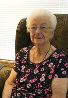
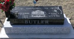
Maida Julliette Butler
| Birth | : | 1930 |
| Death | : | 3 Jun 2021 Lethbridge Census Division, Alberta, Canada |
| Burial | : | Glenwood Cemetery, Glenwood, Claresholm Census Division, Canada |
| Coordinate | : | 49.3859800, -113.5003500 |
| Description | : | BUTLER We are saddened to announce the passing of MAIDA JULIETTE BUTLER, beloved wife of the late LeVerre Butler on June 03, 2021. Maida passed peacefully at Saint Michael's Health Centre in Lethbridge, Alberta, at the age of 90 years. She was the mother of 5, grandmother of 21, great-grandmother of 51, and great-great-grandmother of 1. Legacy Funeral Home, Cardston, will host the Meet the family June 11, 2021, from 7–8 PM. The Family funeral service will be held June 12, 2021, 10 AM. Due to Covid-19 restrictions the funeral will be live-streamed on the Legacy... Read More |
frequently asked questions (FAQ):
-
Where is Maida Julliette Butler's memorial?
Maida Julliette Butler's memorial is located at: Glenwood Cemetery, Glenwood, Claresholm Census Division, Canada.
-
When did Maida Julliette Butler death?
Maida Julliette Butler death on 3 Jun 2021 in Lethbridge Census Division, Alberta, Canada
-
Where are the coordinates of the Maida Julliette Butler's memorial?
Latitude: 49.3859800
Longitude: -113.5003500
Family Members:
Spouse
Flowers:
Nearby Cemetories:
1. Glenwood Cemetery
Glenwood, Claresholm Census Division, Canada
Coordinate: 49.3859800, -113.5003500
2. Pioneer Cemetery
Levern, Claresholm Census Division, Canada
Coordinate: 49.3489700, -113.4642000
3. Thompson Hutterite Cemetery
Glenwood, Claresholm Census Division, Canada
Coordinate: 49.4269974, -113.5401975
4. Riverside Hutterite Colony Cemetery
Glenwood, Claresholm Census Division, Canada
Coordinate: 49.4379404, -113.4492438
5. Ewelme Hutterite Cemetery
Glenwood, Claresholm Census Division, Canada
Coordinate: 49.4510436, -113.4906843
6. Hartley Cemetery
Hartleyville, Claresholm Census Division, Canada
Coordinate: 49.3777000, -113.6227000
7. Springridge Mennonite Church Cemetery
Springridge, Claresholm Census Division, Canada
Coordinate: 49.4529305, -113.6340179
8. Hill Spring Pioneer Cemetery
Hill Spring, Claresholm Census Division, Canada
Coordinate: 49.3035000, -113.6249000
9. Hill Spring Cemetery
Hill Spring, Claresholm Census Division, Canada
Coordinate: 49.3128700, -113.6436100
10. Fishburn United Church Cemetery
Pincher Creek, Claresholm Census Division, Canada
Coordinate: 49.3783700, -113.7011300
11. Saint Catherine Cemetery
Stand Off, Claresholm Census Division, Canada
Coordinate: 49.4516900, -113.3112300
12. Standoff Hutterite Colony Cemetery
Stand Off, Claresholm Census Division, Canada
Coordinate: 49.4829507, -113.3130885
13. Waterton Hutterite Cemetery
Hill Spring, Claresholm Census Division, Canada
Coordinate: 49.2661602, -113.6918691
14. Blue Ridge Hutterite Cemetery
Hill Spring, Claresholm Census Division, Canada
Coordinate: 49.2320117, -113.6305672
15. Saint Henry's Roman Catholic Church Cemetery
Twin Butte, Claresholm Census Division, Canada
Coordinate: 49.3189900, -113.7728900
16. Brocket Colony Cemetery
Pincher Creek, Claresholm Census Division, Canada
Coordinate: 49.4655200, -113.7694100
17. West Raley Hutterite Cemetery
Raley, Claresholm Census Division, Canada
Coordinate: 49.2908857, -113.2283616
18. Leavitt Cemetery
Leavitt, Claresholm Census Division, Canada
Coordinate: 49.1830500, -113.4768200
19. Cardston Cemetery
Cardston, Claresholm Census Division, Canada
Coordinate: 49.1906900, -113.3415300
20. Brocket Cemetery
Brocket, Claresholm Census Division, Canada
Coordinate: 49.5457100, -113.7667700
21. Pincher Creek Mennonite Brethren Cemetery
Pincher Creek, Claresholm Census Division, Canada
Coordinate: 49.4699090, -113.8627370
22. Mountain View Cemetery
Mountain View, Claresholm Census Division, Canada
Coordinate: 49.1293300, -113.5986300
23. East Cardston Hutterite Cemetery
Cardston, Claresholm Census Division, Canada
Coordinate: 49.1908348, -113.2258004
24. Beazer Cemetery
Beazer, Claresholm Census Division, Canada
Coordinate: 49.1097500, -113.4975800


