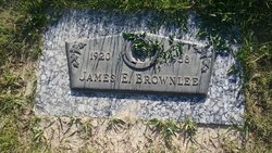
| Birth | : | 6 Jan 1885 Lyons, Laclede County, Missouri, USA |
| Death | : | 14 Oct 1959 Choteau, Teton County, Montana, USA |
| Burial | : | Mount Hope Cemetery, Independence, Montgomery County, USA |
| Coordinate | : | 37.2413300, -95.7060050 |
| Description | : | Malissa Jane Vermillion was born in Missouri, Jan. 6, 1885. She was educated and grew to womanhood there and on Dec. 9, 1909, she married James R. Brownlee in Delto, MO. In 1911 they came to Hartline, WA, and stayed there one year and in 1912 moved to Gildford where they farmed until Aug. 1945 when they retired to make their home in Kalispell. Malissa was survived by one son, Mack, in Gildford; three daughters, Mrs. Phil Doughty, Augusta, Mrs. Dean Howey, Seattle, Mrs. Edith Kennedy, Coquille, OR, and ten grandchildren. She was also survived by four... Read More |
frequently asked questions (FAQ):
-
Where is Malissa Jane Vermillion Brownlee's memorial?
Malissa Jane Vermillion Brownlee's memorial is located at: Mount Hope Cemetery, Independence, Montgomery County, USA.
-
When did Malissa Jane Vermillion Brownlee death?
Malissa Jane Vermillion Brownlee death on 14 Oct 1959 in Choteau, Teton County, Montana, USA
-
Where are the coordinates of the Malissa Jane Vermillion Brownlee's memorial?
Latitude: 37.2413300
Longitude: -95.7060050
Family Members:
Parent
Spouse
Siblings
Children
Flowers:
Nearby Cemetories:
1. Mount Hope Cemetery
Independence, Montgomery County, USA
Coordinate: 37.2413300, -95.7060050
2. Calvary Cemetery
Independence, Montgomery County, USA
Coordinate: 37.2486000, -95.7043991
3. Saint Andrews Cemetery
Independence, Montgomery County, USA
Coordinate: 37.2566986, -95.6658020
4. Pratt Cemetery
Montgomery County, USA
Coordinate: 37.2324982, -95.6557999
5. Le Hunt Cemetery
Montgomery County, USA
Coordinate: 37.2744300, -95.7586200
6. Radical Cemetery
Montgomery County, USA
Coordinate: 37.2882996, -95.7416992
7. Bethel Cemetery
Independence, Montgomery County, USA
Coordinate: 37.2761002, -95.6457977
8. Montgomery County Poor Farm Cemetery
Liberty, Montgomery County, USA
Coordinate: 37.1888590, -95.6493690
9. Choteau Cemetery
Independence, Montgomery County, USA
Coordinate: 37.3194700, -95.6746700
10. Harmony Cemetery
Cherryvale, Montgomery County, USA
Coordinate: 37.2324982, -95.5950012
11. Quaker Cemetery
Elk City, Montgomery County, USA
Coordinate: 37.2395900, -95.8243400
12. Thompson Homestead Cemetery
Liberty, Montgomery County, USA
Coordinate: 37.1767000, -95.6183100
13. Krone Cemetery
Montgomery County, USA
Coordinate: 37.3302400, -95.7494600
14. Highland Cemetery
Montgomery County, USA
Coordinate: 37.2092018, -95.8283005
15. Saint Francis Xavier Cemetery
Cherryvale, Montgomery County, USA
Coordinate: 37.2633018, -95.5753021
16. Liberty Cemetery
Liberty, Montgomery County, USA
Coordinate: 37.1581890, -95.6001580
17. Pleasant Dale Cemetery
Cherryvale, Montgomery County, USA
Coordinate: 37.3139700, -95.5860700
18. Parker Cemetery
Montgomery County, USA
Coordinate: 37.2630997, -95.8572006
19. Spring Hill Cemetery
Montgomery County, USA
Coordinate: 37.1235600, -95.6595500
20. Simpson Cemetery
Elk City, Montgomery County, USA
Coordinate: 37.3269005, -95.8186035
21. Centennial Cemetery
Cherryvale, Montgomery County, USA
Coordinate: 37.2296982, -95.5466995
22. Hinton Cemetery
Liberty, Montgomery County, USA
Coordinate: 37.1384900, -95.6101000
23. Spindletop Cemetery
Cherryvale, Montgomery County, USA
Coordinate: 37.2958400, -95.5570700
24. All Saints Cemetery
Liberty, Montgomery County, USA
Coordinate: 37.1542015, -95.5757980


