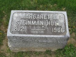
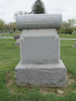
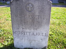
Margaret Esther Smith Hull
| Birth | : | 5 Jul 1872 Sandusky County, Ohio, USA |
| Death | : | 17 Jan 1966 Pioneer, Williams County, Ohio, USA |
| Burial | : | Hueston Cemetery, Forest, Hardin County, USA |
| Coordinate | : | 40.8041992, -83.5547028 |
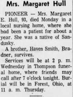
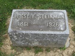
| Description | : | Margaret Esther Hull, daughter of Richard and Margret Ann (Von Thurn) Smith was born July 5, 1872 in Sandusky County and departed this life January 17, 1966 at the Coats Rest Home in Pioneer, aged 93 years, six months and 12 days. On Dec. 1, 1907, she was united in marriage to J. F. Steinman of Forrest, Ohio. To this union no children were born. In March, 1926 he passed to the great beyond. On Nov. 15, 1926 she was united in marriage to Merritt Hull who passed away in 1932. She accepted Christ at an early age... Read More |
frequently asked questions (FAQ):
-
Where is Margaret Esther Smith Hull's memorial?
Margaret Esther Smith Hull's memorial is located at: Hueston Cemetery, Forest, Hardin County, USA.
-
When did Margaret Esther Smith Hull death?
Margaret Esther Smith Hull death on 17 Jan 1966 in Pioneer, Williams County, Ohio, USA
-
Where are the coordinates of the Margaret Esther Smith Hull's memorial?
Latitude: 40.8041992
Longitude: -83.5547028
Family Members:
Flowers:
Nearby Cemetories:
1. Hueston Cemetery
Forest, Hardin County, USA
Coordinate: 40.8041992, -83.5547028
2. Price Cemetery
Hardin County, USA
Coordinate: 40.7894190, -83.5311400
3. Patterson Cemetery
Patterson, Hardin County, USA
Coordinate: 40.7873340, -83.5283400
4. Johnson Cemetery
Delaware Township, Hancock County, USA
Coordinate: 40.8410988, -83.5456009
5. Callahan Cemetery
Wyandot County, USA
Coordinate: 40.8106003, -83.4922028
6. Hall Family Cemetery
Hardin County, USA
Coordinate: 40.7620750, -83.5952380
7. Earlywine Cemetery
Mount Blanchard, Hancock County, USA
Coordinate: 40.8699989, -83.5875015
8. Dunkirk Cemetery
Dunkirk, Hardin County, USA
Coordinate: 40.7764015, -83.6417007
9. Spoon Cemetery
Wharton, Wyandot County, USA
Coordinate: 40.8574982, -83.4914017
10. Adams Cemetery
Mount Blanchard, Hancock County, USA
Coordinate: 40.8727989, -83.5180969
11. Williamstown Cemetery
Arlington, Hancock County, USA
Coordinate: 40.8349991, -83.6500015
12. Grant Cemetery
Grant, Hardin County, USA
Coordinate: 40.7242012, -83.5607986
13. Jackson Center Cemetery
Kirby, Wyandot County, USA
Coordinate: 40.7694016, -83.4574966
14. Armstrong Cemetery
Kirby, Wyandot County, USA
Coordinate: 40.8319016, -83.4471970
15. Wharton Cemetery
Wharton, Wyandot County, USA
Coordinate: 40.8581100, -83.4568700
16. Dola Cemetery
Dola, Hardin County, USA
Coordinate: 40.7799988, -83.6746979
17. Castor Cemetery
Arlington, Hancock County, USA
Coordinate: 40.8918991, -83.6044006
18. Burson Cemetery
Mount Blanchard, Hancock County, USA
Coordinate: 40.8998000, -83.5643000
19. Unidentified Cemetery #1
Jackson Township, Wyandot County, USA
Coordinate: 40.7389000, -83.4612670
20. Mount Blanchard Cemetery
Mount Blanchard, Hancock County, USA
Coordinate: 40.9036102, -83.5522232
21. Saint Mary Catholic Cemetery
Kirby, Wyandot County, USA
Coordinate: 40.8167200, -83.4165900
22. Krout Cemetery
Mount Blanchard, Hancock County, USA
Coordinate: 40.9129982, -83.5559998
23. Good Hope Cemetery
Wyandot County, USA
Coordinate: 40.7094002, -83.4828033
24. Riverview Cemetery
Mount Blanchard, Hancock County, USA
Coordinate: 40.9136009, -83.5563965

