Maria Ella Penrose Edmundson
| Birth | : | 4 Dec 1864 Iowa, USA |
| Death | : | 15 Nov 1901 Mount Pleasant, Miller County, Missouri, USA |
| Burial | : | Mount Pleasant Cemetery, Eldon, Miller County, USA |
| Coordinate | : | 38.3667700, -92.5300800 |
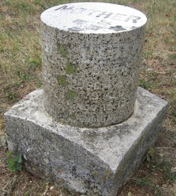
| Inscription | : | M. Ella Edmundson 4 Dec 1864-15 Nov 1901 Wife of Frank |
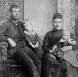
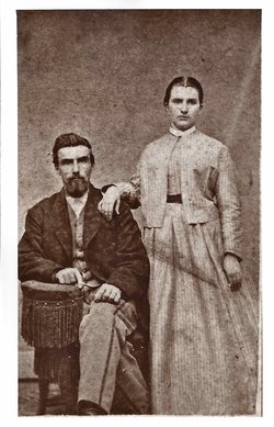
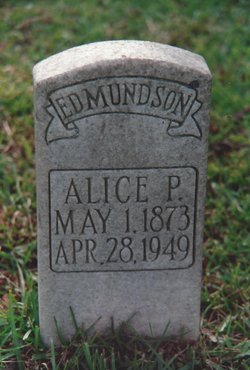
| Description | : | Migrating south from Iowa to Alabama, Frank & Ella settled for a while in a resort community known as Pleasant Mount, Missouri (now called Mt. Pleasant). While there in 1901 Ella gave birth to their fifth child (well past the customary due date). The child (Harry) died at birth and Ella died 11 days later. Ella and Harry were buried together in Pleasant Mount. Frank and Ella had previously lost another child (John Cleo b. 1892, d. 1894). Frank ultimately settled in Fairhope, AL. and in 1903 re-married to Ella's sister, Alice Hawley Penrose who went on to raise Frank's... Read More |
frequently asked questions (FAQ):
-
Where is Maria Ella Penrose Edmundson's memorial?
Maria Ella Penrose Edmundson's memorial is located at: Mount Pleasant Cemetery, Eldon, Miller County, USA.
-
When did Maria Ella Penrose Edmundson death?
Maria Ella Penrose Edmundson death on 15 Nov 1901 in Mount Pleasant, Miller County, Missouri, USA
-
Where are the coordinates of the Maria Ella Penrose Edmundson's memorial?
Latitude: 38.3667700
Longitude: -92.5300800
Family Members:
Parent
Spouse
Siblings
Children
Flowers:
Nearby Cemetories:
1. Mount Pleasant Cemetery
Eldon, Miller County, USA
Coordinate: 38.3667700, -92.5300800
2. Mount Vernon Cemetery
Eldon, Miller County, USA
Coordinate: 38.3624992, -92.5606003
3. Salem Cemetery
Saline Township, Miller County, USA
Coordinate: 38.3691232, -92.5697260
4. Salem Cemetery
Eldon, Miller County, USA
Coordinate: 38.3697014, -92.5714035
5. Eldon Cemetery
Eldon, Miller County, USA
Coordinate: 38.3642006, -92.5868988
6. Olean Cemetery
Olean, Miller County, USA
Coordinate: 38.4131012, -92.5413971
7. Green Ridge Baptist Church Cemetery
Eldon, Miller County, USA
Coordinate: 38.4116200, -92.5645700
8. Allen Cemetery
Olean, Miller County, USA
Coordinate: 38.4150009, -92.5008011
9. Hite Cemetery
Miller County, USA
Coordinate: 38.4039001, -92.5935974
10. Etter-Walker Cemetery
Burris Fork, Moniteau County, USA
Coordinate: 38.4333700, -92.5525400
11. Walker Cemetery
Moniteau County, USA
Coordinate: 38.4338989, -92.5522003
12. Farris Cemetery
Moniteau County, USA
Coordinate: 38.4369900, -92.5380000
13. Artz-Wenzel Cemetery
Eldon, Miller County, USA
Coordinate: 38.2980995, -92.5622025
14. Jackson Chapel Methodist Church Cemetery
California, Moniteau County, USA
Coordinate: 38.4447900, -92.5286500
15. Taylor Cemetery
Eldon, Miller County, USA
Coordinate: 38.3443985, -92.6303024
16. Harbison-Russell Cemetery
Miller County, USA
Coordinate: 38.2990000, -92.4633500
17. Skinner Cemetery
Miller County, USA
Coordinate: 38.2806015, -92.5481033
18. Gray Cemetery
Moniteau County, USA
Coordinate: 38.4536018, -92.5456009
19. Gageville Cemetery
Miller County, USA
Coordinate: 38.3161011, -92.4330978
20. Dooley Cemetery
Eldon, Miller County, USA
Coordinate: 38.3191400, -92.6353500
21. Colburn Cemetery
Eldon, Miller County, USA
Coordinate: 38.4246300, -92.6275500
22. Spring Garden Cemetery
Spring Garden, Miller County, USA
Coordinate: 38.3922005, -92.4111023
23. Phillips Cemetery
High Point, Moniteau County, USA
Coordinate: 38.4430300, -92.6125300
24. Bruce-Lewis-McGahan Cemetery
Enon, Moniteau County, USA
Coordinate: 38.4667500, -92.5172100


