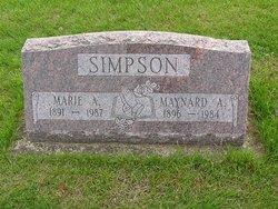
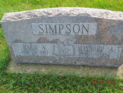
Marie Alda Forrest Simpson
| Birth | : | 3 Jul 1891 Middlebury, Elkhart County, Indiana, USA |
| Death | : | 19 Feb 1987 Goshen, Elkhart County, Indiana, USA |
| Burial | : | Drury Dobbins Baptist Church Cemetery, Lattimore, Cleveland County, USA |
| Coordinate | : | 35.3386540, -81.7065240 |
| Plot | : | 4th Addition, Row 4 |
frequently asked questions (FAQ):
-
Where is Marie Alda Forrest Simpson's memorial?
Marie Alda Forrest Simpson's memorial is located at: Drury Dobbins Baptist Church Cemetery, Lattimore, Cleveland County, USA.
-
When did Marie Alda Forrest Simpson death?
Marie Alda Forrest Simpson death on 19 Feb 1987 in Goshen, Elkhart County, Indiana, USA
-
Where are the coordinates of the Marie Alda Forrest Simpson's memorial?
Latitude: 35.3386540
Longitude: -81.7065240
Family Members:
Parent
Spouse
Siblings
Flowers:
Nearby Cemetories:
1. Drury Dobbins Baptist Church Cemetery
Lattimore, Cleveland County, USA
Coordinate: 35.3386540, -81.7065240
2. Drury Dobbins Church Cemetery
Ellenboro, Rutherford County, USA
Coordinate: 35.3403200, -81.7093340
3. Dobbins Cemetery
Ellenboro, Rutherford County, USA
Coordinate: 35.3369410, -81.7163310
4. Beam Cemetery
Ellenboro, Rutherford County, USA
Coordinate: 35.3497009, -81.7127991
5. Edwards Cemetery
Ellenboro, Rutherford County, USA
Coordinate: 35.3445590, -81.7403870
6. Campfield Memorial Baptist Cemetery
Ellenboro, Rutherford County, USA
Coordinate: 35.3147202, -81.7288895
7. Thomas Walker Family Cemetery
Rutherford County, USA
Coordinate: 35.3693990, -81.7184830
8. Zachariah McDaniel Cemetery
Ellenboro, Rutherford County, USA
Coordinate: 35.3213300, -81.7416800
9. Daily-Brooks Graveyard
Ellenboro, Rutherford County, USA
Coordinate: 35.3060141, -81.7232363
10. Glover Cemetery
Ellenboro, Rutherford County, USA
Coordinate: 35.3521996, -81.7472000
11. Youngs Chapel AME Zion
Mooresboro, Cleveland County, USA
Coordinate: 35.3032750, -81.6978580
12. Elizabeth Edwards Gravesite
Ellenboro, Rutherford County, USA
Coordinate: 35.3567930, -81.7468030
13. Bethel Baptist Church Cemetery
Ellenboro, Rutherford County, USA
Coordinate: 35.3258810, -81.7544180
14. Liberty Baptist Cemetery
Ellenboro, Rutherford County, USA
Coordinate: 35.3034477, -81.7356873
15. Sandy Run Baptist Church Cemetery
Mooresboro, Cleveland County, USA
Coordinate: 35.2963700, -81.6963300
16. Heavenbound Baptist Church Cemetery
Ellenboro, Rutherford County, USA
Coordinate: 35.3307330, -81.7623250
17. Old Hopewell Church Cemetery
Ellenboro, Rutherford County, USA
Coordinate: 35.3863889, -81.7130556
18. Plain View Baptist Cemetery
Ellenboro, Rutherford County, USA
Coordinate: 35.2988750, -81.7410280
19. Hopewell Community Cemetery
Ellenboro, Rutherford County, USA
Coordinate: 35.3821440, -81.7343430
20. Rehobeth Methodist Church Cemetery
Shelby, Cleveland County, USA
Coordinate: 35.3659500, -81.6556200
21. Harrill Cemetery
Lattimore, Cleveland County, USA
Coordinate: 35.3168410, -81.6515920
22. Piney Mountain Baptist Cemetery
Ellenboro, Rutherford County, USA
Coordinate: 35.3454310, -81.7706050
23. Sandy Plains Baptist Church Cemetery
New House, Cleveland County, USA
Coordinate: 35.3895200, -81.6891200
24. Webb Baptist Cemetery
Ellenboro, Rutherford County, USA
Coordinate: 35.3231900, -81.7696300

