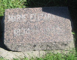
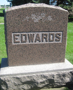
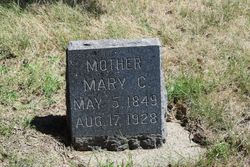
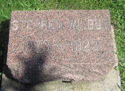
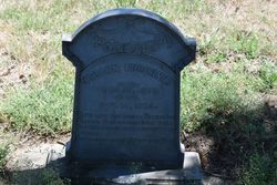
Marie Elizabeth “Mary” Furchner Edwards
| Birth | : | 5 Jun 1874 Michigan, USA |
| Death | : | 10 Jul 1930 Craig, Plymouth County, Iowa, USA |
| Burial | : | Alderbrook Cemetery, Desha, Independence County, USA |
| Coordinate | : | 35.7372017, -91.6905975 |
| Description | : | Mrs. Webb Edwards of Craig, mother of Mrs. Antone Roeper of Hawarden passed away at her home last Friday. Mrs. Edwards had been ill for five years, suffering from cancer. She was just 56 years of age at the time of her death. Her husband preceded her in death seven years, being killed in an autobobile accident. They lived at Struble for many years and then went to Craig where they engaged in business. She is survived by her daughter,Mrs. Roeper, four grandchildren, two sisters, Mrs. Louis Coleman of Le Mars and Mrs. E.F. Riter of Sioux Falls,... Read More |
frequently asked questions (FAQ):
-
Where is Marie Elizabeth “Mary” Furchner Edwards's memorial?
Marie Elizabeth “Mary” Furchner Edwards's memorial is located at: Alderbrook Cemetery, Desha, Independence County, USA.
-
When did Marie Elizabeth “Mary” Furchner Edwards death?
Marie Elizabeth “Mary” Furchner Edwards death on 10 Jul 1930 in Craig, Plymouth County, Iowa, USA
-
Where are the coordinates of the Marie Elizabeth “Mary” Furchner Edwards's memorial?
Latitude: 35.7372017
Longitude: -91.6905975
Family Members:
Parent
Spouse
Siblings
Flowers:
Nearby Cemetories:
1. Alderbrook Cemetery
Desha, Independence County, USA
Coordinate: 35.7372017, -91.6905975
2. Wyatt Cemetery
Desha, Independence County, USA
Coordinate: 35.7363610, -91.6879720
3. Old Ruddell Hill Cemetery
Independence County, USA
Coordinate: 35.7722015, -91.7018967
4. New Hope Cemetery
Bethesda, Independence County, USA
Coordinate: 35.7750664, -91.6707764
5. Jamestown Cemetery
Jamestown, Independence County, USA
Coordinate: 35.6982960, -91.7075730
6. Pioneer Cemetery
Batesville, Independence County, USA
Coordinate: 35.7706680, -91.6514200
7. Saint Paul Episcopal Church Columbarium
Batesville, Independence County, USA
Coordinate: 35.7718750, -91.6503550
8. Jones Tucker Cemetery
Independence County, USA
Coordinate: 35.7756500, -91.7268300
9. Locust Grove Cemetery
Locust Grove, Independence County, USA
Coordinate: 35.7127991, -91.7442017
10. Inman Cemetery
Jamestown, Independence County, USA
Coordinate: 35.6878014, -91.6808014
11. Thornsberry A Gray Cemetery
Batesville, Independence County, USA
Coordinate: 35.7639391, -91.6378059
12. Allen Chapel Freewill Baptist Church Cemetery
Batesville, Independence County, USA
Coordinate: 35.7275330, -91.6281060
13. Oaklawn Cemetery
Batesville, Independence County, USA
Coordinate: 35.7649994, -91.6350021
14. Ruddell Hill Cemetery
Batesville, Independence County, USA
Coordinate: 35.7921982, -91.6866989
15. Morgan Cemetery
McHue, Independence County, USA
Coordinate: 35.6859000, -91.6620000
16. Gill Cemetery
Independence County, USA
Coordinate: 35.7647018, -91.7514038
17. Johnson Cemetery
Independence County, USA
Coordinate: 35.7924995, -91.6583023
18. Barnes Cemetery
Batesville, Independence County, USA
Coordinate: 35.7888985, -91.7397003
19. Egner Cemetery
Salado, Independence County, USA
Coordinate: 35.7083015, -91.6108017
20. Kyler Cemetery
Batesville, Independence County, USA
Coordinate: 35.6741982, -91.6280975
21. Saint Mary's Parish Columbarium
Batesville, Independence County, USA
Coordinate: 35.7678940, -91.5961580
22. Pilgrims Rest Cemetery
Bethesda, Independence County, USA
Coordinate: 35.7910995, -91.7680969
23. Stark Cemetery
Moorefield, Independence County, USA
Coordinate: 35.7827988, -91.5994034
24. Greenfield Cemetery
Independence County, USA
Coordinate: 35.8269005, -91.6660995

