

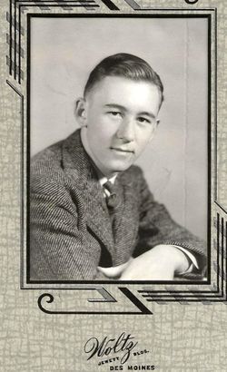
Marilyn “Joan” Pals Carroll
| Birth | : | 26 Jun 1930 Belmond, Wright County, Iowa, USA |
| Death | : | 2 Dec 2018 Northwood, Worth County, Iowa, USA |
| Burial | : | Osage Cemetery, Osage, Mitchell County, USA |
| Coordinate | : | 43.2916700, -92.8201700 |
| Description | : | Marilyn Joan Carroll, 88, died peacefully on Sunday, December 2, 2018, at Lutheran Retirement Home in Northwood, Iowa. Funeral Services at the Champion-Bucheit Funeral Home in Osage, Pastor Julie Schubert officiating, burial in the Osage Cemetery. Joan was born on June 26, 1930, in Belmond, Iowa, the daughter of Joe and Mourine (Lieuwen) Pals. She attended and graduated from the Belmond Community Schools. She humbly would acknowledge that she was the Salutatorian of her class. Immediately following graduation from high school, Joan attended Iowa State Teachers College and began her teaching career at Goldfield Community Schools where she... Read More |
frequently asked questions (FAQ):
-
Where is Marilyn “Joan” Pals Carroll's memorial?
Marilyn “Joan” Pals Carroll's memorial is located at: Osage Cemetery, Osage, Mitchell County, USA.
-
When did Marilyn “Joan” Pals Carroll death?
Marilyn “Joan” Pals Carroll death on 2 Dec 2018 in Northwood, Worth County, Iowa, USA
-
Where are the coordinates of the Marilyn “Joan” Pals Carroll's memorial?
Latitude: 43.2916700
Longitude: -92.8201700
Family Members:
Flowers:


Nearby Cemetories:
1. Osage Cemetery
Osage, Mitchell County, USA
Coordinate: 43.2916700, -92.8201700
2. Sacred Heart Cemetery
Osage, Mitchell County, USA
Coordinate: 43.2742004, -92.7917023
3. South Osage Mennonite Church Cemetery
Osage, Mitchell County, USA
Coordinate: 43.2544556, -92.7915573
4. Tucker Cemetery
Osage, Mitchell County, USA
Coordinate: 43.2494011, -92.8319016
5. Oak Grove Cemetery
Mitchell, Mitchell County, USA
Coordinate: 43.3156013, -92.8707962
6. Calvary Cemetery
Osage, Mitchell County, USA
Coordinate: 43.2238998, -92.8300018
7. Orchard Cemetery
Orchard, Mitchell County, USA
Coordinate: 43.2249985, -92.7838898
8. Dudley Cemetery
Dudley (historical), Mitchell County, USA
Coordinate: 43.2252998, -92.8743973
9. Riverview Cemetery
Saint Ansgar, Mitchell County, USA
Coordinate: 43.3430328, -92.9220200
10. Rock Creek Cemetery
Meroa, Mitchell County, USA
Coordinate: 43.2352791, -92.9225006
11. Eden Presbyterian Cemetery
Meroa, Mitchell County, USA
Coordinate: 43.2131004, -92.9103012
12. West End Cemetery
Meroa, Mitchell County, USA
Coordinate: 43.2216682, -92.9250031
13. Saint Ansgar Cemetery
Saint Ansgar, Mitchell County, USA
Coordinate: 43.3777809, -92.9094391
14. Immanuel Lutheran Cemetery
Saint Ansgar, Mitchell County, USA
Coordinate: 43.3717003, -92.9257965
15. First Lutheran Cemetery
Saint Ansgar, Mitchell County, USA
Coordinate: 43.3841705, -92.9194412
16. Liberty Cemetery
Little Cedar, Mitchell County, USA
Coordinate: 43.3856010, -92.7230988
17. Beaver Creek Cemetery
Brownville, Mitchell County, USA
Coordinate: 43.3397217, -92.6727829
18. Blakestad Cemetery
Saint Ansgar, Mitchell County, USA
Coordinate: 43.3711014, -92.9400024
19. Saint Johns Lutheran Cemetery
Rock Creek, Mitchell County, USA
Coordinate: 43.3295560, -92.9849770
20. Saint Peters Cemetery
New Haven, Mitchell County, USA
Coordinate: 43.2858315, -92.6427765
21. Saint Johns Lutheran Old Cemetery
Rock Creek, Mitchell County, USA
Coordinate: 43.3313904, -92.9897232
22. Stillwater Cemetery
Orchard, Mitchell County, USA
Coordinate: 43.2130585, -92.6780624
23. McKinley Cemetery
Saint Ansgar, Mitchell County, USA
Coordinate: 43.3906400, -92.9368300
24. Howardville Cemetery
Floyd, Floyd County, USA
Coordinate: 43.1866989, -92.7016983