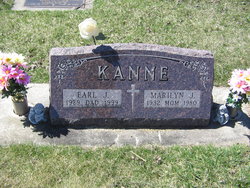
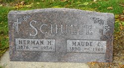
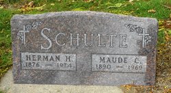
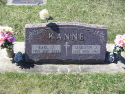
Marilyn Joan Schulte Kanne
| Birth | : | 31 Jan 1932 Wynot, Cedar County, Nebraska, USA |
| Death | : | 26 Jan 1980 Carroll, Carroll County, Iowa, USA |
| Burial | : | Holy Family Cemetery, Lidderdale, Carroll County, USA |
| Coordinate | : | 42.1178017, -94.7839966 |
| Description | : | Lidderdale - Mrs. Earl (Marilyn) Kane, 47, of Lidderdale, died at 6:25 a.m. Saturday, Jan. 26, at St. Anthony Regional Hospital in Carroll. She was a former employe of General Electric in Carroll. Mass of the Christian Burial will be celebrated at 1:30 p.m. Tuesday, Jan. 29, at Holy Family church in Lidderdale with the Rev. Eugene Ceperly officiating. Burial will be in the parish cemetery. Pallbearers will be Gene Wiederin, Al Ausman, Kenny Huegerich, Joe Kennebeck, Frank Hacker and Larry Daniel. Mass servers will be nephews jerry Wernimont and Jeff and Les Schleisman. Lyle Schleisman will be lector... Read More |
frequently asked questions (FAQ):
-
Where is Marilyn Joan Schulte Kanne's memorial?
Marilyn Joan Schulte Kanne's memorial is located at: Holy Family Cemetery, Lidderdale, Carroll County, USA.
-
When did Marilyn Joan Schulte Kanne death?
Marilyn Joan Schulte Kanne death on 26 Jan 1980 in Carroll, Carroll County, Iowa, USA
-
Where are the coordinates of the Marilyn Joan Schulte Kanne's memorial?
Latitude: 42.1178017
Longitude: -94.7839966
Family Members:
Parent
Spouse
Siblings
Flowers:
Nearby Cemetories:
1. Holy Family Cemetery
Lidderdale, Carroll County, USA
Coordinate: 42.1178017, -94.7839966
2. Immanuel Cemetery
Lidderdale, Carroll County, USA
Coordinate: 42.1389008, -94.8022003
3. East Liberty Cemetery
Lidderdale, Carroll County, USA
Coordinate: 42.1591988, -94.7636032
4. West Lawn Cemetery
Glidden, Carroll County, USA
Coordinate: 42.0649986, -94.7406006
5. Dickson Cemetery
Glidden Township, Carroll County, USA
Coordinate: 42.1074982, -94.6939011
6. Lanesboro Cemetery
Lanesboro, Carroll County, USA
Coordinate: 42.1810989, -94.7230988
7. Carroll City Cemetery
Carroll, Carroll County, USA
Coordinate: 42.0560963, -94.8599856
8. North Coon Cemetery
Carroll County, USA
Coordinate: 42.1260986, -94.6716995
9. Mount Olivet Cemetery
Carroll, Carroll County, USA
Coordinate: 42.0536340, -94.8595510
10. Our Lady Of Mount Carmel Cemetery
Mount Carmel, Carroll County, USA
Coordinate: 42.1547012, -94.9088974
11. Saint Francis Cemetery
Maple River, Carroll County, USA
Coordinate: 42.0969009, -94.9372025
12. Cottonwood Cemetery
Lake City, Calhoun County, USA
Coordinate: 42.2491989, -94.7936020
13. Dillavou Cemetery
Kendrick Township, Greene County, USA
Coordinate: 42.0802994, -94.6138992
14. Saint Marys Catholic Cemetery
Willey, Carroll County, USA
Coordinate: 41.9783363, -94.8212204
15. Luckow Cemetery
Auburn, Sac County, USA
Coordinate: 42.2168999, -94.9266968
16. Bishop Cemetery
Calhoun Township, Calhoun County, USA
Coordinate: 42.2230400, -94.6453190
17. Holy Angels Cemetery
Carroll County, USA
Coordinate: 42.0014000, -94.9141998
18. Saint Bernards Cemetery
Breda, Carroll County, USA
Coordinate: 42.1786003, -94.9732971
19. Lake City Cemetery
Lake City, Calhoun County, USA
Coordinate: 42.2719002, -94.7574997
20. Saint Marys Catholic Cemetery
Lake City, Calhoun County, USA
Coordinate: 42.2730000, -94.7567000
21. Saint Marys Cemetery
Sac County, USA
Coordinate: 42.2611008, -94.8839035
22. Oak Lawn Cemetery
Auburn, Sac County, USA
Coordinate: 42.2611008, -94.8852997
23. Grant City Cemetery
Grant City, Sac County, USA
Coordinate: 42.2681007, -94.8908005
24. Arcadia Cemetery
Arcadia Township, Carroll County, USA
Coordinate: 42.1000680, -95.0130550

