
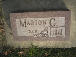
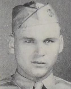
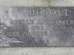
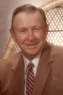
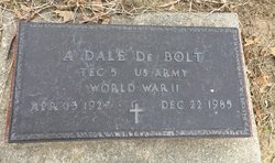
Marion Conrad DeBolt
| Birth | : | 9 May 1912 Pottawattamie County, Iowa, USA |
| Death | : | 22 Apr 1982 Fort Collins, Larimer County, Colorado, USA |
| Burial | : | Douglas Public Cemetery, Douglas, Renfrew County, Canada |
| Coordinate | : | 45.5119600, -76.9439500 |
| Plot | : | 2nd Addition, Lot 55 |
| Inscription | : | DAD |
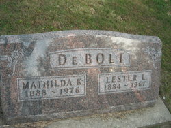
| Description | : | Monday Rites for Marion C. DeBolt Funeral services for Marion Conrad DeBolt of Loveland, CO, formerly of Emerson, was held on Monday morning April 26, at 10:30 a.m. at the First Baptist Church with Pastor J.F. Kunce, officiating. Arrangements were in charge of Nelson-Boylan Funeral Chapel of Red Oak. Interment was in Emerson Cemetery. Mr. DeBolt was born in Silver Creek Township in Pottawattamie County on May 9, 1912, to Lester L. and Matilda Kruse DeBolt, and died on Thursday in Fort Collins, CO, after an extended illness. He was a farmer and carpenter and lived most of his life in the Emerson area... Read More |
frequently asked questions (FAQ):
-
Where is Marion Conrad DeBolt's memorial?
Marion Conrad DeBolt's memorial is located at: Douglas Public Cemetery, Douglas, Renfrew County, Canada.
-
When did Marion Conrad DeBolt death?
Marion Conrad DeBolt death on 22 Apr 1982 in Fort Collins, Larimer County, Colorado, USA
-
Where are the coordinates of the Marion Conrad DeBolt's memorial?
Latitude: 45.5119600
Longitude: -76.9439500
Family Members:
Parent
Spouse

Siblings
Children
Flowers:


Nearby Cemetories:
1. Saint Michael Roman Catholic Cemetery
Bromley, Renfrew County, Canada
Coordinate: 45.5166367, -76.9439485
2. Steele Family Cemetery
Renfrew County, Canada
Coordinate: 45.4313100, -76.9579600
3. Saint James the Less R.C. Cemetery
Eganville, Renfrew County, Canada
Coordinate: 45.5401297, -77.0971687
4. Pioneer Cemetery
Osceola, Renfrew County, Canada
Coordinate: 45.6231291, -76.9430902
5. Melville United Cemetery
Eganville, Renfrew County, Canada
Coordinate: 45.5410290, -77.0997980
6. Saint John's Anglican Cemetery
Eganville, Renfrew County, Canada
Coordinate: 45.5427300, -77.0995300
7. Rosebank Cemetery
Rosebank, Renfrew County, Canada
Coordinate: 45.5251000, -76.7829110
8. Saint Pius V Cemetery
Osceola, Renfrew County, Canada
Coordinate: 45.6257000, -76.9445000
9. Cobden Cemetery
Cobden, Renfrew County, Canada
Coordinate: 45.6171200, -76.8671200
10. Grace Lutheran Cemetery
Eganville, Renfrew County, Canada
Coordinate: 45.5423880, -77.1096580
11. Haley Cemetery
Haley Station, Renfrew County, Canada
Coordinate: 45.5722300, -76.7880700
12. Lett's Corners United Cemetery
Letts Corners, Renfrew County, Canada
Coordinate: 45.5774600, -77.1023800
13. Admaston Cemetery
Admaston, Renfrew County, Canada
Coordinate: 45.4568750, -76.7694830
14. Dacre Memorial Cemetery
Dacre, Renfrew County, Canada
Coordinate: 45.3657300, -76.9442000
15. Saint Clements Anglican Church Cemetery
Clontarf, Renfrew County, Canada
Coordinate: 45.4094210, -77.1016850
16. Micksburg United Cemetery
Micksburg, Renfrew County, Canada
Coordinate: 45.6615600, -77.0353000
17. Beachburg Mennonite Cemetery
Cobden, Renfrew County, Canada
Coordinate: 45.6728430, -76.8527980
18. Micksburg Presbyterian Cemetery
Micksburg, Renfrew County, Canada
Coordinate: 45.6705200, -77.0462600
19. Beachburg Mennonite Cemetery
Beachburg, Renfrew County, Canada
Coordinate: 45.6751052, -76.8551953
20. Holy Well Cemetery
Mount Saint Patrick, Renfrew County, Canada
Coordinate: 45.3408000, -76.8812000
21. Saint Francis Xavier Cemetery
Renfrew, Renfrew County, Canada
Coordinate: 45.4872100, -76.6921600
22. Mount Saint Patrick Roman Catholic Cemetery
Mount Saint Patrick, Renfrew County, Canada
Coordinate: 45.3374250, -76.8789530
23. Saint Stephen Anglican Cemetery
Micksburg, Renfrew County, Canada
Coordinate: 45.6759620, -77.0546720
24. North Horton Cemetery
Renfrew, Renfrew County, Canada
Coordinate: 45.5177800, -76.6718355