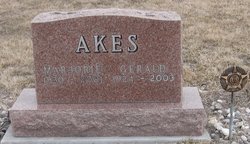
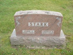
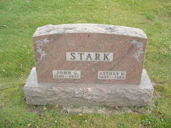
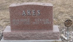
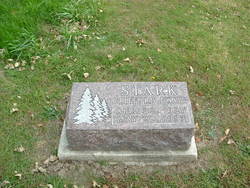
Marjorie Jean Stark Akes
| Birth | : | 14 Feb 1930 |
| Death | : | 23 Jun 2001 |
| Burial | : | Card Creek Cemetery, Roulette, Potter County, USA |
| Coordinate | : | 41.7844009, -78.1896973 |
| Description | : | Daughter of John Leslie Stark and Esther Merle Cole. AKES, MARJORIE J 14 Feb 1930 23 Jun 2001 (V) 71 50111 (Grimes, Polk, IA)(none specified) Iowa |
frequently asked questions (FAQ):
-
Where is Marjorie Jean Stark Akes's memorial?
Marjorie Jean Stark Akes's memorial is located at: Card Creek Cemetery, Roulette, Potter County, USA.
-
When did Marjorie Jean Stark Akes death?
Marjorie Jean Stark Akes death on 23 Jun 2001 in
-
Where are the coordinates of the Marjorie Jean Stark Akes's memorial?
Latitude: 41.7844009
Longitude: -78.1896973
Family Members:
Parent
Spouse
Siblings
Flowers:
Nearby Cemetories:
1. Card Creek Cemetery
Roulette, Potter County, USA
Coordinate: 41.7844009, -78.1896973
2. Hill Cemetery
Roulette, Potter County, USA
Coordinate: 41.7710991, -78.1530991
3. Sartwell Creek Cemetery
Williston, Potter County, USA
Coordinate: 41.8239000, -78.1881000
4. John Lyman Cemetery
Roulette, Potter County, USA
Coordinate: 41.7764015, -78.1352997
5. Fishing Creek Cemetery
Roulette, Potter County, USA
Coordinate: 41.8178000, -78.1431000
6. Portage Valley Cemetery
Wrights, McKean County, USA
Coordinate: 41.7412000, -78.2417000
7. Fairview Cemetery
Port Allegany, McKean County, USA
Coordinate: 41.8177986, -78.2743988
8. Port Allegany Cemetery
McKean County, USA
Coordinate: 41.8133000, -78.2801000
9. Saint Gabriels Cemetery
McKean County, USA
Coordinate: 41.8314018, -78.2944031
10. Lewis Hill Cemetery
McKean County, USA
Coordinate: 41.8255997, -78.3028030
11. Keating Summit Cemetery
Keating Summit, Potter County, USA
Coordinate: 41.6847000, -78.1781000
12. Saint Eulalias Cemetery
Potter County, USA
Coordinate: 41.7583008, -78.0539017
13. Hebron Cemetery
Hebron, Potter County, USA
Coordinate: 41.8433060, -78.0679530
14. Grimes District Cemetery
Port Allegany, McKean County, USA
Coordinate: 41.8362000, -78.3183000
15. Odin Cemetery
Odin, Potter County, USA
Coordinate: 41.7051000, -78.0878000
16. Woodland Cemetery
Hebron, Potter County, USA
Coordinate: 41.8389100, -78.0462000
17. Eulalia Cemetery
Coudersport, Potter County, USA
Coordinate: 41.7682991, -78.0299988
18. Clara Cemetery
Clara, Potter County, USA
Coordinate: 41.8926000, -78.1029000
19. Annin Creek Cemetery
Turtlepoint, McKean County, USA
Coordinate: 41.9042110, -78.2596270
20. Homer Cemetery
Inez, Potter County, USA
Coordinate: 41.7282000, -78.0170000
21. Lymansville Cemetery
Lymansville, Potter County, USA
Coordinate: 41.7713000, -77.9873000
22. Maple View Rest Home Cemetery
Coudersport, Potter County, USA
Coordinate: 41.7712890, -77.9871870
23. Hollenbeck Cemetery
Potter County, USA
Coordinate: 41.8481000, -78.0051000
24. Bell Run Cemetery
McKean County, USA
Coordinate: 41.9357100, -78.2314300

