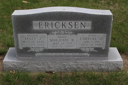
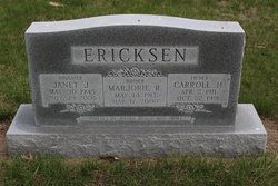
Marjorie Ruth Jones Ericksen
| Birth | : | 14 May 1913 Hamilton County, Nebraska, USA |
| Death | : | 17 Mar 2000 Aurora, Hamilton County, Nebraska, USA |
| Burial | : | Biggar Ridge United Baptist Cemetery, Biggar Ridge, Carleton County, Canada |
| Coordinate | : | 46.5447160, -67.2811100 |
| Plot | : | Lot 45 |
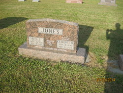
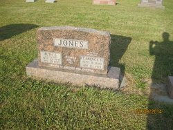
| Description | : | Daughter of Clarence & Ruth (Gustafson) Jones. Married to Carroll H. Ericksen on 8-25-1934. |
frequently asked questions (FAQ):
-
Where is Marjorie Ruth Jones Ericksen's memorial?
Marjorie Ruth Jones Ericksen's memorial is located at: Biggar Ridge United Baptist Cemetery, Biggar Ridge, Carleton County, Canada.
-
When did Marjorie Ruth Jones Ericksen death?
Marjorie Ruth Jones Ericksen death on 17 Mar 2000 in Aurora, Hamilton County, Nebraska, USA
-
Where are the coordinates of the Marjorie Ruth Jones Ericksen's memorial?
Latitude: 46.5447160
Longitude: -67.2811100
Family Members:
Parent
Spouse
Children
Flowers:
Nearby Cemetories:
1. Biggar Ridge United Baptist Cemetery
Biggar Ridge, Carleton County, Canada
Coordinate: 46.5447160, -67.2811100
2. Argyle Cemetery
Argyle, Carleton County, Canada
Coordinate: 46.5135490, -67.3402740
3. Highlands Cemetery
Highlands, Carleton County, Canada
Coordinate: 46.4937040, -67.3787100
4. Knowlesville Cemetery
Knowlesville, Carleton County, Canada
Coordinate: 46.4550000, -67.3770000
5. Glassville United Church Cemetery
Glassville, Carleton County, Canada
Coordinate: 46.4806300, -67.4215300
6. Sarchfield Graves
Brighton, Carleton County, Canada
Coordinate: 46.4200060, -67.3013720
7. Esdraelon Cemetery
Esdraelon, Carleton County, Canada
Coordinate: 46.4345400, -67.4139200
8. Armond Cemetery
Armond, Carleton County, Canada
Coordinate: 46.3913600, -67.3819400
9. Upper Gordonsville Cemetery
Gordonsville, Carleton County, Canada
Coordinate: 46.4698880, -67.5012780
10. Gordonsville Cemetery
Gordonsville, Carleton County, Canada
Coordinate: 46.4562660, -67.4921840
11. Windsor Cemetery
Windsor, Carleton County, Canada
Coordinate: 46.3965100, -67.4080800
12. Fielding Cemetery
Fielding, Carleton County, Canada
Coordinate: 46.4713400, -67.5298530
13. Johnville Cemetery
Johnville, Carleton County, Canada
Coordinate: 46.5870263, -67.5493302
14. Mount Pleasant Cemetery
Mount Pleasant, Carleton County, Canada
Coordinate: 46.3925300, -67.4743800
15. Lower Windsor Cemetery
Lower Windsor, Carleton County, Canada
Coordinate: 46.3582300, -67.4209600
16. Carlisle Cemetery
Carlisle, Carleton County, Canada
Coordinate: 46.3429230, -67.3802480
17. Mineral Cemetery
Kent, Carleton County, Canada
Coordinate: 46.5918753, -67.5843827
18. Bannon Cemetery
Carleton, Carleton County, Canada
Coordinate: 46.3699220, -67.4637000
19. Bristol Free Baptist Church Cemetery
Florenceville-Bristol, Carleton County, Canada
Coordinate: 46.4714600, -67.5754500
20. Bristol Community Cemetery
Florenceville-Bristol, Carleton County, Canada
Coordinate: 46.4661420, -67.5732070
21. Lower Wicklow Cemetery
Wicklow, Carleton County, Canada
Coordinate: 46.4916000, -67.5862200
22. Bristol United Church Cemetery
Florenceville-Bristol, Carleton County, Canada
Coordinate: 46.4722370, -67.5787790
23. Barker Cemetery
Bath, Carleton County, Canada
Coordinate: 46.5102780, -67.5961110
24. Bristol Old Cemetery
Florenceville-Bristol, Carleton County, Canada
Coordinate: 46.4662680, -67.5852480


