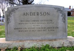
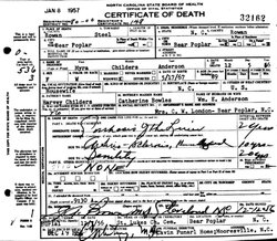
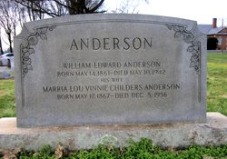
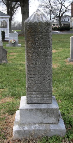
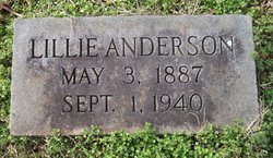
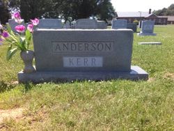
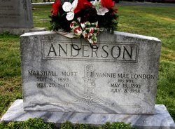
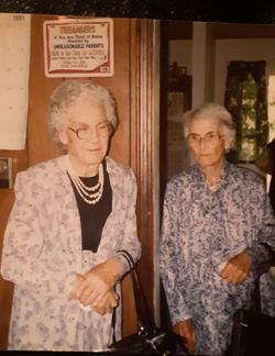
Marria Lou Vinnie “Myra” Childers Anderson
| Birth | : | 17 May 1867 Alexander County, North Carolina, USA |
| Death | : | 5 Dec 1956 Bear Poplar, Rowan County, North Carolina, USA |
| Burial | : | Saint Lukes Evangelical Lutheran Church Cemetery, Mount Ulla, Rowan County, USA |
| Coordinate | : | 35.6810800, -80.6849760 |
| Description | : | Marria--or Myra--was the 4th child of James Harvey Childers & his first wife, Elizabeth Catherine Bowles. She grew up in Alexander County, NC. Her education was grades 1-5. She was listed in the 1870 Census living with her parents & siblings in Sugar Loaf Township, Alexander County, NC. In the 1880 Census, it shows her living in Gwaltneys Township, Alexander County, NC & that she had attended school within the Census year & could read & write. On 18 Oct 1884, she married William Anderson. In 1900, it lists her living in Lovelace Township, Wilkes County, NC with her husband... Read More |
frequently asked questions (FAQ):
-
Where is Marria Lou Vinnie “Myra” Childers Anderson's memorial?
Marria Lou Vinnie “Myra” Childers Anderson's memorial is located at: Saint Lukes Evangelical Lutheran Church Cemetery, Mount Ulla, Rowan County, USA.
-
When did Marria Lou Vinnie “Myra” Childers Anderson death?
Marria Lou Vinnie “Myra” Childers Anderson death on 5 Dec 1956 in Bear Poplar, Rowan County, North Carolina, USA
-
Where are the coordinates of the Marria Lou Vinnie “Myra” Childers Anderson's memorial?
Latitude: 35.6810800
Longitude: -80.6849760
Family Members:
Parent
Spouse
Siblings
Children
Nearby Cemetories:
1. Oakland Presbyterian Church USA
Mount Ulla Township, Rowan County, USA
Coordinate: 35.6549000, -80.6785000
2. Ebenezer Methodist Church Cemetery
Mount Ulla, Rowan County, USA
Coordinate: 35.6930200, -80.6425900
3. Mount Zion Baptist Church
Mount Ulla, Rowan County, USA
Coordinate: 35.6712060, -80.6366480
4. Back Creek Presbyterian Church Cemetery
Mount Ulla, Rowan County, USA
Coordinate: 35.6415901, -80.6991501
5. Cleveland Memorial Garden
Cleveland, Rowan County, USA
Coordinate: 35.7276640, -80.6863050
6. Thyatira Presbyterian Church Cemetery
Mill Bridge, Rowan County, USA
Coordinate: 35.6506310, -80.6371002
7. Mount Tabor Presbyterian Church Cemetery
Cleveland, Rowan County, USA
Coordinate: 35.6826700, -80.7501100
8. Cleveland First Baptist Church Cemetery
Cleveland, Rowan County, USA
Coordinate: 35.7347650, -80.6802790
9. Christ Episcopal Church Cemetery
Cleveland, Rowan County, USA
Coordinate: 35.7333000, -80.6653380
10. Cleveland Town Cemetery
Cleveland, Rowan County, USA
Coordinate: 35.7357660, -80.6806540
11. Allen Temple Presbyterian Church Cemetery
Cleveland, Rowan County, USA
Coordinate: 35.7343320, -80.6684760
12. Knox Chapel United Methodist Church
Cleveland, Rowan County, USA
Coordinate: 35.7081200, -80.7457400
13. Sills Creek AME Zion Church Cemetery
Mount Ulla, Rowan County, USA
Coordinate: 35.6209000, -80.7099000
14. Cedar Grove AME Zion Church Cemetery
Rowan County, USA
Coordinate: 35.7240520, -80.6270450
15. Centenary Methodist Church Cemetery
Mount Ulla, Rowan County, USA
Coordinate: 35.6272202, -80.7414398
16. Sherrills Ford Road Church Cemetery
Salisbury, Rowan County, USA
Coordinate: 35.6884308, -80.5954590
17. Lebanon Lutheran Church Cemetery
Cleveland, Rowan County, USA
Coordinate: 35.7402300, -80.6266800
18. Knox Grove Baptist Church
Cleveland, Rowan County, USA
Coordinate: 35.7557070, -80.7115100
19. Third Creek Presbyterian Church Cemetery
Cleveland, Rowan County, USA
Coordinate: 35.7607420, -80.6841160
20. Antioch Baptist Church Cemetery
Iredell County, USA
Coordinate: 35.7072400, -80.7780450
21. Antioch Baptist Church Cemetery
Cleveland, Rowan County, USA
Coordinate: 35.7074203, -80.7789536
22. Amity Evangelical Lutheran Cemetery
Iredell County, USA
Coordinate: 35.6990140, -80.7847230
23. House of Prayer of Faith Cemetery
Cleveland, Rowan County, USA
Coordinate: 35.7132900, -80.7851700
24. Saint Marks Lutheran Church Cemetery
Salisbury, Rowan County, USA
Coordinate: 35.6541670, -80.5822220

