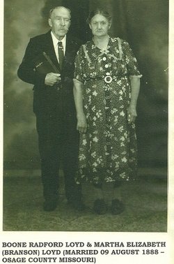
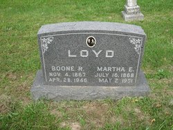
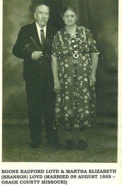
Martha Elizabeth Branson Loyd
| Birth | : | 16 Jul 1868 Osage County, Missouri, USA |
| Death | : | 2 May 1951 Osage County, Missouri, USA |
| Burial | : | White Church Cemetery, Byron, Osage County, USA |
| Coordinate | : | 38.3256240, -91.6790840 |
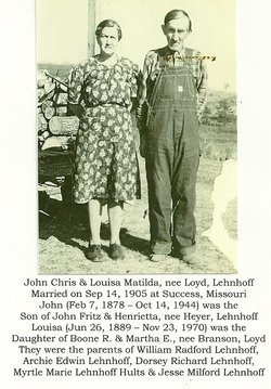
| Description | : | Martha was the daughter of David Branson and Matilda Phelps Branson. Martha was married to Boone R Loyd on August 9, 1888 |
frequently asked questions (FAQ):
-
Where is Martha Elizabeth Branson Loyd's memorial?
Martha Elizabeth Branson Loyd's memorial is located at: White Church Cemetery, Byron, Osage County, USA.
-
When did Martha Elizabeth Branson Loyd death?
Martha Elizabeth Branson Loyd death on 2 May 1951 in Osage County, Missouri, USA
-
Where are the coordinates of the Martha Elizabeth Branson Loyd's memorial?
Latitude: 38.3256240
Longitude: -91.6790840
Family Members:
Parent
Spouse
Siblings
Children
Flowers:
Nearby Cemetories:
1. White Church Cemetery
Byron, Osage County, USA
Coordinate: 38.3256240, -91.6790840
2. Heyer Cemetery
Osage County, USA
Coordinate: 38.3241997, -91.6968994
3. Thomas H Smith Family Cemetery
Bland, Gasconade County, USA
Coordinate: 38.3016701, -91.6327820
4. Old Bland Cemetery
Bland, Gasconade County, USA
Coordinate: 38.3125000, -91.6260986
5. Francis Cemetery
Byron, Osage County, USA
Coordinate: 38.3264008, -91.7358017
6. Feuersville Lutheran Church Cemetery
Feuersville, Osage County, USA
Coordinate: 38.3768997, -91.6832962
7. Backues Cemetery
Belle, Maries County, USA
Coordinate: 38.2846820, -91.7253680
8. Union Cemetery
Bland, Gasconade County, USA
Coordinate: 38.2933006, -91.6216965
9. Old Bland Methodist Cemetery
Gasconade County, USA
Coordinate: 38.3302193, -91.6066666
10. Old United Methodist Cemetery
Gasconade County, USA
Coordinate: 38.3283005, -91.6035995
11. Crider Cemetery
Gasconade County, USA
Coordinate: 38.2733002, -91.6294022
12. Campbell Cemetery
Belle, Maries County, USA
Coordinate: 38.2588997, -91.6718979
13. Saint Michael Cemetery
Gasconade County, USA
Coordinate: 38.2757988, -91.6211014
14. Bueker Cemetery
Osage County, USA
Coordinate: 38.3974991, -91.6694031
15. Liberty Cemetery
Belle, Maries County, USA
Coordinate: 38.2606010, -91.7266998
16. Nixon Cemetery
Osage County, USA
Coordinate: 38.4002991, -91.6613998
17. College Hill Cemetery
Osage County, USA
Coordinate: 38.3902840, -91.7300220
18. Koenig Cemetery
Koenig, Osage County, USA
Coordinate: 38.3507996, -91.7716980
19. New Bethel Cemetery
Bland, Gasconade County, USA
Coordinate: 38.3736760, -91.6016650
20. Cleavesville Cemetery
Bland, Gasconade County, USA
Coordinate: 38.2707300, -91.6057300
21. Travis Cemetery
Belle, Maries County, USA
Coordinate: 38.2518997, -91.7288971
22. Howard Cemetery
Canaan, Gasconade County, USA
Coordinate: 38.2888985, -91.5832977
23. Cox-Cooper Cemetery
Feuersville, Osage County, USA
Coordinate: 38.4131012, -91.6844025
24. Lange Cemetery
Osage County, USA
Coordinate: 38.4099998, -91.6461029

