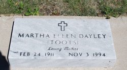
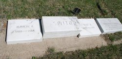
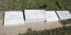
Martha Ellen “Toots” Smith Dayley
| Birth | : | 24 Feb 1911 Garden County, Nebraska, USA |
| Death | : | 3 Nov 1994 Fort Morgan, Morgan County, Colorado, USA |
| Burial | : | Forest Hill Cemetery, Fitchburg, Worcester County, USA |
| Coordinate | : | 42.5681000, -71.8103027 |
| Inscription | : | (Toots) Loving Mother |
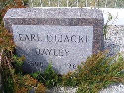
| Description | : | Wife of Earl Edward "Jack" Dayley. Mother of Fay Ellen (Tuff) Custer, Mary Rose (Robert) Wright and Jackie Joe Dayley. |
frequently asked questions (FAQ):
-
Where is Martha Ellen “Toots” Smith Dayley's memorial?
Martha Ellen “Toots” Smith Dayley's memorial is located at: Forest Hill Cemetery, Fitchburg, Worcester County, USA.
-
When did Martha Ellen “Toots” Smith Dayley death?
Martha Ellen “Toots” Smith Dayley death on 3 Nov 1994 in Fort Morgan, Morgan County, Colorado, USA
-
Where are the coordinates of the Martha Ellen “Toots” Smith Dayley's memorial?
Latitude: 42.5681000
Longitude: -71.8103027
Family Members:
Parent
Spouse
Siblings
Flowers:
Nearby Cemetories:
1. Forest Hill Cemetery
Fitchburg, Worcester County, USA
Coordinate: 42.5681000, -71.8103027
2. Agudas Achim Cemetery
Fitchburg, Worcester County, USA
Coordinate: 42.5628166, -71.8155441
3. Saint Joseph Cemetery
Fitchburg, Worcester County, USA
Coordinate: 42.5667000, -71.8208008
4. Laurel Hill Cemetery
Fitchburg, Worcester County, USA
Coordinate: 42.5812900, -71.8047800
5. South Street Cemetery
Fitchburg, Worcester County, USA
Coordinate: 42.5799680, -71.7978560
6. West Street Cemetery
Fitchburg, Worcester County, USA
Coordinate: 42.5881600, -71.8132600
7. Saint Bernard's Cemetery
Fitchburg, Worcester County, USA
Coordinate: 42.5778008, -71.7791977
8. Alpine Hill Cemetery
Fitchburg, Worcester County, USA
Coordinate: 42.5948600, -71.8379200
9. Hartwell Cemetery
Fitchburg, Worcester County, USA
Coordinate: 42.6092200, -71.8259300
10. Dean Hill Cemetery
Fitchburg, Worcester County, USA
Coordinate: 42.6144400, -71.8491700
11. Pine Grove Cemetery
Leominster, Worcester County, USA
Coordinate: 42.5306015, -71.7561035
12. Evergreen Cemetery
Leominster, Worcester County, USA
Coordinate: 42.5332985, -71.7491989
13. Whitmanville Cemetery
Westminster, Worcester County, USA
Coordinate: 42.5815300, -71.8953500
14. Woodside Cemetery
Westminster, Worcester County, USA
Coordinate: 42.5402985, -71.8933029
15. North Cemetery
Lunenburg, Worcester County, USA
Coordinate: 42.6041985, -71.7305984
16. Saint Leo Cemetery
Leominster, Worcester County, USA
Coordinate: 42.5153008, -71.7472000
17. South Cemetery
Lunenburg, Worcester County, USA
Coordinate: 42.5806007, -71.7093964
18. Saint Cecilias Cemetery
Leominster, Worcester County, USA
Coordinate: 42.5166800, -71.7331900
19. Russell Cemetery
Ashburnham, Worcester County, USA
Coordinate: 42.6437000, -71.8659100
20. Mount Pleasant Cemetery
Westminster, Worcester County, USA
Coordinate: 42.5424995, -71.9222031
21. Parker I Cemetery
Princeton, Worcester County, USA
Coordinate: 42.4828500, -71.8529500
22. Gardner State Hospital Cemetery
Gardner, Worcester County, USA
Coordinate: 42.5853300, -71.9388800
23. New Cemetery
Ashburnham, Worcester County, USA
Coordinate: 42.6318400, -71.9137400
24. North Cemetery
Princeton, Worcester County, USA
Coordinate: 42.4797700, -71.8724000

