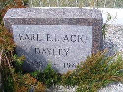
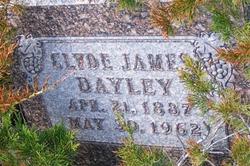
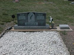
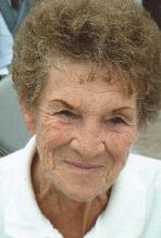
Earl E. “Jack” Dayley
| Birth | : | 5 May 1898 Lewellen, Garden County, Nebraska, USA |
| Death | : | 15 Apr 1961 Sterling, Logan County, Colorado, USA |
| Burial | : | Cool Springs Cemetery, Forest City, Rutherford County, USA |
| Coordinate | : | 35.3396988, -81.8711014 |
| Plot | : | Block 5, Lot 41 |
| Description | : | Garden County News (Oshkosh, Nebraska), Apr. 20, 1961, Page 1 Earl Edward "Jack" Dayley, 62, a lifelong resident of this area, died at the home of his daughter Mrs. Duane Ouster in Sterling Saturday evening [April 15, 1961]. He had been in failing health in recent weeks but had gone to Fort Morgan and Sterling to visit and the seriousness of his condition was not known. Funeral services were held Tuesday afternoon at the Wright Funeral home. Father John Madsen had charge of the services with music provided by Rev. and Mrs. Paul Wagner accompanied by their daughter Jeanette. Burial was in... Read More |
frequently asked questions (FAQ):
-
Where is Earl E. “Jack” Dayley's memorial?
Earl E. “Jack” Dayley's memorial is located at: Cool Springs Cemetery, Forest City, Rutherford County, USA.
-
When did Earl E. “Jack” Dayley death?
Earl E. “Jack” Dayley death on 15 Apr 1961 in Sterling, Logan County, Colorado, USA
-
Where are the coordinates of the Earl E. “Jack” Dayley's memorial?
Latitude: 35.3396988
Longitude: -81.8711014
Family Members:
Parent
Spouse
Siblings
Children
Flowers:
Nearby Cemetories:
1. Cool Springs Cemetery
Forest City, Rutherford County, USA
Coordinate: 35.3396988, -81.8711014
2. Saint Luke F.B.H. Church Cemetery
Forest City, Rutherford County, USA
Coordinate: 35.3405390, -81.8697340
3. Old Cool Springs Baptist Cemetery
Rutherford County, USA
Coordinate: 35.3420280, -81.8712940
4. Oak Grove Missionary Baptist Church
Forest City, Rutherford County, USA
Coordinate: 35.3296300, -81.8782300
5. Saint Paul AME Zion Cemetery
Forest City, Rutherford County, USA
Coordinate: 35.3407600, -81.8863900
6. Pleasant Grove United Methodist Church Cemetery
Forest City, Rutherford County, USA
Coordinate: 35.3490000, -81.8845000
7. M&T Ministries Cemetery
Forest City, Rutherford County, USA
Coordinate: 35.3324970, -81.8517900
8. Wells Springs UMC Cemetery
Forest City, Rutherford County, USA
Coordinate: 35.3485413, -81.8906326
9. Glenwood Baptist Cemetery
Bostic, Rutherford County, USA
Coordinate: 35.3422700, -81.8374700
10. Bostic Baptist Cemetery
Bostic, Rutherford County, USA
Coordinate: 35.3489370, -81.8371580
11. Morrow Cemetery
Forest City, Rutherford County, USA
Coordinate: 35.3216800, -81.8361000
12. Smith Grove Baptist Cemetery
Forest City, Rutherford County, USA
Coordinate: 35.3740660, -81.8730180
13. McDonald Family Cemetery
Forest City, Rutherford County, USA
Coordinate: 35.3075850, -81.8876240
14. Alexander Mills Cemetery
Alexander Mills, Rutherford County, USA
Coordinate: 35.3059100, -81.8566200
15. Sunset Memorial Park
Forest City, Rutherford County, USA
Coordinate: 35.3200800, -81.9088050
16. Joshua Baptist Cemetery
Bostic, Rutherford County, USA
Coordinate: 35.3331750, -81.8260650
17. Whiteside Cemetery
Spindale, Rutherford County, USA
Coordinate: 35.3605400, -81.9118200
18. Adaville Baptist Church Cemetery
Spindale, Rutherford County, USA
Coordinate: 35.3356680, -81.9201110
19. Concord Baptist Church Cemetery
Bostic, Rutherford County, USA
Coordinate: 35.3482000, -81.8227690
20. Bethany Baptist Church Cemetery
Forest City, Rutherford County, USA
Coordinate: 35.3029200, -81.8933260
21. Russell Tabernacle CME Church Memorial Garden
Spindale, Rutherford County, USA
Coordinate: 35.3587510, -81.9164120
22. Restoration Church Cemetery
Forest City, Rutherford County, USA
Coordinate: 35.3328200, -81.9228500
23. Spindale Cemetery
Spindale, Rutherford County, USA
Coordinate: 35.3507996, -81.9218979
24. Morrow Curve Cemetery
Alexander Mills, Rutherford County, USA
Coordinate: 35.3007300, -81.8490800

