
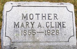
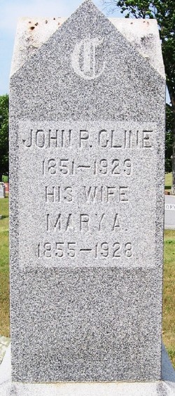
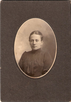
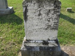
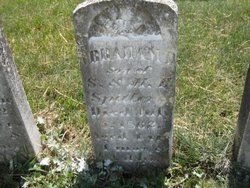
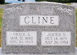
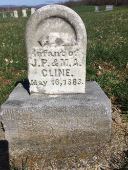
Mary A. Spitler Cline
| Birth | : | 1855 |
| Death | : | 1928 |
| Burial | : | All Saints Church, Shotesham, South Norfolk District, England |
| Coordinate | : | 52.5428610, 1.3120560 |
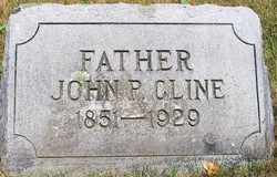
| Description | : | Wife of John P. Cline. |
frequently asked questions (FAQ):
-
Where is Mary A. Spitler Cline's memorial?
Mary A. Spitler Cline's memorial is located at: All Saints Church, Shotesham, South Norfolk District, England.
-
When did Mary A. Spitler Cline death?
Mary A. Spitler Cline death on 1928 in
-
Where are the coordinates of the Mary A. Spitler Cline's memorial?
Latitude: 52.5428610
Longitude: 1.3120560
Family Members:
Parent
Spouse
Siblings

Children
Flowers:


Nearby Cemetories:
1. All Saints Church
Shotesham, South Norfolk District, England
Coordinate: 52.5428610, 1.3120560
2. St Mary Churchyard
Shotesham, South Norfolk District, England
Coordinate: 52.5411110, 1.2985880
3. St. Mary's Churchyard
Saxlingham Nethergate, South Norfolk District, England
Coordinate: 52.5268910, 1.2880390
4. St Mary Churchyard
Howe, South Norfolk District, England
Coordinate: 52.5497970, 1.3541770
5. St Mary's Churchyard
Newton Flotman, South Norfolk District, England
Coordinate: 52.5393520, 1.2617220
6. All Saints Churchyard
Poringland, South Norfolk District, England
Coordinate: 52.5657160, 1.3496310
7. St Remigius Churchyard
Dunston, South Norfolk District, England
Coordinate: 52.5722420, 1.2872510
8. Saint Edmund Churchyard
Caistor St Edmund, South Norfolk District, England
Coordinate: 52.5826350, 1.2936850
9. St Margaret Churchyard
Hempnall, South Norfolk District, England
Coordinate: 52.5018500, 1.3004810
10. St Peters Churchyard
Brooke, South Norfolk District, England
Coordinate: 52.5452560, 1.3814930
11. St Andrew Churchyard
Framingham Earl, South Norfolk District, England
Coordinate: 52.5748560, 1.3596480
12. St Margaret's Churchyard
Kirstead, South Norfolk District, England
Coordinate: 52.5358860, 1.3840860
13. St Mary Churchyard
Arminghall, South Norfolk District, England
Coordinate: 52.5900300, 1.3234620
14. St Andrew Churchyard
Framingham Pigot, South Norfolk District, England
Coordinate: 52.5826070, 1.3606380
15. St. Mary Magdalen Churchyard
Mulbarton, South Norfolk District, England
Coordinate: 52.5638930, 1.2360530
16. St Michael And All Saint's
Flordon, South Norfolk District, England
Coordinate: 52.5294700, 1.2261400
17. St Wandregesilus Churchyard
Bixley, South Norfolk District, England
Coordinate: 52.5955900, 1.3330900
18. St Catherine Churchyard
Fritton, Great Yarmouth Borough, England
Coordinate: 52.4919750, 1.2796600
19. St. Peter and St. Paul Churchyard
Bergh Apton, South Norfolk District, England
Coordinate: 52.5480290, 1.4060870
20. All Saints Churchyard
Keswick, South Norfolk District, England
Coordinate: 52.5951470, 1.2675790
21. St Nicholas Churchyard
Bracon Ash, South Norfolk District, England
Coordinate: 52.5559000, 1.2137000
22. Saint Andrews Churchyard
Bedingham, South Norfolk District, England
Coordinate: 52.4902500, 1.3643180
23. Saint John the Baptist Churchyard
Morningthorpe, South Norfolk District, England
Coordinate: 52.4859170, 1.2654150
24. Saint Andrews
Kirby Bedon, South Norfolk District, England
Coordinate: 52.5989160, 1.3635240