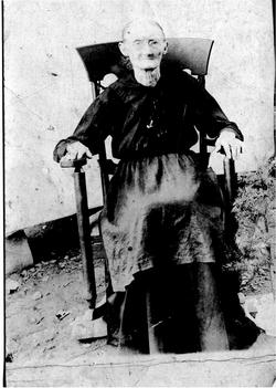
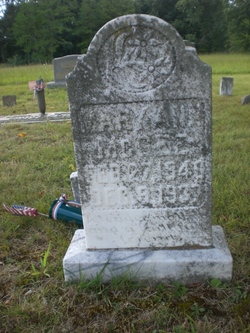
Mary Ann Smithson McGee
| Birth | : | 27 Feb 1840 Cannon County, Tennessee, USA |
| Death | : | 8 Dec 1937 Cannon County, Tennessee, USA |
| Burial | : | Liberty Chapel Cemetery, Crawford County, USA |
| Coordinate | : | 40.8422794, -82.8935178 |
| Inscription | : | A tender mother and a faithful friend. |
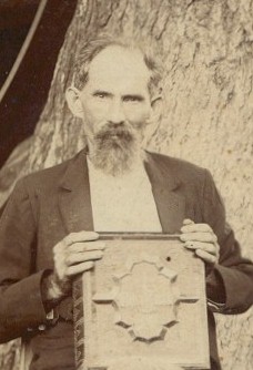
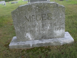
| Description | : | Mary Ann was the daughter of James & Martha Patsy Hutchins Smithson. She married James W. McGee 26 Jul, 1864 in Cannon Co., TN.. They had seven children Elizabeth Jane, Margaret, Willie, Sara Ann, Joe, John Walker, & Elijah McGee. |
frequently asked questions (FAQ):
-
Where is Mary Ann Smithson McGee's memorial?
Mary Ann Smithson McGee's memorial is located at: Liberty Chapel Cemetery, Crawford County, USA.
-
When did Mary Ann Smithson McGee death?
Mary Ann Smithson McGee death on 8 Dec 1937 in Cannon County, Tennessee, USA
-
Where are the coordinates of the Mary Ann Smithson McGee's memorial?
Latitude: 40.8422794
Longitude: -82.8935178
Family Members:
Parent
Spouse
Siblings
Children
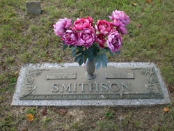
Flowers:
Nearby Cemetories:
1. Liberty Chapel Cemetery
Crawford County, USA
Coordinate: 40.8422794, -82.8935178
2. Blowers Cemetery
Bucyrus, Crawford County, USA
Coordinate: 40.8282040, -82.8964160
3. Kruse Cemetery
Sulphur Springs, Crawford County, USA
Coordinate: 40.8561540, -82.8815730
4. Conley Cemetery
Crawford County, USA
Coordinate: 40.8592880, -82.8950910
5. Roop Cemetery
Crawford County, USA
Coordinate: 40.8499414, -82.9139471
6. Luke Cemetery
Crawford County, USA
Coordinate: 40.8363991, -82.8553009
7. Stewart Cemetery
Bucyrus, Crawford County, USA
Coordinate: 40.8121986, -82.9253006
8. Salem Cemetery
North Robinson, Crawford County, USA
Coordinate: 40.7985992, -82.8977966
9. Shroll Cemetery
Bucyrus, Crawford County, USA
Coordinate: 40.8131920, -82.9475470
10. Yider Cemetery
Crawford County, USA
Coordinate: 40.8929900, -82.9020070
11. Union Cemetery
Sulphur Springs, Crawford County, USA
Coordinate: 40.8857994, -82.8561020
12. Saint Paul Lutheran Cemetery
Sulphur Springs, Crawford County, USA
Coordinate: 40.8950000, -82.8880000
13. Loss Creek Cemetery
Galion, Crawford County, USA
Coordinate: 40.8445280, -82.8164860
14. Sandusky Cemetery
Bucyrus, Crawford County, USA
Coordinate: 40.8654728, -82.8175378
15. Tustison Cemetery
Dekalb, Crawford County, USA
Coordinate: 40.8787130, -82.8220330
16. Quaker Cemetery
Bucyrus, Crawford County, USA
Coordinate: 40.8335090, -82.9790930
17. Biddle Cemetery
Crestline, Crawford County, USA
Coordinate: 40.8272018, -82.8088989
18. Union Cemetery
Bucyrus, Crawford County, USA
Coordinate: 40.8147640, -82.9794310
19. Holy Trinity Cemetery
Bucyrus, Crawford County, USA
Coordinate: 40.8145750, -82.9803230
20. County Home Cemetery
Crawford County, USA
Coordinate: 40.7731018, -82.9199982
21. Lutheran Burying Ground (Defunct)
Bucyrus, Crawford County, USA
Coordinate: 40.8071380, -82.9791190
22. Crawford County Memory Gardens
Crestline, Crawford County, USA
Coordinate: 40.8081128, -82.8037923
23. Brenner Cemetery
Chatfield, Crawford County, USA
Coordinate: 40.9203230, -82.9014880
24. Campbell Cemetery
Crawford County, USA
Coordinate: 40.7625008, -82.8964005

