

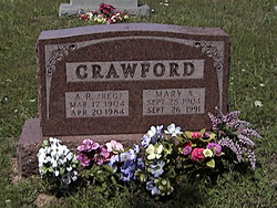
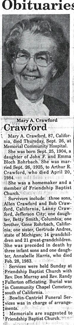
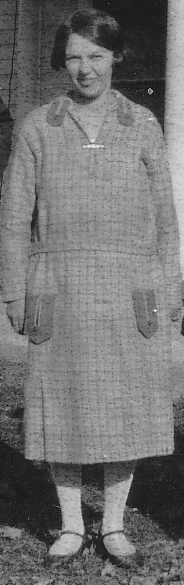
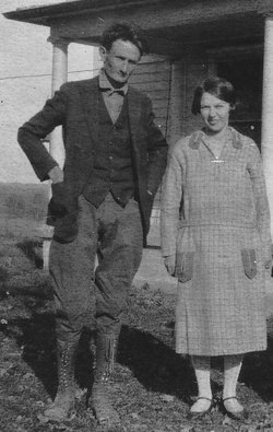
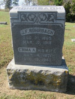
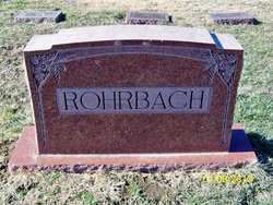
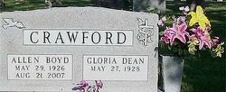
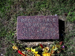
Mary Anna Rohrbach Crawford
| Birth | : | 25 Sep 1904 California, Moniteau County, Missouri, USA |
| Death | : | 26 Sep 1991 California, Moniteau County, Missouri, USA |
| Burial | : | St Andrew's Church, Burton upon Stather, North Lincolnshire Unitary Authority, England |
| Coordinate | : | 53.6501180, -0.6850550 |
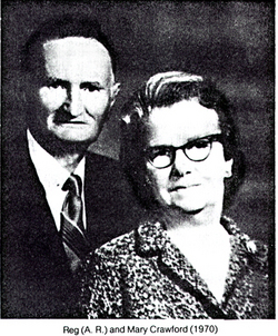
| Description | : | Mary is the wife of Arthur Reginald Crawford. See Reggie's memorial for more information. "Aunt Mary" was very dear to her nieces, Virgie, Betty & Jo Ann Crawford. She set a very good example of a good and Godly woman. |
frequently asked questions (FAQ):
-
Where is Mary Anna Rohrbach Crawford's memorial?
Mary Anna Rohrbach Crawford's memorial is located at: St Andrew's Church, Burton upon Stather, North Lincolnshire Unitary Authority, England.
-
When did Mary Anna Rohrbach Crawford death?
Mary Anna Rohrbach Crawford death on 26 Sep 1991 in California, Moniteau County, Missouri, USA
-
Where are the coordinates of the Mary Anna Rohrbach Crawford's memorial?
Latitude: 53.6501180
Longitude: -0.6850550
Family Members:
Parent

Spouse
Siblings

Children


Nearby Cemetories:
1. St Andrew's Church
Burton upon Stather, North Lincolnshire Unitary Authority, England
Coordinate: 53.6501180, -0.6850550
2. St Mary the Virgin Church
Fockerby, North Lincolnshire Unitary Authority, England
Coordinate: 53.6613050, -0.7138730
3. All Saints' Churchyard
Flixborough, North Lincolnshire Unitary Authority, England
Coordinate: 53.6247100, -0.6819480
4. St Oswald Church
Luddington, North Lincolnshire Unitary Authority, England
Coordinate: 53.6448740, -0.7387490
5. All Saints Churchyard Old
Flixborough, North Lincolnshire Unitary Authority, England
Coordinate: 53.6178950, -0.6754930
6. Alkborough Cemetery
Alkborough, North Lincolnshire Unitary Authority, England
Coordinate: 53.6816460, -0.6686090
7. St Marks Church
Amcotts, North Lincolnshire Unitary Authority, England
Coordinate: 53.6166950, -0.7088900
8. All Saints Churchyard
Adlingfleet, East Riding of Yorkshire Unitary Authority, England
Coordinate: 53.6786760, -0.7238110
9. All Saints Churchyard
Winterton, North Lincolnshire Unitary Authority, England
Coordinate: 53.6555710, -0.5968640
10. Crosby Cemetery
Scunthorpe, North Lincolnshire Unitary Authority, England
Coordinate: 53.5978800, -0.6639600
11. St Bartholomews Churchyard
Eastoft, North Lincolnshire Unitary Authority, England
Coordinate: 53.6397700, -0.7823500
12. Winterton Cemetery
Winterton, North Lincolnshire Unitary Authority, England
Coordinate: 53.6548190, -0.5847270
13. Scunthorpe Cemetery
Scunthorpe, North Lincolnshire Unitary Authority, England
Coordinate: 53.5932400, -0.6512140
14. Holy Trinity Churchyard
Blacktoft, East Riding of Yorkshire Unitary Authority, England
Coordinate: 53.7082510, -0.7271700
15. All Saints Churchyard
Winteringham, North Lincolnshire Unitary Authority, England
Coordinate: 53.6902800, -0.6010700
16. All Saints Churchyard
Winteringham, North Lincolnshire Unitary Authority, England
Coordinate: 53.6904182, -0.6010190
17. St Lawrence Churchyard
Scunthorpe, North Lincolnshire Unitary Authority, England
Coordinate: 53.5864180, -0.6554010
18. St John the Baptist
Whitton, North Lincolnshire Unitary Authority, England
Coordinate: 53.7093390, -0.6342340
19. Woodlands Cemetery and Crematorium
Scunthorpe, North Lincolnshire Unitary Authority, England
Coordinate: 53.5810900, -0.6744900
20. Brumby Cemetery
Scunthorpe, North Lincolnshire Unitary Authority, England
Coordinate: 53.5799400, -0.6448700
21. St Bartholomew's Church
Appleby, North Lincolnshire Unitary Authority, England
Coordinate: 53.6234280, -0.5603240
22. St Oswald Churchyard
Althorpe, North Lincolnshire Unitary Authority, England
Coordinate: 53.5765570, -0.7408910
23. St Mary Churchyard
Broomfleet, East Riding of Yorkshire Unitary Authority, England
Coordinate: 53.7338120, -0.6649730
24. St John The Baptist Churchyard Extension
Burringham, North Lincolnshire Unitary Authority, England
Coordinate: 53.5708230, -0.7439800