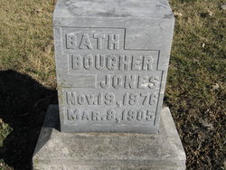
Mary Bathilda “Bath” Boucher Jones
| Birth | : | 19 Nov 1876 Greeley, Anderson County, Kansas, USA |
| Death | : | 8 Mar 1905 Anderson County, Kansas, USA |
| Burial | : | Greeley City Cemetery, Greeley, Anderson County, USA |
| Coordinate | : | 38.3752327, -95.1258011 |
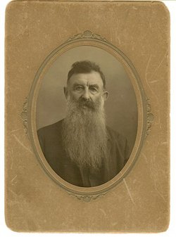
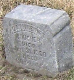
| Description | : | Married Harry Jones ------------------------------ "THE GREELEY GRAPHIC Vol XVI Greeley, Anderson County, Kans. March 5, 1908 No. 24 HENRY BOUCHER DEAD Tuesday, the citizens of Greeley were informed of the death in Garnett at the home of his son-in-law, W. O. Decker of Henry Boucher, one of the pioneers of Kansas. Three Boucher brothers at an early day settled on what has since been known as Boucher Branch, four miles north east of here. John, the eldest has been gone for many years. Simon, the youngest, was laid in Greeley cemetery Dec 31, 1897, and... Read More |
frequently asked questions (FAQ):
-
Where is Mary Bathilda “Bath” Boucher Jones's memorial?
Mary Bathilda “Bath” Boucher Jones's memorial is located at: Greeley City Cemetery, Greeley, Anderson County, USA.
-
When did Mary Bathilda “Bath” Boucher Jones death?
Mary Bathilda “Bath” Boucher Jones death on 8 Mar 1905 in Anderson County, Kansas, USA
-
Where are the coordinates of the Mary Bathilda “Bath” Boucher Jones's memorial?
Latitude: 38.3752327
Longitude: -95.1258011
Family Members:
Parent
Siblings
Children
Flowers:
Nearby Cemetories:
1. Greeley City Cemetery
Greeley, Anderson County, USA
Coordinate: 38.3752327, -95.1258011
2. Lanter Family Cemetery
Anderson County, USA
Coordinate: 38.3827100, -95.1059000
3. Saint Johns Cemetery
Greeley, Anderson County, USA
Coordinate: 38.3546982, -95.1256027
4. Pottawatomie Baptist Mission Cemetery
Lane, Franklin County, USA
Coordinate: 38.4049500, -95.1028200
5. Sutton Valley Cemetery
Greeley, Anderson County, USA
Coordinate: 38.3311005, -95.1044006
6. Berea Cemetery
Franklin County, USA
Coordinate: 38.3981018, -95.1849976
7. Baker Cemetery
Lane, Franklin County, USA
Coordinate: 38.4371986, -95.1333008
8. Sturgeon Cemetery
Lane, Franklin County, USA
Coordinate: 38.4376100, -95.1254100
9. Smith Cemetery
Richmond, Franklin County, USA
Coordinate: 38.4253700, -95.1785950
10. Saint Boniface Catholic Cemetery
Scipio, Anderson County, USA
Coordinate: 38.3650017, -95.2109985
11. Wait Cemetery
Parker, Linn County, USA
Coordinate: 38.3527985, -95.0378036
12. Judy Cemetery
Garnett, Anderson County, USA
Coordinate: 38.3093987, -95.1753006
13. Lane Cemetery
Lane, Franklin County, USA
Coordinate: 38.4411011, -95.0699997
14. Myers Cemetery
Lane, Franklin County, USA
Coordinate: 38.4578820, -95.0935150
15. Needham Cemetery
Lane, Franklin County, USA
Coordinate: 38.4700012, -95.1231003
16. Beacon of Truth Cemetery
Richmond, Franklin County, USA
Coordinate: 38.3895300, -95.2470200
17. Spring Grove Quaker Cemetery
Miami County, USA
Coordinate: 38.4409600, -95.0185100
18. Chandler Family Cemetery
Beagle, Miami County, USA
Coordinate: 38.4057600, -94.9951200
19. South Sugar Valley Cemetery
Garnett, Anderson County, USA
Coordinate: 38.2697890, -95.1021450
20. West Scipio Cemetery
Anderson County, USA
Coordinate: 38.3685989, -95.2660980
21. Garnett Cemetery
Garnett, Anderson County, USA
Coordinate: 38.2961006, -95.2249985
22. Green Valley Cemetery
Miami County, USA
Coordinate: 38.4700012, -95.0472031
23. Holy Angels Cemetery
Garnett, Anderson County, USA
Coordinate: 38.2974100, -95.2312200
24. Richmond Cemetery
Richmond, Franklin County, USA
Coordinate: 38.4040500, -95.2670700


