
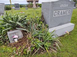
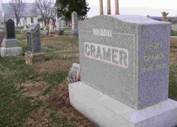

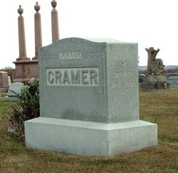
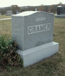
Mary Cramer
| Birth | : | 1889 Millville, Ray County, Missouri, USA |
| Death | : | 10 Mar 1919 Kansas City, Jackson County, Missouri, USA |
| Burial | : | Goulburn Old Cemetery, Goulburn, Goulburn Mulwaree Council, Australia |
| Coordinate | : | -34.7444690, 149.7378160 |
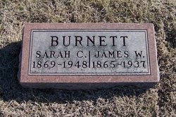
| Description | : | Death of Miss Mary Cramer News was received in Hardin Monday of the death of Miss Mary Cramer, which occurred at the home of her sister, Mrs. Jas. Burnett, Kansas City early that morning following a brief illness with influenza and pneumonia. Deceased was about thirty years of age and is the youngest daughter of Mr. and Mrs. Henry Cramer, well known and highly respected residents of the Ovid country, north of Hardin. Miss Cramer was a talented musician and at the time of her death was employed as teacher in a Kansas City Conservatory, where she had been... Read More |
frequently asked questions (FAQ):
-
Where is Mary Cramer's memorial?
Mary Cramer's memorial is located at: Goulburn Old Cemetery, Goulburn, Goulburn Mulwaree Council, Australia.
-
When did Mary Cramer death?
Mary Cramer death on 10 Mar 1919 in Kansas City, Jackson County, Missouri, USA
-
Where are the coordinates of the Mary Cramer's memorial?
Latitude: -34.7444690
Longitude: 149.7378160
Family Members:
Parent
Siblings
Flowers:


Nearby Cemetories:
1. Goulburn Old Cemetery
Goulburn, Goulburn Mulwaree Council, Australia
Coordinate: -34.7444690, 149.7378160
2. Saint Saviours Anglican Cemetery
Goulburn, Goulburn Mulwaree Council, Australia
Coordinate: -34.7406960, 149.7432970
3. Goulburn Jewish Cemetery
Goulburn, Goulburn Mulwaree Council, Australia
Coordinate: -34.7551950, 149.7433550
4. Goulburn General Cemetery
Goulburn, Goulburn Mulwaree Council, Australia
Coordinate: -34.7442800, 149.7541200
5. Saint Saviours Cathedral Churchyard
Goulburn, Goulburn Mulwaree Council, Australia
Coordinate: -34.7531700, 149.7159700
6. Kenmore Roman Catholic Cemetery
Goulburn, Goulburn Mulwaree Council, Australia
Coordinate: -34.7244290, 149.7319710
7. Sts Peter & Paul Old Cathedral
Goulburn, Goulburn Mulwaree Council, Australia
Coordinate: -34.7556340, 149.7150370
8. Kenmore Mental Hospital Cemetery
Kenmore, Goulburn Mulwaree Council, Australia
Coordinate: -34.7187600, 149.7554470
9. St Patricks College (now Trinity Catholic College)
Goulburn, Goulburn Mulwaree Council, Australia
Coordinate: -34.7492240, 149.6969980
10. St. Andrew's Cemetery
Tirrannaville, Goulburn Mulwaree Council, Australia
Coordinate: -34.8181980, 149.6833340
11. Thurlow Methodist Church
Baw Baw, Goulburn Mulwaree Council, Australia
Coordinate: -34.7086590, 149.6179610
12. St Johns Anglican Churchyard
Towrang, Goulburn Mulwaree Council, Australia
Coordinate: -34.6956160, 149.8507090
13. Merrilla Cemetery
Goulburn, Goulburn Mulwaree Council, Australia
Coordinate: -34.7486220, 149.5993750
14. St James Anglican Cemetery
Pomeroy, Goulburn Mulwaree Council, Australia
Coordinate: -34.7488140, 149.5993110
15. St. Mary Cemetery
Yarra, Goulburn Mulwaree Council, Australia
Coordinate: -34.7973480, 149.6142910
16. Merrilla Methodist Cemetery
Merrilla, Goulburn Mulwaree Council, Australia
Coordinate: -34.7428100, 149.5785790
17. Komungla General Cemetery
Komungla, Goulburn Mulwaree Council, Australia
Coordinate: -34.8784540, 149.6404940
18. Mummell Catholic cemetery
Mummel, Goulburn Mulwaree Council, Australia
Coordinate: -34.6680260, 149.5499320
19. Murrel Cemetery
Mummel, Goulburn Mulwaree Council, Australia
Coordinate: -34.6680600, 149.5498400
20. Parkesbourne Methodist Cemetery
Parkesbourne, Goulburn Mulwaree Council, Australia
Coordinate: -34.7588220, 149.5222900
21. Marulan Anglican Cemetery
Marulan, Goulburn Mulwaree Council, Australia
Coordinate: -34.7318400, 149.9817200
22. Christ Church Anglican Churchyard
Bungonia, Goulburn Mulwaree Council, Australia
Coordinate: -34.8590005, 149.9432472
23. Marulan Catholic Cemetery
Marulan, Goulburn Mulwaree Council, Australia
Coordinate: -34.7281400, 149.9862120
24. Bungonia Cemetery
Bungonia, Goulburn Mulwaree Council, Australia
Coordinate: -34.8632150, 149.9422700