| Birth | : | 11 Dec 1904 Ellis County, Kansas, USA |
| Death | : | 27 Dec 1992 Lyons, Rice County, Kansas, USA |
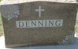
| Burial | : | Saint Anthony Cemetery, Graham County, USA |
| Coordinate | : | 39.1892014, -100.0805969 |
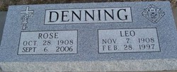
| Inscription | : | Carl Knoll and Mary Denning married Feb. 6, 1923 |
| Description | : | Mary D. (Denning) Knoll, 88, died Sunday, Dec. 27, 1992 at Rice County District No. 1 Hospital, Lyons. She was born Dec. 11, 1904 at Hyacith to Benedict and Catherine (Dinkel) Denning. She married Carl Knoll Feb. 6, 1923 at St. Peter. He died Sept. 12, 1990. She was a homemaker and a longtime resident of WaKeeney. She was a member of Christ the King Catholic Church, WaKeeney. Survivors include two sons, Thomas, Lakewood, Colo., and Alvin, Littleton, Colo.; three daughters, Marcella Sanders, Lyons, Olivia Dinges,... Read More |
frequently asked questions (FAQ):
-
Where is Mary D. Denning Knoll's memorial?
Mary D. Denning Knoll's memorial is located at: Saint Anthony Cemetery, Graham County, USA.
-
When did Mary D. Denning Knoll death?
Mary D. Denning Knoll death on 27 Dec 1992 in Lyons, Rice County, Kansas, USA
-
Where are the coordinates of the Mary D. Denning Knoll's memorial?
Latitude: 39.1892014
Longitude: -100.0805969
Family Members:
Parent
Spouse
Siblings
Children
Flowers:
Nearby Cemetories:
1. Leland Cemetery
Penokee, Graham County, USA
Coordinate: 39.2256012, -100.0149994
2. Mount Pleasant Community Cemetery
Studley, Sheridan County, USA
Coordinate: 39.2550011, -100.1635971
3. Bethel Christian Cemetery
Studley, Sheridan County, USA
Coordinate: 39.2334100, -100.2051300
4. Saline Valley Cemetery
Trego County, USA
Coordinate: 39.1180992, -99.9610977
5. Brush Creek Cemetery
Graham County, USA
Coordinate: 39.3011900, -99.9743400
6. Morland Cemetery
Morland, Graham County, USA
Coordinate: 39.3431015, -100.0708008
7. Saint Michaels Cemetery
Collyer, Trego County, USA
Coordinate: 39.0318985, -100.1153030
8. Quinter Cemetery
Quinter, Gove County, USA
Coordinate: 39.0736008, -100.2236023
9. Union Cemetery
Collyer, Trego County, USA
Coordinate: 39.0299988, -100.1125031
10. Prairie Home Cemetery
Graham County, USA
Coordinate: 39.1903000, -99.8566971
11. Penokee Cemetery
Penokee, Graham County, USA
Coordinate: 39.3425293, -99.9727402
12. Studley Cemetery
Studley, Sheridan County, USA
Coordinate: 39.3568993, -100.1631012
13. Old Order German Baptist Cemetery
Quinter, Gove County, USA
Coordinate: 39.0299988, -100.2052994
14. Baugher Cemetery
Studley, Sheridan County, USA
Coordinate: 39.3205600, -100.2560800
15. Anderson Cemetery
Graham County, USA
Coordinate: 39.4077988, -100.0975037
16. Sacred Heart Cemetery
Park, Gove County, USA
Coordinate: 39.1147003, -100.3555984
17. Rock Creek Cemetery
Graham County, USA
Coordinate: 39.4075012, -99.9935989
18. Kansas Veterans Cemetery at Wakeeney
WaKeeney, Trego County, USA
Coordinate: 39.0172200, -99.8715300
19. West Park Cemetery
Gove County, USA
Coordinate: 39.1107100, -100.3688300
20. Christ the King Catholic Cemetery
WaKeeney, Trego County, USA
Coordinate: 39.0166500, -99.8712000
21. Wakeeney City Cemetery
WaKeeney, Trego County, USA
Coordinate: 39.0158005, -99.8711014
22. Bow Creek Cemetery
Tasco, Sheridan County, USA
Coordinate: 39.4227982, -100.2564011
23. Memorial Lawn Cemetery
Hill City, Graham County, USA
Coordinate: 39.3927803, -99.8452072
24. Hill City Cemetery
Hill City, Graham County, USA
Coordinate: 39.3944893, -99.8451996


