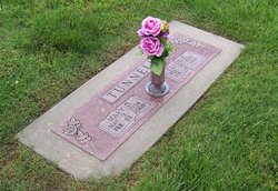
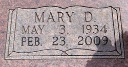
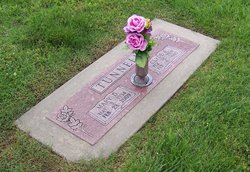
Mary Darlene Larson Tunnell
| Birth | : | 3 May 1934 Neosho County, Kansas, USA |
| Death | : | 23 Feb 2009 Chanute, Neosho County, Kansas, USA |
| Burial | : | Wachogue Cemetery, Springfield, Hampden County, USA |
| Coordinate | : | 42.0950860, -72.5109030 |
| Plot | : | Center Section, northeast |
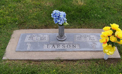
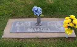
| Description | : | **************************** Published Feb. 25, 2009 - Chanute, KS Mary Tunnell, 74, Chanute, Kansas, died Monday, Feb. 23 at her home. Mary was born in Rural Chanute, Kansas on May 3, 1934, the daughter of Harry and Hattie (Johnson) Larson. She graduated from Chanute High School in 1951. She attended Chanute Junior College graduating in 1953. Mary continued her education at Pittsburg State University earning her Bachelor's Degree in 1966 and her Master's Degree in 1979. She was united in marriage to Clyde Tunnell on October 29, 1954 at the Colfax Baptist Church. He preceded her in death on February 6, 1993. Mary was an Elementary... Read More |
frequently asked questions (FAQ):
-
Where is Mary Darlene Larson Tunnell's memorial?
Mary Darlene Larson Tunnell's memorial is located at: Wachogue Cemetery, Springfield, Hampden County, USA.
-
When did Mary Darlene Larson Tunnell death?
Mary Darlene Larson Tunnell death on 23 Feb 2009 in Chanute, Neosho County, Kansas, USA
-
Where are the coordinates of the Mary Darlene Larson Tunnell's memorial?
Latitude: 42.0950860
Longitude: -72.5109030
Family Members:
Parent
Spouse
Siblings
Flowers:
Nearby Cemetories:
1. Wachogue Cemetery
Springfield, Hampden County, USA
Coordinate: 42.0950860, -72.5109030
2. Saint Marks Memorial Garden
East Longmeadow, Hampden County, USA
Coordinate: 42.0725600, -72.5007430
3. Kesser Israel Cemetery
Springfield, Hampden County, USA
Coordinate: 42.1145610, -72.5304670
4. Sons of Israel Cemetery
Springfield, Hampden County, USA
Coordinate: 42.1143000, -72.5316000
5. City of Homes Cemetery
Springfield, Hampden County, USA
Coordinate: 42.1142980, -72.5316060
6. Brookside Cemetery
East Longmeadow, Hampden County, USA
Coordinate: 42.0842819, -72.4809036
7. Gate of Heaven Cemetery
Springfield, Hampden County, USA
Coordinate: 42.1048370, -72.4778450
8. Green Lawn Cemetery
East Longmeadow, Hampden County, USA
Coordinate: 42.0645561, -72.5079727
9. Hillcrest Park Cemetery
Springfield, Hampden County, USA
Coordinate: 42.1274986, -72.4933014
10. Saint Michael's Cemetery
Springfield, Hampden County, USA
Coordinate: 42.1240997, -72.5392914
11. Maplewood Cemetery
Springfield, Hampden County, USA
Coordinate: 42.1307983, -72.4957962
12. Bay Path Cemetery
Springfield, Hampden County, USA
Coordinate: 42.1231003, -72.5519028
13. Cherry Lane Cemetery
Springfield, Hampden County, USA
Coordinate: 42.0971985, -72.5689011
14. Unitarian Universalist Church Memorial Garden
Springfield, Hampden County, USA
Coordinate: 42.0711740, -72.5611830
15. Trinity United Methodist Church Memorial Garden
Springfield, Hampden County, USA
Coordinate: 42.0824900, -72.5739240
16. Baptist Village Cemetery
East Longmeadow, Hampden County, USA
Coordinate: 42.0559920, -72.4711310
17. Springfield Cemetery
Springfield, Hampden County, USA
Coordinate: 42.1015180, -72.5764990
18. Oak Grove Cemetery
Springfield, Hampden County, USA
Coordinate: 42.1264000, -72.5625000
19. Sinai Memorial Park
Springfield, Hampden County, USA
Coordinate: 42.1427994, -72.5291977
20. Billings Hill Cemetery
East Longmeadow, Hampden County, USA
Coordinate: 42.0433860, -72.5000000
21. Polish National Cemetery
Springfield, Hampden County, USA
Coordinate: 42.1441870, -72.5417380
22. Barney Family Mausoleum
Springfield, Hampden County, USA
Coordinate: 42.0759600, -72.5802940
23. Adams Cemetery
Wilbraham, Hampden County, USA
Coordinate: 42.1082993, -72.4389038
24. Saint Michaels Churchyard
Springfield, Hampden County, USA
Coordinate: 42.1040970, -72.5841540

