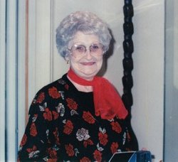
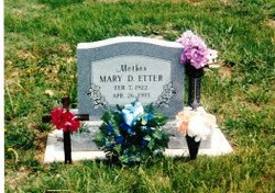
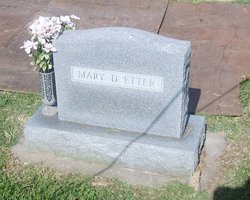
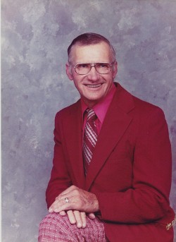
Mary Dicie Hedrick-Roulston Etter
| Birth | : | 7 Feb 1922 Elk City, Montgomery County, Kansas, USA |
| Death | : | 26 Apr 1993 Wichita, Sedgwick County, Kansas, USA |
| Burial | : | Calvary Lutheran Cemetery, Ulen Township, Clay County, USA |
| Coordinate | : | 47.0907100, -96.2587100 |
| Description | : | Mary D. Etter, 71, of Wichita, retired licensed practical nurse, died Monday, April 26, 1993. Services are 10 a.m. Thursday at Westside Baptist Church, Wichita; and at 1 p.m. Thursday in Sunset Lawns Cemetery, El Dorado. Survivors include: sons, David Roulston, Clifford Roulston, both of Wichita; daughter, Donna McJimsey of Haysville; sister, Faye Long of El Dorado; nine grandchildren; eight great-grandchildren. Memorials are to the Westside Baptist Church. Culbertson-Smith Mortuary has the arrangements. (El Dorado Times ~ 28 April 1993 ~ Transcribed by Lori DeWinkler) My Beloved Mother, By Donna |
frequently asked questions (FAQ):
-
Where is Mary Dicie Hedrick-Roulston Etter's memorial?
Mary Dicie Hedrick-Roulston Etter's memorial is located at: Calvary Lutheran Cemetery, Ulen Township, Clay County, USA.
-
When did Mary Dicie Hedrick-Roulston Etter death?
Mary Dicie Hedrick-Roulston Etter death on 26 Apr 1993 in Wichita, Sedgwick County, Kansas, USA
-
Where are the coordinates of the Mary Dicie Hedrick-Roulston Etter's memorial?
Latitude: 47.0907100
Longitude: -96.2587100
Family Members:
Parent
Spouse
Siblings
Children
Flowers:
Nearby Cemetories:
1. Calvary Lutheran Cemetery
Ulen Township, Clay County, USA
Coordinate: 47.0907100, -96.2587100
2. Bethlehem Memorial Cemetery
Ulen Township, Clay County, USA
Coordinate: 47.0915900, -96.2588000
3. Sliper Cemetery
Ulen Township, Clay County, USA
Coordinate: 47.0931015, -96.2656021
4. Creamery Cemetery
Ulen, Clay County, USA
Coordinate: 47.0785820, -96.2587730
5. Bethlehem Lutheran West Cemetery
Ulen Township, Clay County, USA
Coordinate: 47.0783600, -96.2803800
6. Old Jevnaker Cemetery
Hagen Township, Clay County, USA
Coordinate: 47.1441710, -96.3515780
7. Walworth Baptist Cemetery
Walworth Township, Becker County, USA
Coordinate: 47.1404600, -96.1517000
8. Keene Lutheran Cemetery
Keene Township, Clay County, USA
Coordinate: 47.0354400, -96.3650300
9. Atlanta Cemetery
Atlanta Township, Becker County, USA
Coordinate: 47.0522300, -96.1314440
10. Syre Cemetery
Syre, Norman County, USA
Coordinate: 47.1869090, -96.2592670
11. United Norwegian Lutheran Cemetery
Rockwell Township, Norman County, USA
Coordinate: 47.1652778, -96.3647222
12. Old Aspelund Church Cemetery
Flom Township, Norman County, USA
Coordinate: 47.1519610, -96.1300710
13. Aspelund Lutheran Church Cemetery
Flom Township, Norman County, USA
Coordinate: 47.1574300, -96.1315480
14. Jevnaker Cemetery
Rockwell Township, Norman County, USA
Coordinate: 47.1514015, -96.3953018
15. Immanuel Lutheran Cemetery
Flom Township, Norman County, USA
Coordinate: 47.1894455, -96.1725006
16. Salem West Cemetery
Hitterdal, Clay County, USA
Coordinate: 46.9757300, -96.2600000
17. Salem East Cemetery
Hitterdal, Clay County, USA
Coordinate: 46.9744800, -96.2583300
18. Buffalo River Pioneer Cemetery
Cuba Township, Becker County, USA
Coordinate: 46.9650250, -96.1737160
19. Highland Grove Lutheran Cemetery
Highland Grove Township, Clay County, USA
Coordinate: 46.9518700, -96.2113500
20. East Wild Rice Lutheran Cemetery
Flom Township, Norman County, USA
Coordinate: 47.2244200, -96.1742980
21. Lysne Cemetery
Cromwell Township, Clay County, USA
Coordinate: 46.9639015, -96.3752975
22. Bethlehem Cemetery
Flom Township, Norman County, USA
Coordinate: 47.2244660, -96.1306220
23. Felton Cemetery
Felton Township, Clay County, USA
Coordinate: 47.0643997, -96.4993973
24. Zion Cemetery
Twin Valley, Norman County, USA
Coordinate: 47.2566986, -96.2630997

