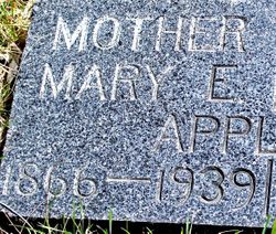
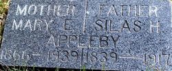
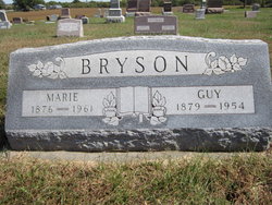
Mary E. Bryson Appleby
| Birth | : | 13 Jun 1866 Ohio, USA |
| Death | : | 1939 Denver, Worth County, Missouri, USA |
| Burial | : | Encino Cemetery, Encino, Torrance County, USA |
| Coordinate | : | 34.6450000, -105.4665000 |
| Plot | : | Sec 5, Row 2, North end by drive. |
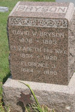
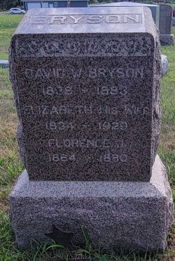
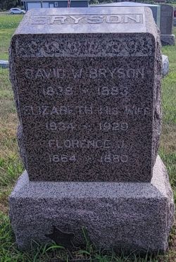
| Description | : | 83y 4m 23d. Wife of Silas Appleby. Daughter of Silas & Elizabeth Bryson. |
frequently asked questions (FAQ):
-
Where is Mary E. Bryson Appleby's memorial?
Mary E. Bryson Appleby's memorial is located at: Encino Cemetery, Encino, Torrance County, USA.
-
When did Mary E. Bryson Appleby death?
Mary E. Bryson Appleby death on 1939 in Denver, Worth County, Missouri, USA
-
Where are the coordinates of the Mary E. Bryson Appleby's memorial?
Latitude: 34.6450000
Longitude: -105.4665000
Family Members:
Parent
Spouse
Siblings
Children
Nearby Cemetories:
1. Encino Cemetery
Encino, Torrance County, USA
Coordinate: 34.6450000, -105.4665000
2. Guadalupe Cemetery
Encino, Torrance County, USA
Coordinate: 34.6483000, -105.4678000
3. Negra Cemetery
Torrance County, USA
Coordinate: 34.6529120, -105.5377640
4. Hindi Family Cemetery
Torrance County, USA
Coordinate: 34.4672012, -105.3964005
5. Duran Cemetery
Duran, Torrance County, USA
Coordinate: 34.4636007, -105.3915816
6. Derramadero Cemetery
Derramadero, Torrance County, USA
Coordinate: 34.8286500, -105.3319400
7. Red Hills Cemetery
Torrance County, USA
Coordinate: 34.8576240, -105.5820310
8. South Pinos Wells Cemetery
Cedarvale, Torrance County, USA
Coordinate: 34.4459000, -105.6278992
9. Pinos Wells Cemetery
Pinos Wells, Torrance County, USA
Coordinate: 34.4505997, -105.6382980
10. Evergreen Cemetery
Vaughn, Guadalupe County, USA
Coordinate: 34.5938988, -105.1806030
11. Lucy Cemetery
Lucy, Torrance County, USA
Coordinate: 34.6390340, -105.8333340
12. Cedarvale Cemetery
Cedarvale, Torrance County, USA
Coordinate: 34.3765000, -105.6915000
13. Palma Townsite Cemetery
Palma, Torrance County, USA
Coordinate: 34.9772930, -105.4656020
14. Milagro Cemetery
Milagro, Guadalupe County, USA
Coordinate: 34.9459020, -105.2724940
15. Our Lady of Sorrows Cemetery
Guadalupe County, USA
Coordinate: 34.9459770, -105.2726160
16. Sombrio Cemetery
Guadalupe County, USA
Coordinate: 34.8773100, -105.1420400
17. Progresso Cemetery
Torrance County, USA
Coordinate: 34.4777985, -105.8806000
18. Holy Family Cemetery
Pintada, Guadalupe County, USA
Coordinate: 34.8814700, -105.0713000
19. Corona Cemetery
Corona, Lincoln County, USA
Coordinate: 34.2406590, -105.5875720
20. Old Pintada Cemetery
Pintada, Guadalupe County, USA
Coordinate: 34.8856010, -105.0433140
21. Saint Helen Cemetery
Pastura, Guadalupe County, USA
Coordinate: 34.7830030, -104.9446030
22. El Rosario Cemetery
Willard, Torrance County, USA
Coordinate: 34.6044006, -106.0306015
23. Farmer Cemetery
Willard, Torrance County, USA
Coordinate: 34.5745440, -106.0268070
24. Protestant Cemetery
Willard, Torrance County, USA
Coordinate: 34.5957985, -106.0330963

