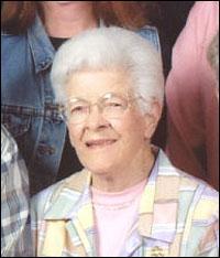
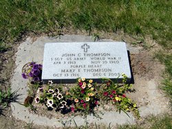
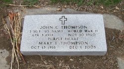
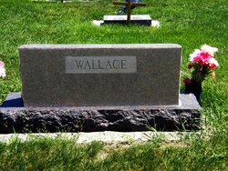
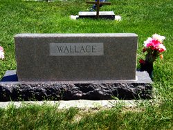
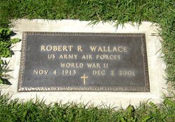
Mary Edith Wallace Thompson
| Birth | : | 13 Oct 1916 Billings, Yellowstone County, Montana, USA |
| Death | : | 6 Dec 2005 Butte, Silver Bow County, Montana, USA |
| Burial | : | Arvada Cemetery, Arvada, Jefferson County, USA |
| Coordinate | : | 39.7969017, -105.1077805 |
| Description | : | Obituary from Helena's Independent Record 12/09/2005: Mary Edith Thompson, age 89, of Helena died of natural causes on Dec. 6, 2005, at Big Sky Care Center in Helena. Mary was born in Billings Oct. 13, 1916, to Cleveland R. and Annie (Steele) Wallace. She graduated from high school and continued her education at Billings Business College. Mary married John C. Thompson in Townsend on Aug. 17, 1941. Early in her life Mary worked for the Chamber of Commerce and Bridenbaugh Clinic in Billings. In 1962, Mary worked for Neifert-White Lumber Company in Townsend and in 1972 was employed by Eddy’s Bakery in their... Read More |
frequently asked questions (FAQ):
-
Where is Mary Edith Wallace Thompson's memorial?
Mary Edith Wallace Thompson's memorial is located at: Arvada Cemetery, Arvada, Jefferson County, USA.
-
When did Mary Edith Wallace Thompson death?
Mary Edith Wallace Thompson death on 6 Dec 2005 in Butte, Silver Bow County, Montana, USA
-
Where are the coordinates of the Mary Edith Wallace Thompson's memorial?
Latitude: 39.7969017
Longitude: -105.1077805
Family Members:
Parent
Spouse
Siblings
Flowers:

Rest Well
Left by Anonymous on 13 Dec 2005

Left by Anonymous on 13 Dec 2005

Merry Christmas In Heaven!
Left by Anonymous on 24 Dec 2005

Left by Anonymous on 15 Feb 2006

Rest in peace
Left by Anonymous on 07 Dec 2006
Left by Anonymous on 17 Dec 2006

May eternal blessings be yours
Left by Anonymous on 03 Oct 2007

Left by Anonymous on 12 Nov 2009
Nearby Cemetories:
1. Arvada Cemetery
Arvada, Jefferson County, USA
Coordinate: 39.7969017, -105.1077805
2. Holy Cross Lutheran Church Columbarium
Wheat Ridge, Jefferson County, USA
Coordinate: 39.7799500, -105.1090300
3. Mount Olivet Catholic Cemetery
Wheat Ridge, Jefferson County, USA
Coordinate: 39.7832985, -105.1477966
4. Glory of God Lutheran Church Columbarium
Wheat Ridge, Jefferson County, USA
Coordinate: 39.7680000, -105.1352000
5. Crown Hill Cemetery
Wheat Ridge, Jefferson County, USA
Coordinate: 39.7580986, -105.0942001
6. Belgin Cemetery
Arvada, Jefferson County, USA
Coordinate: 39.8349037, -105.1306610
7. Ralston Cemetery
Arvada, Jefferson County, USA
Coordinate: 39.8088989, -105.1603012
8. Our Lady of Fatima Catholic Church Cemetery
Lakewood, Jefferson County, USA
Coordinate: 39.7472000, -105.1146000
9. Shepherd of The Hills Presbyterian Church Cemetery
Lakewood, Jefferson County, USA
Coordinate: 39.7472000, -105.1278000
10. Golden Hill Cemetery
Lakewood, Jefferson County, USA
Coordinate: 39.7392006, -105.1346970
11. Saint Pauls Episcopal Columbarium
Lakewood, Jefferson County, USA
Coordinate: 39.7328000, -105.1004000
12. Holy Shepherd Lutheran Church Columbarium
Lakewood, Jefferson County, USA
Coordinate: 39.7314900, -105.1089000
13. Westminster Presbyterian Church Columbarium
Westminster, Adams County, USA
Coordinate: 39.8370620, -105.0357056
14. Belleview Cemetery
Adams County, USA
Coordinate: 39.8488000, -105.0298000
15. Acacia Cemetery (Defunct)
Denver, Denver County, USA
Coordinate: 39.7603680, -105.0138070
16. Auraria Cemetery
Denver County, USA
Coordinate: 39.7526500, -105.0096400
17. Green Mountain United Methodist Church Columbarium
Lakewood, Jefferson County, USA
Coordinate: 39.7126260, -105.1419500
18. Ridgeway Burial Site
Arvada, Jefferson County, USA
Coordinate: 39.8463710, -105.2092960
19. Golden Cemetery
Golden, Jefferson County, USA
Coordinate: 39.7280617, -105.1961136
20. Calvary Episcopal Church Columbarium
Golden, Jefferson County, USA
Coordinate: 39.7539291, -105.2214203
21. Old Golden City Cemetery
Golden, Jefferson County, USA
Coordinate: 39.7637210, -105.2275040
22. White Ash Mine Memorial
Golden, Jefferson County, USA
Coordinate: 39.7517430, -105.2276090
23. Saint Paul Lutheran Church Columbarium
Denver, Denver County, USA
Coordinate: 39.7419000, -104.9834500
24. First Mennonite Church Memorial Garden
Denver, Denver County, USA
Coordinate: 39.7302000, -104.9933000

