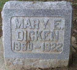
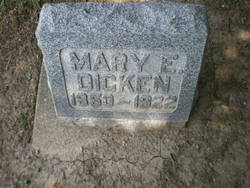
Mary Eliza Johnson Dicken
| Birth | : | 23 Dec 1850 Mooresville, Morgan County, Indiana, USA |
| Death | : | 22 Mar 1922 Missouri, USA |
| Burial | : | Maryborough Crematorium, Maryborough, Fraser Coast Region, Australia |
| Coordinate | : | -25.5116294, 152.6716756 |
| Plot | : | Section E, Lot 111, sp. 2, |
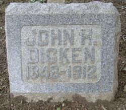
| Description | : | Born in late December of 1851 or 1850* in Mooresville, Morgan County, Indiana, Mary Eliza Johnson was the daughter of Captain Richard P. Johnson (1818-1882) and Mary Catherine Benton (1821-1868). Mary Eliza Johnson married John Henry Dicken on May 20, 1869, in Wabash, Indiana. It is not clear exactly how Mary and John met, but after the Civl War, Mary's father, who was a tailor, moved to Wasbash. Mary and John had one daughter, Bertha Dicken, born on May 15, 1873, in Wabash, Indiana. Bertha Dicken married Robert Patterson Woods on March 13, 1894 in Wabash. Robert and Bertha resided in... Read More |
frequently asked questions (FAQ):
-
Where is Mary Eliza Johnson Dicken's memorial?
Mary Eliza Johnson Dicken's memorial is located at: Maryborough Crematorium, Maryborough, Fraser Coast Region, Australia.
-
When did Mary Eliza Johnson Dicken death?
Mary Eliza Johnson Dicken death on 22 Mar 1922 in Missouri, USA
-
Where are the coordinates of the Mary Eliza Johnson Dicken's memorial?
Latitude: -25.5116294
Longitude: 152.6716756
Family Members:
Parent
Spouse
Siblings
Flowers:
Nearby Cemetories:
1. Maryborough Crematorium
Maryborough, Fraser Coast Region, Australia
Coordinate: -25.5116294, 152.6716756
2. Maryborough Lawn Cemetery
Maryborough, Fraser Coast Region, Australia
Coordinate: -25.5126410, 152.6731850
3. Maryborough Cemetery
Maryborough, Fraser Coast Region, Australia
Coordinate: -25.5165460, 152.6735930
4. Maryborough Pioneer Cemetery
Maryborough, Fraser Coast Region, Australia
Coordinate: -25.5232830, 152.6746380
5. Elizabeth Park Rose Gardens
Maryborough, Fraser Coast Region, Australia
Coordinate: -25.5317100, 152.6952600
6. Commissioner Bidwill's Grave
Maryborough, Fraser Coast Region, Australia
Coordinate: -25.5631670, 152.7110000
7. Barlows Farm Cemetery
Takura, Fraser Coast Region, Australia
Coordinate: -25.3330030, 152.7191200
8. Tiaro Cemetery
Tiaro, Fraser Coast Region, Australia
Coordinate: -25.7173650, 152.5856850
9. Aalborg Danish Cemetery
Nikenbah, Fraser Coast Region, Australia
Coordinate: -25.3169800, 152.8047240
10. Bayside Gardens Crematorium
Nikenbah, Fraser Coast Region, Australia
Coordinate: -25.3135540, 152.8020030
11. Howard Remembrance Park
Howard, Fraser Coast Region, Australia
Coordinate: -25.3054360, 152.5470520
12. Hervey Bay Crematorium
Hervey Bay, Fraser Coast Region, Australia
Coordinate: -25.2991870, 152.8075780
13. Polson Cemetery
Point Vernon, Fraser Coast Region, Australia
Coordinate: -25.2522717, 152.8135186
14. Deborah Cemetery
Netherby, Fraser Coast Region, Australia
Coordinate: -25.7827119, 152.4940048
15. Big Woody Island Cemetery
Hervey Bay, Fraser Coast Region, Australia
Coordinate: -25.2828650, 152.9544730
16. St Mary's Anglican Churchyard
Brooweena, Fraser Coast Region, Australia
Coordinate: -25.6155810, 152.2342900
17. Munna Creek Cemetery
Gundiah, Fraser Coast Region, Australia
Coordinate: -25.8943010, 152.4806150
18. Agnes Vale Station Cemetery
Childers, Bundaberg Region, Australia
Coordinate: -25.2720660, 152.2496070
19. Childers Lawn Cemetery
Childers, Bundaberg Region, Australia
Coordinate: -25.2241618, 152.2642764
20. Dickabram Cemetery
Miva, Gympie Region, Australia
Coordinate: -25.9604510, 152.4848260
21. Apple Tree Creek Cemetery
Apple Tree Creek, Bundaberg Region, Australia
Coordinate: -25.2254030, 152.2386650
22. Gunalda Cemetery
Gunalda, Gympie Region, Australia
Coordinate: -25.9877920, 152.5557680
23. Tozer Park Cemetery (Defunct)
Gympie, Gympie Region, Australia
Coordinate: -26.0008330, 152.7438890
24. Neerdie Cemetery
Gympie, Gympie Region, Australia
Coordinate: -26.0008540, 152.7442570


