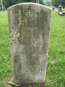
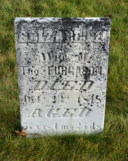
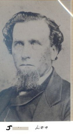
| Birth | : | 1763 Pennsylvania, USA |
| Death | : | 1823 Prairie Creek, Vigo County, Indiana, USA |
| Burial | : | Woods Chapel Cemetery, Greene County, USA |
| Coordinate | : | 35.9846992, -90.5678024 |
| Description | : | Birth and death dates are approximate only. --U.S. Marriage Records, 1784-- Name: James Lee Gender: Male Birth Place: Virginia Birth Year: 1760 Spouse Name: Polly Jones Marriage Year: 1784 Marriage State: Pennsylvania |
frequently asked questions (FAQ):
-
Where is Mary Elizabeth “Polly” Jones Lee's memorial?
Mary Elizabeth “Polly” Jones Lee's memorial is located at: Woods Chapel Cemetery, Greene County, USA.
-
When did Mary Elizabeth “Polly” Jones Lee death?
Mary Elizabeth “Polly” Jones Lee death on 1823 in Prairie Creek, Vigo County, Indiana, USA
-
Where are the coordinates of the Mary Elizabeth “Polly” Jones Lee's memorial?
Latitude: 35.9846992
Longitude: -90.5678024
Family Members:
Spouse
Children
Flowers:

Left by Anonymous on 19 Feb 2014
My dear many times removed great grandmother I think of you often & would love to converse with you about your life as a pioneer woman & who your parents were & your father in law even though he died before you were born.I am so full of curiosity.
Left by Anonymous on 19 Apr 2015
Left by Anonymous on 20 May 2019
Nearby Cemetories:
1. Woods Chapel Cemetery
Greene County, USA
Coordinate: 35.9846992, -90.5678024
2. Sims Cemetery
Craighead County, USA
Coordinate: 35.9639015, -90.5550003
3. Sweet Moments Cemetery
Craighead County, USA
Coordinate: 35.9631004, -90.5849991
4. Bethel Cemetery
Greene County, USA
Coordinate: 36.0022011, -90.5361023
5. Browns Chapel Cemetery
Paragould, Greene County, USA
Coordinate: 36.0168991, -90.5500031
6. Liberty Cemetery
Greene County, USA
Coordinate: 35.9992350, -90.6110070
7. Clarks Chapel Cemetery
Paragould, Greene County, USA
Coordinate: 35.9804020, -90.6189040
8. Pine Knot Cemetery
Paragould, Greene County, USA
Coordinate: 36.0283012, -90.5988998
9. Finch Cemetery
Finch, Greene County, USA
Coordinate: 36.0102997, -90.6241989
10. Pruett's Chapel Cemetery
Paragould, Greene County, USA
Coordinate: 36.0332985, -90.5278015
11. Pine Log Cemetery
Brookland, Craighead County, USA
Coordinate: 35.9314003, -90.6053009
12. Rutherford Cemetery
Craighead County, USA
Coordinate: 35.9578018, -90.6444016
13. Saint Marys Cemetery
Paragould, Greene County, USA
Coordinate: 36.0449982, -90.5093994
14. Old Bethel Cemetery
Paragould, Greene County, USA
Coordinate: 36.0126220, -90.6587790
15. Center Hill Cemetery
Paragould, Greene County, USA
Coordinate: 36.0602989, -90.5393982
16. Shiloh Cemetery
Paragould, Greene County, USA
Coordinate: 36.0667000, -90.5622025
17. Brookland Methodist Cemetery
Brookland, Craighead County, USA
Coordinate: 35.9015160, -90.5847330
18. Linwood Cemetery
Paragould, Greene County, USA
Coordinate: 36.0508003, -90.5025024
19. Nober Cemetery
Brookland, Craighead County, USA
Coordinate: 35.8932991, -90.6038971
20. Noble Cemetery
Craighead County, USA
Coordinate: 35.8931240, -90.6043840
21. Rock Hill Cemetery
Jonesboro, Craighead County, USA
Coordinate: 35.9441986, -90.6757965
22. Fairview Cemetery
Paragould, Greene County, USA
Coordinate: 36.0842018, -90.5653000
23. Lansing-Cox Cemetery
Greene County, USA
Coordinate: 35.9794600, -90.4447900
24. Mount Zion Cemetery
Walcott, Greene County, USA
Coordinate: 36.0231018, -90.6828003


