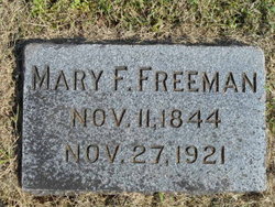
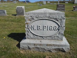
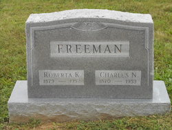
Mary Frances Pigg Freeman
| Birth | : | 11 Nov 1844 Orrick, Ray County, Missouri, USA |
| Death | : | 27 Nov 1921 Orrick, Ray County, Missouri, USA |
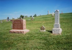
| Burial | : | Bedford Cemetery, Howe, Nemaha County, USA |
| Coordinate | : | 40.3128014, -95.8308029 |
| Plot | : | Section 3 |
frequently asked questions (FAQ):
-
Where is Mary Frances Pigg Freeman's memorial?
Mary Frances Pigg Freeman's memorial is located at: Bedford Cemetery, Howe, Nemaha County, USA.
-
When did Mary Frances Pigg Freeman death?
Mary Frances Pigg Freeman death on 27 Nov 1921 in Orrick, Ray County, Missouri, USA
-
Where are the coordinates of the Mary Frances Pigg Freeman's memorial?
Latitude: 40.3128014
Longitude: -95.8308029
Family Members:
Parent
Siblings
Children
Nearby Cemetories:
1. Bedford Cemetery
Howe, Nemaha County, USA
Coordinate: 40.3128014, -95.8308029
2. Howell Cemetery
Nemaha County, USA
Coordinate: 40.3008003, -95.8405991
3. Holy Cross Cemetery
Nemaha County, USA
Coordinate: 40.3417015, -95.8405991
4. Kite Cemetery
Nemaha County, USA
Coordinate: 40.3414001, -95.7842026
5. Saint Paul Lutheran Cemetery
Auburn, Nemaha County, USA
Coordinate: 40.3752000, -95.8573000
6. Pleasant View Cemetery
Auburn, Nemaha County, USA
Coordinate: 40.2681007, -95.9163971
7. Sheridan Cemetery
Auburn, Nemaha County, USA
Coordinate: 40.3936005, -95.8591995
8. Sheridan West Memorial Cemetery
Auburn, Nemaha County, USA
Coordinate: 40.3920580, -95.8701320
9. Stella Cemetery
Stella, Richardson County, USA
Coordinate: 40.2268982, -95.7671967
10. Saint Johns Lutheran Cemetery
Auburn, Nemaha County, USA
Coordinate: 40.3335000, -95.9576000
11. Saint Pauls Lutheran Cemetery
Auburn, Nemaha County, USA
Coordinate: 40.3771230, -95.9328000
12. Prairie Union Cemetery
Shubert, Richardson County, USA
Coordinate: 40.2475800, -95.7150200
13. Penniwell Cemetery
Shubert, Richardson County, USA
Coordinate: 40.2619000, -95.6994500
14. Mound Cemetery
Humboldt, Richardson County, USA
Coordinate: 40.1960983, -95.8602982
15. London Cemetery
Peru, Nemaha County, USA
Coordinate: 40.4225006, -95.7621994
16. Linden Cemetery
Nemaha County, USA
Coordinate: 40.4216995, -95.9032974
17. Nemaha Cemetery
Nemaha, Nemaha County, USA
Coordinate: 40.3469009, -95.6596985
18. Trinity Lutheran Cemetery
Nemaha County, USA
Coordinate: 40.3058014, -96.0093994
19. Martin Luther Church Cemetery
Nemaha County, USA
Coordinate: 40.3345040, -96.0098670
20. Mount Zion Cemetery
Nemaha County, USA
Coordinate: 40.2761002, -96.0113983
21. Standerford Cemetery
Humboldt, Richardson County, USA
Coordinate: 40.2110000, -95.9656000
22. Highland Baptist Cemetery
Auburn, Nemaha County, USA
Coordinate: 40.4578018, -95.8191986
23. Saint James Lutheran Cemetery
Nemaha County, USA
Coordinate: 40.2757500, -96.0161500
24. Highland Methodist Cemetery
Nemaha County, USA
Coordinate: 40.4581850, -95.8097140

