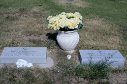
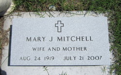
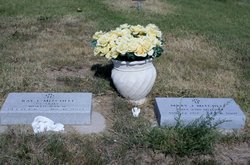
Mary J Michael Mitchell
| Birth | : | 24 Aug 1919 Iola, Allen County, Kansas, USA |
| Death | : | 21 Jul 2007 Moran, Allen County, Kansas, USA |
| Burial | : | All Saints Church, Shotesham, South Norfolk District, England |
| Coordinate | : | 52.5428610, 1.3120560 |
| Description | : | ****************** Iola Register ~ Iola, KS ~ July 23, 2007 Mary J. Mitchell, 87, of Iola, Kansas, died Saturday, July 21, 2007, at Moran Manor in Moran, Kansas. She was born Aug. 24, 1919, in Iola, Kansas, to Cecil and Bessie (Hinton) Michael. She was graduated from Iola High School. On Nov. 8, 1941, she was married to Ray E. Mitchell in Iola, Kansas. He died Aug. 17, 2004. She was a member of First Christian Church in Iola. Survivors include a son, Jack, Edmond, OK; a daughter, Janet Spencer, Iola, KS; four grandchildren, Christina Tolbert and Donna, Kirk and Linda Mitchell; and a great-granddaughter. Two... Read More |
frequently asked questions (FAQ):
-
Where is Mary J Michael Mitchell's memorial?
Mary J Michael Mitchell's memorial is located at: All Saints Church, Shotesham, South Norfolk District, England.
-
When did Mary J Michael Mitchell death?
Mary J Michael Mitchell death on 21 Jul 2007 in Moran, Allen County, Kansas, USA
-
Where are the coordinates of the Mary J Michael Mitchell's memorial?
Latitude: 52.5428610
Longitude: 1.3120560
Family Members:
Parent
Spouse
Siblings
Flowers:
Nearby Cemetories:
1. All Saints Church
Shotesham, South Norfolk District, England
Coordinate: 52.5428610, 1.3120560
2. St Mary Churchyard
Shotesham, South Norfolk District, England
Coordinate: 52.5411110, 1.2985880
3. St. Mary's Churchyard
Saxlingham Nethergate, South Norfolk District, England
Coordinate: 52.5268910, 1.2880390
4. St Mary Churchyard
Howe, South Norfolk District, England
Coordinate: 52.5497970, 1.3541770
5. St Mary's Churchyard
Newton Flotman, South Norfolk District, England
Coordinate: 52.5393520, 1.2617220
6. All Saints Churchyard
Poringland, South Norfolk District, England
Coordinate: 52.5657160, 1.3496310
7. St Remigius Churchyard
Dunston, South Norfolk District, England
Coordinate: 52.5722420, 1.2872510
8. Saint Edmund Churchyard
Caistor St Edmund, South Norfolk District, England
Coordinate: 52.5826350, 1.2936850
9. St Margaret Churchyard
Hempnall, South Norfolk District, England
Coordinate: 52.5018500, 1.3004810
10. St Peters Churchyard
Brooke, South Norfolk District, England
Coordinate: 52.5452560, 1.3814930
11. St Andrew Churchyard
Framingham Earl, South Norfolk District, England
Coordinate: 52.5748560, 1.3596480
12. St Margaret's Churchyard
Kirstead, South Norfolk District, England
Coordinate: 52.5358860, 1.3840860
13. St Mary Churchyard
Arminghall, South Norfolk District, England
Coordinate: 52.5900300, 1.3234620
14. St Andrew Churchyard
Framingham Pigot, South Norfolk District, England
Coordinate: 52.5826070, 1.3606380
15. St. Mary Magdalen Churchyard
Mulbarton, South Norfolk District, England
Coordinate: 52.5638930, 1.2360530
16. St Michael And All Saint's
Flordon, South Norfolk District, England
Coordinate: 52.5294700, 1.2261400
17. St Wandregesilus Churchyard
Bixley, South Norfolk District, England
Coordinate: 52.5955900, 1.3330900
18. St Catherine Churchyard
Fritton, Great Yarmouth Borough, England
Coordinate: 52.4919750, 1.2796600
19. St. Peter and St. Paul Churchyard
Bergh Apton, South Norfolk District, England
Coordinate: 52.5480290, 1.4060870
20. All Saints Churchyard
Keswick, South Norfolk District, England
Coordinate: 52.5951470, 1.2675790
21. St Nicholas Churchyard
Bracon Ash, South Norfolk District, England
Coordinate: 52.5559000, 1.2137000
22. Saint Andrews Churchyard
Bedingham, South Norfolk District, England
Coordinate: 52.4902500, 1.3643180
23. Saint John the Baptist Churchyard
Morningthorpe, South Norfolk District, England
Coordinate: 52.4859170, 1.2654150
24. Saint Andrews
Kirby Bedon, South Norfolk District, England
Coordinate: 52.5989160, 1.3635240


