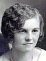
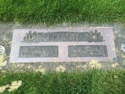
Mary Kanzler Brandt
| Birth | : | 15 Feb 1906 Tacoma, Pierce County, Washington, USA |
| Death | : | 7 Mar 1991 Yakima, Yakima County, Washington, USA |
| Burial | : | Reservation Community Memorial Park, Wapato, Yakima County, USA |
| Coordinate | : | 46.4484291, -120.5375519 |
| Plot | : | A 52 9 |
| Description | : | marriage: August 8, 1928 At the time of her death, Mary was survived by two sons, a brother and a sister. She was preceded in death by her husband Leo, two sisters and one brother. A full obituary was published in the Yakima Herald Republic on March 9, 1991. |
frequently asked questions (FAQ):
-
Where is Mary Kanzler Brandt's memorial?
Mary Kanzler Brandt's memorial is located at: Reservation Community Memorial Park, Wapato, Yakima County, USA.
-
When did Mary Kanzler Brandt death?
Mary Kanzler Brandt death on 7 Mar 1991 in Yakima, Yakima County, Washington, USA
-
Where are the coordinates of the Mary Kanzler Brandt's memorial?
Latitude: 46.4484291
Longitude: -120.5375519
Family Members:
Parent
Spouse
Siblings
Children
Flowers:
Nearby Cemetories:
1. Reservation Community Memorial Park
Wapato, Yakima County, USA
Coordinate: 46.4484291, -120.5375519
2. Union Gap Cemetery
Yakima County, USA
Coordinate: 46.5209084, -120.4850998
3. Lewis Family Cemetery
Yakima, Yakima County, USA
Coordinate: 46.5390013, -120.5052581
4. Yemowat Cemetery
Yakima County, USA
Coordinate: 46.5475006, -120.5730972
5. Shaker Cemetery
White Swan, Yakima County, USA
Coordinate: 46.3891907, -120.6621399
6. Emeunot Cemetery
Wapato, Yakima County, USA
Coordinate: 46.5243988, -120.6616974
7. Pioneer Cemetery
Union Gap, Yakima County, USA
Coordinate: 46.5578003, -120.4697037
8. Sloutier Cemetery
Yakima County, USA
Coordinate: 46.5231018, -120.6722031
9. Tahoma Cemetery
Yakima, Yakima County, USA
Coordinate: 46.5753610, -120.5332320
10. Calvary Cemetery
Yakima, Yakima County, USA
Coordinate: 46.5790740, -120.5407420
11. Saluskin Cemetery
Yakima County, USA
Coordinate: 46.5266991, -120.7039032
12. Methodist Cemetery
White Swan, Yakima County, USA
Coordinate: 46.3862686, -120.7268066
13. Klick-Peter Cemetery
White Swan, Yakima County, USA
Coordinate: 46.3748370, -120.7323250
14. St. Mary's Catholic Cemetery
White Swan, Yakima County, USA
Coordinate: 46.3764000, -120.7391968
15. West Hills Memorial Park
Yakima, Yakima County, USA
Coordinate: 46.5819016, -120.6647034
16. Holy Rosary Cemetery
Moxee City, Yakima County, USA
Coordinate: 46.5531006, -120.3585968
17. Elmwood Cemetery
Toppenish, Yakima County, USA
Coordinate: 46.3673830, -120.3334530
18. Holland Cemetery
Moxee City, Yakima County, USA
Coordinate: 46.5766983, -120.3861008
19. Terrace Heights Memorial Park
Yakima, Yakima County, USA
Coordinate: 46.6068600, -120.4598900
20. Winnier Cemetery
Toppenish, Yakima County, USA
Coordinate: 46.3590060, -120.3192450
21. Toppenish Creek Cemetery
White Swan, Yakima County, USA
Coordinate: 46.3256660, -120.7206900
22. Zillah Cemetery
Zillah, Yakima County, USA
Coordinate: 46.4055202, -120.2726072
23. McCoy Cemetery
Toppenish, Yakima County, USA
Coordinate: 46.3835983, -120.2755966
24. Nelson Pioneer Cemetery
Yakima County, USA
Coordinate: 46.6404310, -120.5831510


