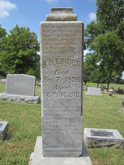
| Birth | : | 20 Mar 1822 Elizabethtown, Hardin County, Kentucky, USA |
| Death | : | 2 Oct 1905 Nelson, Nuckolls County, Nebraska, USA |
| Burial | : | Nelson Cemetery, Nelson, Nuckolls County, USA |
| Coordinate | : | 40.2056084, -98.0791702 |
| Plot | : | Block 7, Lot 23 |
| Inscription | : | Wife of William Stansbury |
| Description | : | *Resided Hardin Co., KY, 1830, with Saml. Linder (female [Linder], age 5-10 [b. 1820-1825)]. *Resided Monroe Co., IN, 1838. *Resided #58, Monroe Co., IN, 1840, with Wm. Stansbury (female Stansbury, age 15-20 [b. 1820-1825]). *Resided Clay Tsp., Owen Co., IN, 1850, with William Stansberry (Mary Stansberry, age 27 [b. ca. 1823], b. KY). *Resided Marshall Co., IL, 1852. *Resided Clarke Co., IA, 1854. *Resided #723, Knox Pct., Clarke Co., IA, 1860, with W. Stansbury (P[olly] Stansbury, age 37 [b. ca. 1823], b. KY). *Resided #15, Knox Tsp., Clarke Co., IA, 1870, with William Stansberry (Mary Stansberry, age 48 [b. ca. 1822], b. KY). *Resided Nuckolls Co., NE, 1876. *Resided #27, Nelson Pct., Nuckolls Co.,... Read More |
frequently asked questions (FAQ):
-
Where is Mary Linder Stansbury's memorial?
Mary Linder Stansbury's memorial is located at: Nelson Cemetery, Nelson, Nuckolls County, USA.
-
When did Mary Linder Stansbury death?
Mary Linder Stansbury death on 2 Oct 1905 in Nelson, Nuckolls County, Nebraska, USA
-
Where are the coordinates of the Mary Linder Stansbury's memorial?
Latitude: 40.2056084
Longitude: -98.0791702
Family Members:
Parent
Spouse
Siblings
Children
Flowers:
Nearby Cemetories:
1. Nelson Cemetery
Nelson, Nuckolls County, USA
Coordinate: 40.2056084, -98.0791702
2. Oxbow Cemetery
Nelson, Nuckolls County, USA
Coordinate: 40.2560997, -98.0280991
3. Salem Cemetery
Nuckolls County, USA
Coordinate: 40.1255989, -98.0658035
4. Smith Cemetery
Nelson, Nuckolls County, USA
Coordinate: 40.3078003, -98.0567017
5. Nora Cemetery
Nora, Nuckolls County, USA
Coordinate: 40.1394005, -97.9705963
6. Union Cemetery
Nuckolls County, USA
Coordinate: 40.3146706, -98.1236877
7. Phil R Landon Gravesite
Angus, Nuckolls County, USA
Coordinate: 40.2703200, -97.9553200
8. Beulah Cemetery
Nuckolls County, USA
Coordinate: 40.1324997, -98.1986008
9. Sacred Heart Cemetery
Lawrence, Nuckolls County, USA
Coordinate: 40.2921982, -98.2268982
10. Saint Stephens Cemetery
Nuckolls County, USA
Coordinate: 40.2544899, -98.2562485
11. Assumption Church Cemetery
Deweese, Clay County, USA
Coordinate: 40.3507000, -98.1324000
12. Hannum Graves
Lawrence, Nuckolls County, USA
Coordinate: 40.3456500, -98.1766800
13. Oak Grove Cemetery
Oak, Nuckolls County, USA
Coordinate: 40.2326889, -97.8739471
14. Liberty Creek Cemetery
Nuckolls County, USA
Coordinate: 40.3361015, -98.2035980
15. Zion Cemetery
Webster County, USA
Coordinate: 40.2277985, -98.2921982
16. Beaver Creek Cemetery
Webster County, USA
Coordinate: 40.1617012, -98.2882996
17. Evergreen Cemetery
Superior, Nuckolls County, USA
Coordinate: 40.0374985, -98.0650024
18. Bostwick Cemetery
Bostwick, Nuckolls County, USA
Coordinate: 40.0536118, -98.1801071
19. Evergreen Cemetery
Lawrence, Nuckolls County, USA
Coordinate: 40.2922401, -98.2723236
20. Edgar Cemetery
Edgar, Clay County, USA
Coordinate: 40.3587200, -97.9700200
21. Spring Creek Cemetery
Ruskin, Nuckolls County, USA
Coordinate: 40.1258011, -97.8756027
22. Saint Martin-Loucky Cemetery
Deweese, Clay County, USA
Coordinate: 40.3652496, -98.1948624
23. Mount Zion Cemetery
Nuckolls County, USA
Coordinate: 40.1974983, -97.8397522
24. OBanion Cemetery
Blue Hill, Webster County, USA
Coordinate: 40.2850000, -98.3020000


