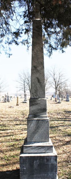
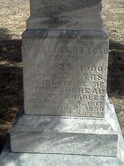
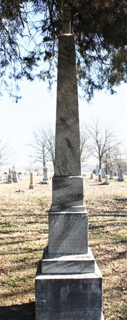
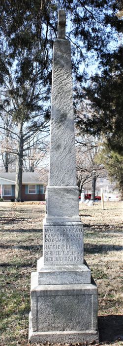
Mary Louise Pereau Pereau
| Birth | : | 27 May 1817 St. Charles County, Missouri, USA |
| Death | : | 6 Aug 1890 Saint Charles, St. Charles County, Missouri, USA |
| Burial | : | Carrollton IOOF Cemetery, Carrollton, Carroll County, USA |
| Coordinate | : | 38.6783360, -85.1715460 |
| Description | : | From Pioneer Families of Missouri, 1876, St Charles: "Mary Louise Pereau married her cousin, William Sulpice Pereau, who came to St. Charles from Montreal, Canada in 1831. They were married by Rev. Charles Van Quickenborn, S.J., under whose supervision the Church of St. Charles was built. Mrs. Pereau and others were the last who received their first communion in the old log church, which stood on Main St, part of the square being now occupied as a lumber yard by Holrah & Machens, and which is well remembered by the older Catholics of St. Charles. A portion of the square... Read More |
frequently asked questions (FAQ):
-
Where is Mary Louise Pereau Pereau's memorial?
Mary Louise Pereau Pereau's memorial is located at: Carrollton IOOF Cemetery, Carrollton, Carroll County, USA.
-
When did Mary Louise Pereau Pereau death?
Mary Louise Pereau Pereau death on 6 Aug 1890 in Saint Charles, St. Charles County, Missouri, USA
-
Where are the coordinates of the Mary Louise Pereau Pereau's memorial?
Latitude: 38.6783360
Longitude: -85.1715460
Family Members:
Spouse
Children
Flowers:
Nearby Cemetories:
1. Carrollton IOOF Cemetery
Carrollton, Carroll County, USA
Coordinate: 38.6783360, -85.1715460
2. Chapel of Memories Mausoleum
Carrollton, Carroll County, USA
Coordinate: 38.6783400, -85.1715500
3. Saint Johns Cemetery
Carrollton, Carroll County, USA
Coordinate: 38.6769000, -85.1786900
4. City Cemetery
Carrollton, Carroll County, USA
Coordinate: 38.6781600, -85.1815260
5. Methodist Church Cemetery
Carrollton, Carroll County, USA
Coordinate: 38.6805190, -85.1821880
6. Butler Family Cemetery
Carrollton, Carroll County, USA
Coordinate: 38.6710090, -85.1651880
7. Gaunt Cemetery
Carrollton, Carroll County, USA
Coordinate: 38.6842040, -85.1621560
8. Cain Cemetery
Lamb, Switzerland County, USA
Coordinate: 38.6918280, -85.1764990
9. Masterson Cemetery
Carroll County, USA
Coordinate: 38.6879000, -85.1509700
10. Gap Hill Cemetery
Carrollton, Carroll County, USA
Coordinate: 38.6749992, -85.1464005
11. Ash Cemetery
Lamb, Switzerland County, USA
Coordinate: 38.6939180, -85.1891040
12. Sample Family Farm Cemetery
Lamb, Switzerland County, USA
Coordinate: 38.7050180, -85.1936290
13. Mound Hill Cemetery
Carrollton, Carroll County, USA
Coordinate: 38.6570600, -85.2028500
14. Carroll County Poor Farm Cemetery
Carroll County, USA
Coordinate: 38.6688880, -85.1308010
15. Craig Township Cemetery
Vevay, Switzerland County, USA
Coordinate: 38.7055290, -85.1368170
16. McKay Cemetery
Vevay, Switzerland County, USA
Coordinate: 38.7160988, -85.1567001
17. May Cemetery
Carroll County, USA
Coordinate: 38.6461560, -85.2047790
18. McKay Cemetery #1
Brooksburg, Jefferson County, USA
Coordinate: 38.7065800, -85.2120790
19. Carraco Cemetery
Carroll County, USA
Coordinate: 38.6527730, -85.1275140
20. Shaw Cemetery
Vevay, Switzerland County, USA
Coordinate: 38.7198380, -85.1510170
21. Coghill Cemetery
Carrollton, Carroll County, USA
Coordinate: 38.6604500, -85.2280130
22. Kings Ridge Cemetery
Carroll County, USA
Coordinate: 38.6738740, -85.2324670
23. Old Bethel Cemetery
Craig Township, Switzerland County, USA
Coordinate: 38.7224370, -85.1385770
24. Gale Cemetery
Brooksburg, Jefferson County, USA
Coordinate: 38.7104170, -85.2236390


