
| Memorials | : | 0 |
| Location | : | Brooksburg, Jefferson County, USA |
| Coordinate | : | 38.7104170, -85.2236390 |
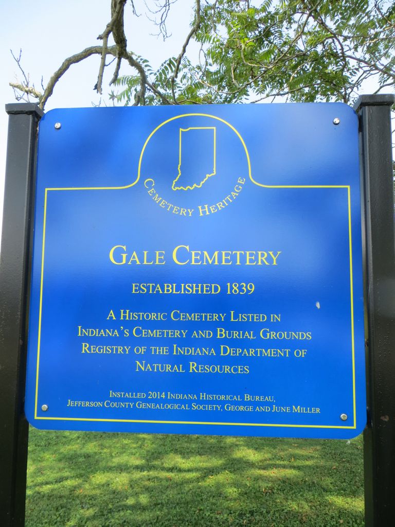
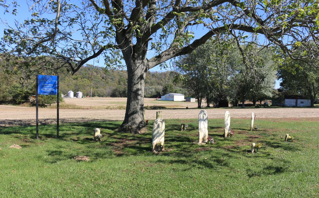
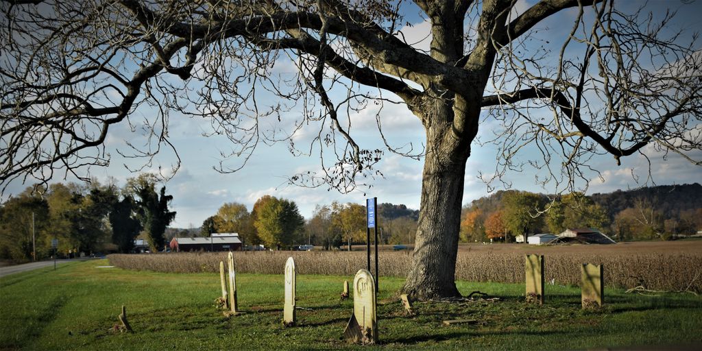
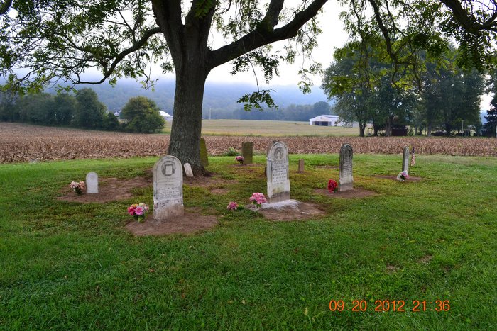
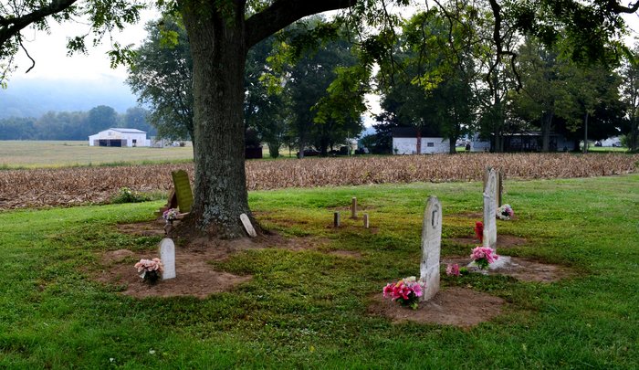
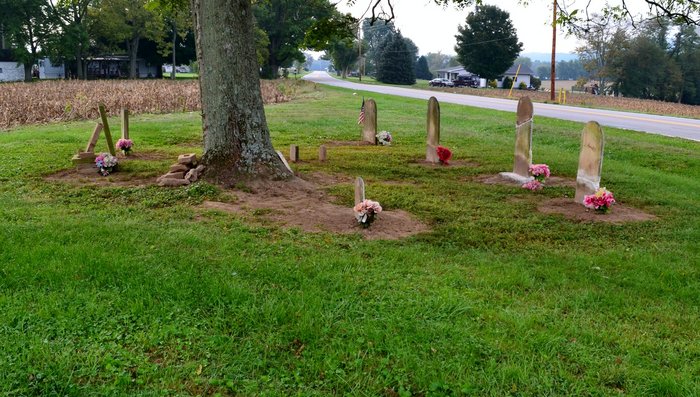
| Description | : | The 1941 DAR cemetery transcription placed the Gale Cemetery. in Section 7 Twp. 3N Range 11 E on the Ohio river east of Brooksburg. Its graves were apparently relocated to the nearby Armstrong Cemetery. The Cemetery has been restored and several stones have been repaired. It is 2 miles east of Brooksburg on the north side of SR 56. |
frequently asked questions (FAQ):
-
Where is Gale Cemetery?
Gale Cemetery is located at Ohio River Scenic Byway (Indiana State Highway 56) Brooksburg, Jefferson County ,Indiana , 47043USA.
-
Gale Cemetery cemetery's updated grave count on graveviews.com?
0 memorials
-
Where are the coordinates of the Gale Cemetery?
Latitude: 38.7104170
Longitude: -85.2236390
Nearby Cemetories:
1. Armstrong Cemetery
Brooksburg, Jefferson County, USA
Coordinate: 38.7172650, -85.2298910
2. McKay Cemetery #1
Brooksburg, Jefferson County, USA
Coordinate: 38.7065800, -85.2120790
3. Vaughn Cemetery
Jefferson County, USA
Coordinate: 38.7191944, -85.2338889
4. Morris Chapel Cemetery
Brooksburg, Jefferson County, USA
Coordinate: 38.7253720, -85.2328910
5. Sample Family Farm Cemetery
Lamb, Switzerland County, USA
Coordinate: 38.7050180, -85.1936290
6. Young Cemetery
Carroll County, USA
Coordinate: 38.7232870, -85.2594270
7. Ash Cemetery
Lamb, Switzerland County, USA
Coordinate: 38.6939180, -85.1891040
8. Brooksburg Cemetery
Brooksburg, Jefferson County, USA
Coordinate: 38.7399330, -85.2429428
9. Kings Ridge Cemetery
Carroll County, USA
Coordinate: 38.6738740, -85.2324670
10. Taylor Cemetery
Carroll County, USA
Coordinate: 38.6778900, -85.2533500
11. Cain Cemetery
Lamb, Switzerland County, USA
Coordinate: 38.6918280, -85.1764990
12. Methodist Church Cemetery
Carrollton, Carroll County, USA
Coordinate: 38.6805190, -85.1821880
13. City Cemetery
Carrollton, Carroll County, USA
Coordinate: 38.6781600, -85.1815260
14. Wolf Cemetery
Jefferson County, USA
Coordinate: 38.7561400, -85.2140600
15. Hunters Bottom Cemetery
Locust, Carroll County, USA
Coordinate: 38.7262700, -85.2802930
16. Mount Zion Nazarene Church Cemetery
Five Points, Switzerland County, USA
Coordinate: 38.7471008, -85.1840057
17. Saint Johns Cemetery
Carrollton, Carroll County, USA
Coordinate: 38.6769000, -85.1786900
18. Spillman Cemetery
Carroll County, USA
Coordinate: 38.6701200, -85.2582700
19. Wright Cemetery
Carroll County, USA
Coordinate: 38.6699500, -85.2586200
20. King-Bradley Cemetery
Carroll County, USA
Coordinate: 38.6953570, -85.2833410
21. Bear Farm Cemetery
Manville, Jefferson County, USA
Coordinate: 38.7569420, -85.2433860
22. Hunters Bottom Cemetery (Defunct)
Carrollton, Carroll County, USA
Coordinate: 38.7332360, -85.2800640
23. Coghill Cemetery
Carrollton, Carroll County, USA
Coordinate: 38.6604500, -85.2280130
24. Chapel of Memories Mausoleum
Carrollton, Carroll County, USA
Coordinate: 38.6783400, -85.1715500