
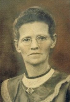
Mary May Wilkins Porter
| Birth | : | 3 Mar 1861 Belleville, Dane County, Wisconsin, USA |
| Death | : | 29 Jun 1927 Parkers Prairie, Otter Tail County, Minnesota, USA |
| Burial | : | Arjeplogs Kyrkogård, Arjeplog, Arjeplogs kommun, Sweden |
| Coordinate | : | 66.0519819, 17.8845496 |
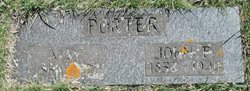
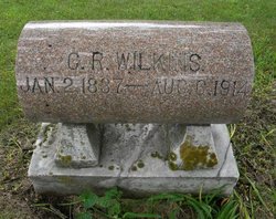
| Description | : | -- -- -- -- -- . NAME: Mary Mae Wilkins (1861–1927). FATHER: Charles R. Wilkins. MOTHER: Mary Elizabeth (Hoover) Wilkins. HUSBAND # 1: Charles William McClain. HUSBAND # 2: John Finley Porter. . -- -- -- -- -- |
frequently asked questions (FAQ):
-
Where is Mary May Wilkins Porter's memorial?
Mary May Wilkins Porter's memorial is located at: Arjeplogs Kyrkogård, Arjeplog, Arjeplogs kommun, Sweden.
-
When did Mary May Wilkins Porter death?
Mary May Wilkins Porter death on 29 Jun 1927 in Parkers Prairie, Otter Tail County, Minnesota, USA
-
Where are the coordinates of the Mary May Wilkins Porter's memorial?
Latitude: 66.0519819
Longitude: 17.8845496
Family Members:
Parent

Spouse
Siblings
Children
Flowers:


Nearby Cemetories:
1. Arjeplogs Kyrkogård
Arjeplog, Arjeplogs kommun, Sweden
Coordinate: 66.0519819, 17.8845496
2. Södra Bergnäs Kyrkogård
Arvidsjaurs kommun, Sweden
Coordinate: 65.6756162, 18.2042333
3. Slagnäs Kyrkogård
Slagnas, Arjeplogs kommun, Sweden
Coordinate: 65.6028381, 18.1647942
4. Sorsele Skogskyrkogård
Sorsele, Sorsele kommun, Sweden
Coordinate: 65.5463190, 17.5079040
5. Sorsele Gamla Kyrkogård
Sorsele, Sorsele kommun, Sweden
Coordinate: 65.5418550, 17.5155340
6. Moskosels Kyrkogård
Moskosel, Arvidsjaurs kommun, Sweden
Coordinate: 65.8707681, 19.4507580
7. Arvidsjaurs Kyrkogård
Arvidsjaur, Arvidsjaurs kommun, Sweden
Coordinate: 65.5955674, 19.1669004
8. Gargnäs Kyrkogård
Gargnas, Sorsele kommun, Sweden
Coordinate: 65.3120659, 17.9621481
9. Adak Kyrkogård
Adak, Malå kommun, Sweden
Coordinate: 65.3521560, 18.5932230
10. Malå Skogskyrkogård
Malå, Malå kommun, Sweden
Coordinate: 65.1892980, 18.7387920
11. Malå Gamla Kyrkogård
Malå, Malå kommun, Sweden
Coordinate: 65.1845440, 18.7416800
12. Gråträsk Kyrkogård
Gratrask, Piteå kommun, Sweden
Coordinate: 65.4861640, 19.7961550
13. Glommersträsk Kyrkogård
Glommerstrask, Arvidsjaurs kommun, Sweden
Coordinate: 65.2812400, 19.6099900
14. Björksele kyrkogård
Bjorksele, Lycksele kommun, Sweden
Coordinate: 64.9884300, 18.5157800
15. Åskilje Cemetery
Askilje, Storumans kommun, Sweden
Coordinate: 64.9083320, 17.8625680
16. Långträsk Kyrkogård
Piteå kommun, Sweden
Coordinate: 65.3866563, 20.3234943
17. Norsjö kyrkogård
Norsjö, Norsjö kommun, Sweden
Coordinate: 64.9147237, 19.4762989
18. Näsets kyrkogård
Norsjö, Norsjö kommun, Sweden
Coordinate: 64.8945800, 19.4582541
19. Øvre Saltdal
Saltdal kommune, Norway
Coordinate: 66.9640472, 15.3122169
20. Botn-Rognan German Cemetery
Rognan, Saltdal kommune, Norway
Coordinate: 67.0936190, 15.4732520
21. Saltdal Main Churchyard
Rognan, Saltdal kommune, Norway
Coordinate: 67.1020400, 15.4062470
22. Latikberg kyrkogård
Latikberg, Vilhelmina kommun, Sweden
Coordinate: 64.6440076, 17.0792300
23. Lugnet kyrkogård
Lycksele, Lycksele kommun, Sweden
Coordinate: 64.6072000, 18.6502000
24. Lycksele Gamla Kyrkogården
Lycksele, Lycksele kommun, Sweden
Coordinate: 64.5988370, 18.6718580