Mary Melissa Hunter Briggs
| Birth | : | 18 Jun 1866 Otoe County, Nebraska, USA |
| Death | : | 9 Mar 1940 Red Oak, Montgomery County, Iowa, USA |
| Burial | : | Wilmot Cemetery, Wilmot, Kentish Council, Australia |
| Coordinate | : | -41.3837350, 146.1871690 |
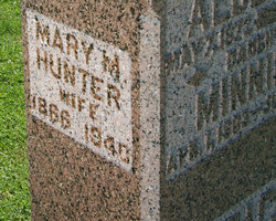
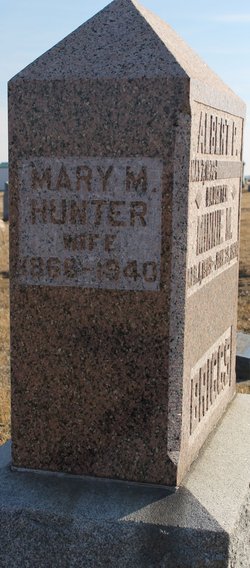
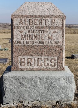
| Description | : | Shares a stone with Albert & Minnie Melissa Hunter was the 6th of 11 children born to Jasper Newton and Elizabeth Ann (Hodges) Hunter on their farm in Otoe County, Nebraska near Nebraska City. The family next lived in Seward County, Nebraska (1880 census) and then York County, Nebraska (Nebraska 1885 census). On May 4, 1886 she married William Albert Powell, in Lincoln County, Nebraska. Their first four children were born in Lincoln County: Earl, Vincent Raymond, Elizabeth, and Chestina. They moved to Williamson County, Illinois in the 1890's, and that is where their last child, Naomi Ruth, was born.... Read More |
frequently asked questions (FAQ):
-
Where is Mary Melissa Hunter Briggs's memorial?
Mary Melissa Hunter Briggs's memorial is located at: Wilmot Cemetery, Wilmot, Kentish Council, Australia.
-
When did Mary Melissa Hunter Briggs death?
Mary Melissa Hunter Briggs death on 9 Mar 1940 in Red Oak, Montgomery County, Iowa, USA
-
Where are the coordinates of the Mary Melissa Hunter Briggs's memorial?
Latitude: -41.3837350
Longitude: 146.1871690
Family Members:
Parent
Spouse
Siblings
Children
Flowers:
Nearby Cemetories:
1. Wilmot Cemetery
Wilmot, Kentish Council, Australia
Coordinate: -41.3837350, 146.1871690
2. Methodist Cemetery
Barrington, Kentish Council, Australia
Coordinate: -41.3382370, 146.2801480
3. Claude Road Cemetery
Claude Road, Kentish Council, Australia
Coordinate: -41.4322840, 146.2871020
4. Sheffield Cemetery
Sheffield, Kentish Council, Australia
Coordinate: -41.3726558, 146.3055161
5. St. Andrew's Churchyard
Sprent, Central Coast Council, Australia
Coordinate: -41.2596490, 146.1593130
6. Sprent Uniting Church Cemetery
Sprent, Central Coast Council, Australia
Coordinate: -41.2491180, 146.1722070
7. Kindred Methodist Cemetery
Kindred, Central Coast Council, Australia
Coordinate: -41.2421020, 146.2223190
8. McCulloch Family Cemetery
Ulverstone, Central Coast Council, Australia
Coordinate: -41.2289670, 146.1591010
9. Lorinna Cemetery
Lorinna, Kentish Council, Australia
Coordinate: -41.5477800, 146.1345900
10. St. James Roman Catholic Cemetery
Railton, Kentish Council, Australia
Coordinate: -41.3569000, 146.4103680
11. St John’s Anglican Church Cemetery
Railton, Kentish Council, Australia
Coordinate: -41.3521240, 146.4130000
12. Railton Roman Catholic Cemetery
Railton, Kentish Council, Australia
Coordinate: -41.3542310, 146.4160170
13. Railton Methodist Cemetery
Railton, Kentish Council, Australia
Coordinate: -41.3517810, 146.4169420
14. George Woodhouse Lookout
Riana, Central Coast Council, Australia
Coordinate: -41.2818184, 145.9948120
15. North Motton Methodist Cemetery
North Motton, Central Coast Council, Australia
Coordinate: -41.2091270, 146.1096290
16. St. John's Anglican Churchyard
North Motton, Central Coast Council, Australia
Coordinate: -41.2076090, 146.1088350
17. Forth Catholic Cemetery
Forth, Devonport City, Australia
Coordinate: -41.1895500, 146.2590100
18. Forth Congregational Cemetery
Forth, Devonport City, Australia
Coordinate: -41.1818520, 146.2463950
19. Forth Pioneer Anglican Cemetery
Forth, Devonport City, Australia
Coordinate: -41.1825950, 146.2535620
20. Forth Methodist Cemetery
Forth, Devonport City, Australia
Coordinate: -41.1797840, 146.2435630
21. Mersey Vale Memorial Park
Quoiba, Devonport City, Australia
Coordinate: -41.2053690, 146.3431210
22. Mersey Gardens Crematorium
Quoiba, Devonport City, Australia
Coordinate: -41.2047470, 146.3453858
23. South Riana Uniting Church Cemetery
Central Coast Council, Australia
Coordinate: -41.2351280, 145.9792410
24. Ulverstone General Cemetery
Ulverstone, Central Coast Council, Australia
Coordinate: -41.1625310, 146.1637200


