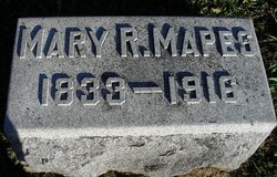
Mary Rebecca Randell Mapes
| Birth | : | 1833 Iowa, USA |
| Death | : | 1916 Cass County, Nebraska, USA |
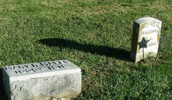
| Burial | : | Pleasant Ridge Cemetery, Plattsmouth, Cass County, USA |
| Coordinate | : | 40.9735985, -95.8827972 |
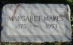
| Description | : | Mary R. Mapes 1833 - 1918 Mary Rebecca Randall married Joseph Mapes, a widower, on April 1, 1873 in Avoca, Pottawatomie, IA. They had two children Thomas A. Mapes born in 1874 and Margaret A. Mapes born in 1876. Mary passed away in 1916 in Plattsmouth, Cass County, NE. |
frequently asked questions (FAQ):
-
Where is Mary Rebecca Randell Mapes's memorial?
Mary Rebecca Randell Mapes's memorial is located at: Pleasant Ridge Cemetery, Plattsmouth, Cass County, USA.
-
When did Mary Rebecca Randell Mapes death?
Mary Rebecca Randell Mapes death on 1916 in Cass County, Nebraska, USA
-
Where are the coordinates of the Mary Rebecca Randell Mapes's memorial?
Latitude: 40.9735985
Longitude: -95.8827972
Family Members:
Spouse
Children
Flowers:
Nearby Cemetories:
1. Pleasant Ridge Cemetery
Plattsmouth, Cass County, USA
Coordinate: 40.9735985, -95.8827972
2. Doom Family Cemetery
Cass County, USA
Coordinate: 40.9550000, -95.8575000
3. Billings Cemetery
Plattsmouth, Cass County, USA
Coordinate: 41.0025000, -95.8897000
4. Youngs Cemetery
Murray, Cass County, USA
Coordinate: 40.9406013, -95.9039001
5. Oak Hill Cemetery
Plattsmouth, Cass County, USA
Coordinate: 41.0106010, -95.9124985
6. Clemmons Cemetery
Murray, Cass County, USA
Coordinate: 40.9300003, -95.8961029
7. Holy Sepulchre Cemetery
Plattsmouth, Cass County, USA
Coordinate: 41.0122660, -95.9128240
8. Rock Bluff Cemetery
Plattsmouth, Cass County, USA
Coordinate: 40.9150009, -95.8469009
9. Van Eaton Cemetery
Pacific Junction, Mills County, USA
Coordinate: 40.9388800, -95.7919400
10. Lewiston Cemetery
Union, Cass County, USA
Coordinate: 40.8856087, -95.8936539
11. Eight Mile Grove Cemetery
Cass County, USA
Coordinate: 40.9509239, -95.9979324
12. Kenosha Cemetery
Cass County, USA
Coordinate: 40.8750000, -95.8427963
13. LaPlatte Cemetery
La Platte, Sarpy County, USA
Coordinate: 41.0694008, -95.9336014
14. Martin Chapel Cemetery
Pacific City, Mills County, USA
Coordinate: 41.0611000, -95.8013992
15. Walnut Hill Cemetery
Mills County, USA
Coordinate: 40.9232900, -95.7517100
16. Godsey Cemetery
Mills County, USA
Coordinate: 41.0705986, -95.8075027
17. Waubonsie Cemetery
Mills County, USA
Coordinate: 40.9451370, -95.7310791
18. Gowens-Turner Cemetery
Glenwood, Mills County, USA
Coordinate: 41.0715510, -95.7952420
19. Otterbein Cemetery
Cass County, USA
Coordinate: 40.8856010, -95.9963989
20. Glenwood Resource Center Cemetery
Glenwood, Mills County, USA
Coordinate: 41.0361720, -95.7338590
21. Buck Cemetery
Cass County, USA
Coordinate: 40.8499985, -95.9403000
22. Mackey Cemetery
Glenwood, Mills County, USA
Coordinate: 40.9017070, -95.7376100
23. Glenwood Cemetery
Glenwood, Mills County, USA
Coordinate: 41.0599670, -95.7480240
24. Glenwood Catholic Cemetery
Glenwood, Mills County, USA
Coordinate: 41.0600000, -95.7453000


