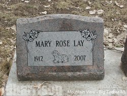
Mary Rose Myers Lay
| Birth | : | 23 Dec 1912 Big Timber, Sweet Grass County, Montana, USA |
| Death | : | 1 Jul 2007 Big Timber, Sweet Grass County, Montana, USA |
| Burial | : | Brookville Lutheran Cemetery, Carroll County, USA |
| Coordinate | : | 42.0550003, -89.6872177 |
| Plot | : | Sec 5, Blk 56, Lot 4, Grv 1 |
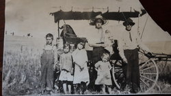
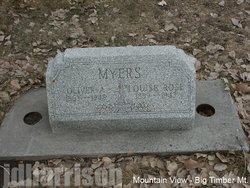
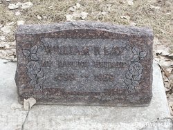
| Description | : | Mary was the third child of ten born to Oliver and Rose (Widdecombe) Myers on December 23, 1912. Mary attended grade schools in Melville, Deer Creek and graduated from Sweet Grass County High School in 1932. Mary was married to William Lay in Bozeman June 18, 1932. They lived on the family ranch on Bridger Creek all their married life. Bill and Mary had a star mail route south of Reed Point for 25 years. She was a lifelong member of the Bridger Creek Women's Club. Bill died in 1959. Mary continued to live on the ranch until she sold it in... Read More |
frequently asked questions (FAQ):
-
Where is Mary Rose Myers Lay's memorial?
Mary Rose Myers Lay's memorial is located at: Brookville Lutheran Cemetery, Carroll County, USA.
-
When did Mary Rose Myers Lay death?
Mary Rose Myers Lay death on 1 Jul 2007 in Big Timber, Sweet Grass County, Montana, USA
-
Where are the coordinates of the Mary Rose Myers Lay's memorial?
Latitude: 42.0550003
Longitude: -89.6872177
Family Members:
Parent
Spouse
Siblings
Flowers:
Nearby Cemetories:
1. Brookville Lutheran Cemetery
Carroll County, USA
Coordinate: 42.0550003, -89.6872177
2. Brookville United Methodist Cemetery
Brookville, Ogle County, USA
Coordinate: 42.0455589, -89.6761322
3. Chambers Grove Cemetery
Forreston, Ogle County, USA
Coordinate: 42.0899811, -89.6841812
4. Schriner Cemetery
Lanark, Carroll County, USA
Coordinate: 42.0374985, -89.7427826
5. Eagle Point Cemetery
Polo, Ogle County, USA
Coordinate: 41.9955406, -89.6846695
6. Union Cemetery
Milledgeville, Carroll County, USA
Coordinate: 42.0019417, -89.7533264
7. Forreston Grove Cemetery
Forreston, Ogle County, USA
Coordinate: 42.1159592, -89.6280365
8. Brick Church Cemetery
Polo, Ogle County, USA
Coordinate: 41.9735603, -89.6671600
9. Haldane Cemetery
Haldane, Ogle County, USA
Coordinate: 42.0691986, -89.5706024
10. Durley Gravesite
Polo, Ogle County, USA
Coordinate: 41.9912987, -89.6033554
11. Nichols Cemetery
Polo, Ogle County, USA
Coordinate: 41.9700012, -89.6500015
12. South Elkhorn Cemetery
South Elkhorn, Carroll County, USA
Coordinate: 41.9672203, -89.7125015
13. White Oak Cemetery
Forreston, Ogle County, USA
Coordinate: 42.1268997, -89.6025009
14. Webster Family Cemetery
Polo, Ogle County, USA
Coordinate: 41.9615288, -89.6521530
15. Fairmount Cemetery
Polo, Ogle County, USA
Coordinate: 42.0005989, -89.5766983
16. Saint Mary Cemetery
Polo, Ogle County, USA
Coordinate: 41.9989014, -89.5777969
17. Reed Cemetery
Polo, Ogle County, USA
Coordinate: 41.9730988, -89.6113968
18. Shannon Brethren Cemetery
Shannon, Carroll County, USA
Coordinate: 42.1458282, -89.7433319
19. Shelly Cemetery
Shannon, Carroll County, USA
Coordinate: 42.1553001, -89.7164001
20. Buffalo Grove Cemetery
Buffalo Grove, Ogle County, USA
Coordinate: 41.9794197, -89.5920410
21. Hewitt Cemetery
Forreston, Ogle County, USA
Coordinate: 42.1201210, -89.5787430
22. Saint Wendelin Cemetery
Shannon, Carroll County, USA
Coordinate: 42.1549988, -89.7506027
23. Lanark City Cemetery
Lanark, Carroll County, USA
Coordinate: 42.0966682, -89.8261108
24. West Branch Cemetery
Haldane, Ogle County, USA
Coordinate: 42.0630989, -89.5355988

