
| Birth | : | 1807 Fayette County, Pennsylvania, USA |
| Death | : | 2 Oct 1875 Jefferson County, Iowa, USA |
| Burial | : | Fell Cemetery, Libertyville, Jefferson County, USA |
| Coordinate | : | 40.9375000, -92.0772018 |
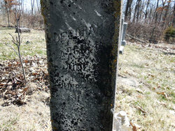
| Description | : | "Fairfield Ledger", Oct. 21, 1875, Pg. 3, Col. 9 Died, at her residence in Libertyville, Sat., Oct. 2, of Bronchitis, Mrs. Mary CARTER, wife of Daniel CARTER, aged 68-9-28..... Added by EQUISS on Mar 13, 2010 9:52 PM =D/O Alexander Adair & Margaret Laughlin,Wilson. W/O Daniel Carter, Married November 17,1841, Jefferson County,Iowa. M/O 5 Children.by jlwolfe |
frequently asked questions (FAQ):
-
Where is Mary Wilson Carter's memorial?
Mary Wilson Carter's memorial is located at: Fell Cemetery, Libertyville, Jefferson County, USA.
-
When did Mary Wilson Carter death?
Mary Wilson Carter death on 2 Oct 1875 in Jefferson County, Iowa, USA
-
Where are the coordinates of the Mary Wilson Carter's memorial?
Latitude: 40.9375000
Longitude: -92.0772018
Family Members:
Parent

Spouse
Siblings
Children
Flowers:


Nearby Cemetories:
1. Fell Cemetery
Libertyville, Jefferson County, USA
Coordinate: 40.9375000, -92.0772018
2. Winsell Cemetery
Fairfield, Jefferson County, USA
Coordinate: 40.9067001, -92.1247025
3. Morgan Burial Plot
Des Moines Township, Jefferson County, USA
Coordinate: 40.9837160, -92.0964340
4. McCleary Cemetery
Jefferson County, USA
Coordinate: 40.9892006, -92.0805969
5. Brethren Cemetery
Batavia, Jefferson County, USA
Coordinate: 40.9768000, -92.1240000
6. Rominger Cemetery
Batavia, Jefferson County, USA
Coordinate: 40.9379000, -92.1503000
7. Jefferson County Poor Farm Cemetery
Libertyville, Jefferson County, USA
Coordinate: 40.9416900, -91.9996200
8. Mount Moriah Cemetery
Douds, Van Buren County, USA
Coordinate: 40.8710000, -92.0860000
9. Cumberland Cemetery
Jefferson County, USA
Coordinate: 40.9248000, -91.9903000
10. Smith Family Cemetery
Libertyville, Jefferson County, USA
Coordinate: 40.9972416, -92.0362857
11. Bethel Cemetery
Birmingham, Van Buren County, USA
Coordinate: 40.8967018, -92.0056000
12. Gregg Cemetery
Jefferson County, USA
Coordinate: 41.0078011, -92.0811005
13. Thompson Cemetery
Jefferson County, USA
Coordinate: 40.9155998, -91.9772034
14. Zion Lutheran Cemetery
Douds, Van Buren County, USA
Coordinate: 40.8563000, -92.0664000
15. Iowaville Cemetery
Selma, Van Buren County, USA
Coordinate: 40.8861008, -92.1628036
16. Batavia Cemetery
Batavia, Jefferson County, USA
Coordinate: 40.9977080, -92.1661100
17. Koons Cemetery
Locust Grove Township, Jefferson County, USA
Coordinate: 41.0286410, -92.0948960
18. Roth Cemetery
Fairfield, Jefferson County, USA
Coordinate: 40.9589005, -91.9574966
19. Clinkinbeard Family Cemetery
Libertyville, Jefferson County, USA
Coordinate: 40.9083300, -91.9583300
20. Coon Cemetery
Jefferson County, USA
Coordinate: 41.0266991, -92.1243973
21. Des Moines River Cemetery
Wapello County, USA
Coordinate: 40.9463000, -92.2042000
22. Passmore Cemetery
Van Buren County, USA
Coordinate: 40.8608017, -92.1549988
23. Courtney Cemetery
Jefferson County, USA
Coordinate: 40.9997711, -92.1788559
24. Memorial Lawn Cemetery
Fairfield, Jefferson County, USA
Coordinate: 41.0068000, -91.9805000