
| Birth | : | 17 Jun 1927 Wood Lake, Cherry County, Nebraska, USA |
| Death | : | 31 Oct 2018 Ainsworth, Brown County, Nebraska, USA |
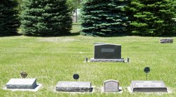
| Burial | : | Giles Cemetery, Cherry County, USA |
| Coordinate | : | 42.1603012, -100.1828003 |
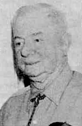
| Description | : | She died Wednesday, Oct. 31, 2018, at the Sandhills Care Center in Ainsworth. Marylouise Hanna was born June 17, 1927 in Wood Lake, Nebraska to Myrtle Mickelson and George Parker Hanna Sr. Marylou attended grade school at the school near the 21 Ranch and later at school district #102. She attended high school at Curtis and Mullen, graduating in 1944 from the Curtis Technical School of Agriculture. She celebrated being a Curtis Aggie and attended her class reunions. Following high school, Marylou spent two years at Kearney State Teachers College. She followed this by teaching fifth grade for... Read More |
frequently asked questions (FAQ):
-
Where is Marylouise “Marylou” Hanna Giles's memorial?
Marylouise “Marylou” Hanna Giles's memorial is located at: Giles Cemetery, Cherry County, USA.
-
When did Marylouise “Marylou” Hanna Giles death?
Marylouise “Marylou” Hanna Giles death on 31 Oct 2018 in Ainsworth, Brown County, Nebraska, USA
-
Where are the coordinates of the Marylouise “Marylou” Hanna Giles's memorial?
Latitude: 42.1603012
Longitude: -100.1828003
Family Members:
Parent
Spouse

Siblings

Flowers:


Nearby Cemetories:
1. Valley View Cemetery
Brown County, USA
Coordinate: 42.1217003, -100.0488968
2. Purdum Cemetery
Purdum, Blaine County, USA
Coordinate: 42.0638190, -100.2574890
3. Hartgrave Cemetery
Cherry County, USA
Coordinate: 42.3244500, -100.2680800
4. Hawley Flats Cemetery
Blaine County, USA
Coordinate: 42.0003014, -100.0203018
5. German Valley Cemetery
Blaine County, USA
Coordinate: 42.0116997, -99.8313980
6. Cornish Cemetery
Brown County, USA
Coordinate: 42.2406006, -99.7863998
7. Brewster Cemetery
Brewster, Blaine County, USA
Coordinate: 41.9291992, -99.8419037
8. Dunning Cemetery
Dunning, Blaine County, USA
Coordinate: 41.8213110, -100.0984530
9. Hillcrest Cemetery
Thedford, Thomas County, USA
Coordinate: 41.9673000, -100.5756000
10. Brownlee Cemetery
Brownlee, Cherry County, USA
Coordinate: 42.2889100, -100.6234710
11. East Woodlawn Cemetery
Johnstown, Brown County, USA
Coordinate: 42.5718994, -100.0382996
12. Woodlawn Cemetery
Johnstown, Brown County, USA
Coordinate: 42.5828018, -100.0736008
13. Duff Cemetery
Duff, Rock County, USA
Coordinate: 42.2028008, -99.5935974
14. Ainsworth Cemetery
Ainsworth, Brown County, USA
Coordinate: 42.5341988, -99.8503036
15. Grand Prairie Cemetery
Brown County, USA
Coordinate: 42.5886002, -99.9894028
16. Jimtown Cemetery
Brownlee, Cherry County, USA
Coordinate: 42.1174000, -100.8014500
17. East Park Cemetery
Ainsworth, Brown County, USA
Coordinate: 42.5511017, -99.8244019
18. Shady Rest Cemetery
Valentine, Cherry County, USA
Coordinate: 42.4598160, -100.6837050
19. German Cemetery
Ainsworth, Brown County, USA
Coordinate: 42.5922012, -99.9103012
20. Mount Hope Cemetery
Wood Lake, Cherry County, USA
Coordinate: 42.6372920, -100.2330200
21. Long Cemetery
Cherry County, USA
Coordinate: 42.2932000, -100.8156000
22. Emanuel Gravesite
Brownlee, Cherry County, USA
Coordinate: 42.3514000, -100.8021500
23. Seneca Cemetery
Seneca, Thomas County, USA
Coordinate: 42.0364990, -100.8328018
24. Grandview Cemetery
Long Pine, Brown County, USA
Coordinate: 42.5251500, -99.7020000