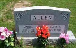
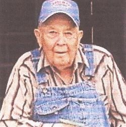
Marylu Pratt Allen
| Birth | : | 1 Oct 1931 Calhoun, Henry County, Missouri, USA |
| Death | : | 6 Nov 2012 Appleton City, St. Clair County, Missouri, USA |
| Burial | : | Appleton City Cemetery, Appleton City, St. Clair County, USA |
| Coordinate | : | 38.1747017, -94.0235977 |
| Description | : | Marylu Allen, 81, died Nov. 6, 2012. Services, 2 p.m. Thurs., Nov. 8, 2012 Hill and Son Funeral Home, Appleton City, MO (660-476-2135). Visitation, preceding the service 1-2 p.m. Burial, Appleton City Cemetery. . Published in Kansas City Star on November 8, 2012 ------------------------------------------------------------------------------------------------------------ ALLEN, Marylu PRATT 1931-2012 Appleton City Cemetery, Appleton City, St. Clair Co, MO Daily Democrat, Clinton MO, Nov 7 2012 - Marylu (Pratt) Allen, 81, died in Appleton City on November 6, 2012, after a long illness. She was born near Calhoun on October 1, 1931. She was the only child of... Read More |
frequently asked questions (FAQ):
-
Where is Marylu Pratt Allen's memorial?
Marylu Pratt Allen's memorial is located at: Appleton City Cemetery, Appleton City, St. Clair County, USA.
-
When did Marylu Pratt Allen death?
Marylu Pratt Allen death on 6 Nov 2012 in Appleton City, St. Clair County, Missouri, USA
-
Where are the coordinates of the Marylu Pratt Allen's memorial?
Latitude: 38.1747017
Longitude: -94.0235977
Family Members:
Parent
Spouse
Nearby Cemetories:
1. Appleton City Cemetery
Appleton City, St. Clair County, USA
Coordinate: 38.1747017, -94.0235977
2. Fennewald Cemetery
Appleton City, St. Clair County, USA
Coordinate: 38.2080994, -94.0271988
3. Spring Grove Cemetery
St. Clair County, USA
Coordinate: 38.1250000, -94.0066986
4. Ridgeway Cemetery
St. Clair County, USA
Coordinate: 38.1114006, -93.9931030
5. Meyers Cemetery
Rockville, Bates County, USA
Coordinate: 38.1193650, -94.0815930
6. Montrose Mound Cemetery
Montrose, Henry County, USA
Coordinate: 38.2406150, -93.9805380
7. Blackwell Cemetery
Bates County, USA
Coordinate: 38.1810989, -94.1183014
8. Montrose Cemetery
Montrose, Henry County, USA
Coordinate: 38.2569008, -94.0038986
9. Round Prairie Cemetery
Bates County, USA
Coordinate: 38.1380997, -94.1247025
10. Daller Cemetery
St. Clair County, USA
Coordinate: 38.0988998, -93.9664001
11. Snodgrass Union Cemetery
Bates County, USA
Coordinate: 38.2583008, -94.0761032
12. Ditty Cemetery
St. Clair County, USA
Coordinate: 38.0908012, -93.9664001
13. Saint Mary's Cemetery
Montrose, Henry County, USA
Coordinate: 38.2705320, -93.9932730
14. Myers Cemetery
Hudson, Bates County, USA
Coordinate: 38.2050018, -94.1519012
15. Bean Cemetery
Appleton City, St. Clair County, USA
Coordinate: 38.0960999, -93.9325027
16. Dickison Cemetery
Bates County, USA
Coordinate: 38.2641300, -94.1032650
17. Short Cemetery
St. Clair County, USA
Coordinate: 38.0797005, -93.9464035
18. Rockville Cemetery
Rockville, Bates County, USA
Coordinate: 38.0647011, -94.0663986
19. Harmony Church Cemetery
St. Clair County, USA
Coordinate: 38.1249199, -93.8898163
20. Saint Ludger's Cemetery
Germantown, Henry County, USA
Coordinate: 38.2930450, -94.0252380
21. Westfield Cemetery
St. Clair County, USA
Coordinate: 38.1707993, -93.8677979
22. Teays Chapel Cemetery
Deepwater, Henry County, USA
Coordinate: 38.2188200, -93.8753280
23. Dewees Cemetery
Pleasant Gap, Bates County, USA
Coordinate: 38.1803770, -94.1858160
24. Vickers Cemetery
Montrose, Henry County, USA
Coordinate: 38.2921982, -93.9518967


