
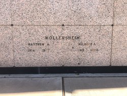
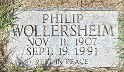
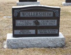
Matthew Abraham Francis “Matt” Wollersheim
| Birth | : | 15 Aug 1914 Coutts, Lethbridge Census Division, Alberta, Canada |
| Death | : | 7 Apr 1987 Mesa, Maricopa County, Arizona, USA |
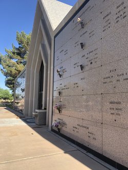
| Burial | : | Valley of the Sun Mortuary and Cemetery, Chandler, Maricopa County, USA |
| Coordinate | : | 33.2330818, -111.8478851 |
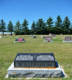
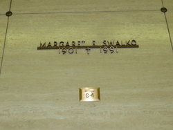
| Plot | : | Chapel Mausoleum |
| Description | : | He was a baby, 16 weighted about 1 1/2 pounds and slept in a shoe box. His father had to go to town and get the priest to come out to the farm and baptize him as they didn't think he was going to live. |
frequently asked questions (FAQ):
-
Where is Matthew Abraham Francis “Matt” Wollersheim's memorial?
Matthew Abraham Francis “Matt” Wollersheim's memorial is located at: Valley of the Sun Mortuary and Cemetery, Chandler, Maricopa County, USA.
-
When did Matthew Abraham Francis “Matt” Wollersheim death?
Matthew Abraham Francis “Matt” Wollersheim death on 7 Apr 1987 in Mesa, Maricopa County, Arizona, USA
-
Where are the coordinates of the Matthew Abraham Francis “Matt” Wollersheim's memorial?
Latitude: 33.2330818
Longitude: -111.8478851
Family Members:
Parent
Spouse
Siblings

Children
Flowers:


Nearby Cemetories:
1. Valley of the Sun Mortuary and Cemetery
Chandler, Maricopa County, USA
Coordinate: 33.2330818, -111.8478851
2. Goodyear-Ocotillo Cemetery
Chandler, Maricopa County, USA
Coordinate: 33.2360992, -111.8486023
3. Risen Savior Lutheran Church Columbarium
Chandler, Maricopa County, USA
Coordinate: 33.2296040, -111.8596590
4. Sun Lakes Methodist Church Columbarium
Sun Lakes, Maricopa County, USA
Coordinate: 33.2183800, -111.8829900
5. Snaketown Cemetery
Santan, Pinal County, USA
Coordinate: 33.1822530, -111.9086410
6. Holy Trinity Lutheran Church Memory Gardens
Chandler, Maricopa County, USA
Coordinate: 33.3094100, -111.8532100
7. Saint Matthew’s Episcopal Church Memorial Garden
Chandler, Maricopa County, USA
Coordinate: 33.3092540, -111.8573010
8. Stotonic Cemetery
Stotonic, Pinal County, USA
Coordinate: 33.1567590, -111.7981930
9. Gilbert Memorial Park
Gilbert, Maricopa County, USA
Coordinate: 33.2633783, -111.7456097
10. Lower Santan Cemetery
Sacaton, Pinal County, USA
Coordinate: 33.1493430, -111.7892470
11. Bapchule Cemetery
Bapchule, Pinal County, USA
Coordinate: 33.1367500, -111.8791200
12. Sweetwater Cemetery
Sweetwater, Pinal County, USA
Coordinate: 33.1319975, -111.8406922
13. Sand Trail Cemetery
Sweetwater, Pinal County, USA
Coordinate: 33.1284880, -111.8523050
14. Santan Day School Cemetery
Sacaton, Pinal County, USA
Coordinate: 33.1412500, -111.7647590
15. Mission del Sol Presbyterian Church Columbarium
Tempe, Maricopa County, USA
Coordinate: 33.3347090, -111.9145440
16. First United Methodist Church Columbarium
Gilbert, Maricopa County, USA
Coordinate: 33.3435440, -111.8057160
17. Desert Cross Lutheran Church Columbarium
Tempe, Maricopa County, USA
Coordinate: 33.3372060, -111.9117590
18. Saint James Episcopal Church Memorial Garden
Tempe, Maricopa County, USA
Coordinate: 33.3343160, -111.9274950
19. Vah-Ki Cemetery
Casa Blanca, Pinal County, USA
Coordinate: 33.1175700, -111.9053300
20. Saint Ann Cemetery
Pinal County, USA
Coordinate: 33.1241989, -111.7397003
21. Cowboy Cemetery
Sacate, Pinal County, USA
Coordinate: 33.1408400, -111.9776700
22. Upper Santan Cemetery
Sacaton, Pinal County, USA
Coordinate: 33.1232420, -111.7376830
23. Desert Palm United Church of Christ Columbarium
Tempe, Maricopa County, USA
Coordinate: 33.3647120, -111.9184340
24. Gethsemane Lutheran Church Memorial Garden
Tempe, Maricopa County, USA
Coordinate: 33.3634360, -111.9246770