
| Birth | : | 31 Jan 1841 Marion County, Iowa, USA |
| Death | : | 19 Dec 1919 Albion, Whitman County, Washington, USA |
| Burial | : | Sunset Memorial Gardens, North Charleston, Charleston County, USA |
| Coordinate | : | 32.9300003, -80.0569000 |
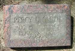
| Inscription | : | Father |
| Description | : | Matthew is the son of Michael Smith and Mary Ellen Greene. His father died on September 11, 1852, and was buried on the Immigration Trail, Burnt River, Durkee, Oregon. In later years the grave was not found. Newspaper article and Picture - 1919: CROSSED PLAINS IN 1852 -- M. C. Smith, Pioneer. Was a Mason since 1875. ALBION, Wash.: Dec. 23. Funeral services for M. C. Smth, who died suddenly at the family home, were held under Masonic rites, Reynolds lodge having charge of the service. Mr. Smith was born in Marion county, Iowa, January 31, 1841. He crossed... Read More |
frequently asked questions (FAQ):
-
Where is Matthew Clay Smith's memorial?
Matthew Clay Smith's memorial is located at: Sunset Memorial Gardens, North Charleston, Charleston County, USA.
-
When did Matthew Clay Smith death?
Matthew Clay Smith death on 19 Dec 1919 in Albion, Whitman County, Washington, USA
-
Where are the coordinates of the Matthew Clay Smith's memorial?
Latitude: 32.9300003
Longitude: -80.0569000
Family Members:
Parent
Spouse

Siblings
Children

Flowers:


Nearby Cemetories:
1. Sunset Memorial Gardens
North Charleston, Charleston County, USA
Coordinate: 32.9300003, -80.0569000
2. Johnson Cemetery
North Charleston, Charleston County, USA
Coordinate: 32.9268990, -80.0507965
3. Carolina Memorial Park
North Charleston, Charleston County, USA
Coordinate: 32.9281006, -80.0408020
4. Bee Cemetery
Hanahan, Berkeley County, USA
Coordinate: 32.9474100, -80.0182100
5. Oak Grove Baptist Church Cemetery
North Charleston, Charleston County, USA
Coordinate: 32.9019012, -80.0199966
6. Shield of Faith Church Cemetery
Goose Creek, Berkeley County, USA
Coordinate: 32.9341930, -80.0063240
7. Greater Bethel AME Church Cemetery
Goose Creek, Berkeley County, USA
Coordinate: 32.9352930, -80.0063160
8. Bethel A .M. E. Church
North Charleston, Charleston County, USA
Coordinate: 32.9015300, -80.0134200
9. Yeamans Park Presbyterian Church
Hanahan, Berkeley County, USA
Coordinate: 32.9135320, -80.0037600
10. Saint James Goose Creek Cemetery
Goose Creek, Berkeley County, USA
Coordinate: 32.9754400, -80.0326100
11. Trinity Missionary Baptist Church
Goose Creek, Berkeley County, USA
Coordinate: 32.9814970, -80.0320500
12. Moore Family Cemetery
North Charleston, Charleston County, USA
Coordinate: 32.9048744, -80.1247598
13. Castle Cemetery
Charleston County, USA
Coordinate: 32.8807983, -80.1025009
14. Historic African American Cemetery
Saint Andrews, Charleston County, USA
Coordinate: 32.8708354, -80.0826019
15. Pet Rest Cemetery & Cremation
Goose Creek, Berkeley County, USA
Coordinate: 32.9908490, -80.0362330
16. Yeamans Hall Plantation Cemetery
Goose Creek, Berkeley County, USA
Coordinate: 32.9268990, -79.9783020
17. African American Cemetery
Saint Andrews, Charleston County, USA
Coordinate: 32.8655640, -80.0809940
18. Philadelphia Missionary Baptist Church Cemetery
Ladson, Charleston County, USA
Coordinate: 32.9873314, -80.1043320
19. Rivers Cemetery
Goose Creek, Berkeley County, USA
Coordinate: 32.9866400, -80.0063980
20. Olive Branch Baptist Church Cemetery
Charleston, Charleston County, USA
Coordinate: 32.8892880, -80.1276560
21. NMC 1
Goose Creek, Berkeley County, USA
Coordinate: 32.9510713, -79.9736998
22. Middleton Place Gardens and Tomb
Dorchester County, USA
Coordinate: 32.9006386, -80.1370087
23. Saint Peter's AME Church Cemetery
North Charleston, Charleston County, USA
Coordinate: 32.8778343, -79.9947891
24. Middleton Place Slave Cemetery
Dorchester County, USA
Coordinate: 32.8991585, -80.1368332