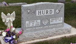
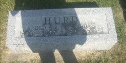
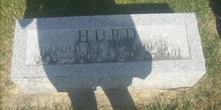
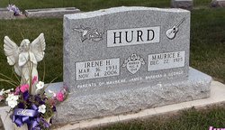
Maurice Edgar Hurd
| Birth | : | 22 Dec 1925 Maynard, Fayette County, Iowa, USA |
| Death | : | 25 Oct 2008 West Union, Fayette County, Iowa, USA |
| Burial | : | Richwood United Methodist Church Cemetery, Richwood, Gloucester County, USA |
| Coordinate | : | 39.7211100, -75.1667700 |
| Description | : | Maurice Edgar Hurd, 82, of Maynard, died Saturday, Oct. 25, at Palmer Lutheran Health Center, West Union, following a long illness. He was born Dec. 22, 1925, in rural Maynard, son of Harold and Nodah Cue Hurd. He married Irene Harriet Buenneke on Aug. 8, 1948, at St. Paul Lutheran Church, Maynard. She died Nov. 14, 2006. He graduated from Maynard High School in 1944. He worked at the Maynard Co-op Creamery and worked as a line forman for Contel Telephone Co. of Fayette. He was a member of St. Paul Lutheran Church, Maynard. Survived by: two daughters, Maurene (Tom) Arlington of Casco,... Read More |
frequently asked questions (FAQ):
-
Where is Maurice Edgar Hurd's memorial?
Maurice Edgar Hurd's memorial is located at: Richwood United Methodist Church Cemetery, Richwood, Gloucester County, USA.
-
When did Maurice Edgar Hurd death?
Maurice Edgar Hurd death on 25 Oct 2008 in West Union, Fayette County, Iowa, USA
-
Where are the coordinates of the Maurice Edgar Hurd's memorial?
Latitude: 39.7211100
Longitude: -75.1667700
Family Members:
Parent
Spouse
Siblings
Children
Flowers:
Nearby Cemetories:
1. Richwood United Methodist Church Cemetery
Richwood, Gloucester County, USA
Coordinate: 39.7211100, -75.1667700
2. Cost Family Cemetery
Pitman, Gloucester County, USA
Coordinate: 39.7307100, -75.1332310
3. Mount Zion Methodist Church Cemetery
Barnsboro, Gloucester County, USA
Coordinate: 39.7547540, -75.1629530
4. Manahath Cemetery
Glassboro, Gloucester County, USA
Coordinate: 39.7154236, -75.1141129
5. Driver Cemetery
Barnsboro, Gloucester County, USA
Coordinate: 39.7631000, -75.1554900
6. Saint Bridgets Cemetery
Glassboro, Gloucester County, USA
Coordinate: 39.7023300, -75.1159000
7. Saint Thomas Episcopal Church Cemetery
Glassboro, Gloucester County, USA
Coordinate: 39.7079200, -75.1101500
8. Mullica Hill Friends Cemetery
Mullica Hill, Gloucester County, USA
Coordinate: 39.7315712, -75.2244415
9. Trinity Bible Cemetery
Glassboro, Gloucester County, USA
Coordinate: 39.7003610, -75.1133800
10. Holy Name of Jesus Catholic Church Cemetery
Mullica Hill, Gloucester County, USA
Coordinate: 39.7411842, -75.2212982
11. Mullica Hill Baptist Cemetery
Mullica Hill, Gloucester County, USA
Coordinate: 39.7337837, -75.2258377
12. First United Methodist Church Cemetery
Glassboro, Gloucester County, USA
Coordinate: 39.7068900, -75.1081300
13. Saint Stephen's Episcopal Church Cemetery
Mullica Hill, Gloucester County, USA
Coordinate: 39.7388300, -75.2244400
14. Trinity United Methodist Church Cemetery
Mullica Hill, Gloucester County, USA
Coordinate: 39.7320251, -75.2273941
15. Hillcrest Memorial Park
Hurffville, Gloucester County, USA
Coordinate: 39.7491989, -75.1110992
16. Aura Methodist Cemetery
Aura, Gloucester County, USA
Coordinate: 39.6725006, -75.1374969
17. Jesse Chew Cemetery
Gloucester County, USA
Coordinate: 39.7736800, -75.1498250
18. Mount Calvary Baptist Church Cemetery
Mullica Hill, Gloucester County, USA
Coordinate: 39.7331009, -75.2371979
19. Bethel Methodist Church Cemetery
Hurffville, Gloucester County, USA
Coordinate: 39.7571983, -75.1110992
20. Hardingville Cemetery
Hardingville, Gloucester County, USA
Coordinate: 39.6632100, -75.1790400
21. Land Of Canaan Cemetery
Glassboro, Gloucester County, USA
Coordinate: 39.6741982, -75.1085968
22. Mantua Methodist Cemetery
Mantua, Gloucester County, USA
Coordinate: 39.7883160, -75.1663420
23. Bunker Hill Presbyterian Church Cemetery
Gloucester County, USA
Coordinate: 39.7451600, -75.0849200
24. Wenonah Cemetery
Wenonah, Gloucester County, USA
Coordinate: 39.7893982, -75.1622009

