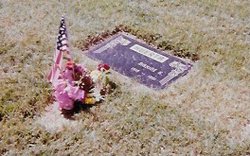
Maxine Kathyrn Miller Hood Huerta
| Birth | : | 9 Feb 1918 Antelope County, Nebraska, USA |
| Death | : | 27 May 1991 Garden Grove, Orange County, California, USA |
| Burial | : | Memory Garden Memorial Park, Brea, Orange County, USA |
| Coordinate | : | 33.9336014, -117.9024963 |
| Plot | : | Veterans Garden Section, Lot A space 1&2, Block 14, Section E |
| Description | : | Maxine Kathyrn Miller was born on February 9, 1918, in Tilden, Nebraska, her father, Albert, was 23, and her mother, Gladys, was 20. She was married three times and had one daughter, Marlus Kay Hood. Maxine married her first husband, Jack Foth, in Los Angeles, California, on October 5, 1940, when she was 22 years old. Jack Foth died on December 7, 1941 during the Japanese attack on Pearl Harbor, Hawaii. Maxine married her second husband, Raymond Douglas Hood, in Long Beach, California, on December 1, 1945. Raymond Douglas Hood died on January 3, 1960, in Anaheim, California. Maxine married... Read More |
frequently asked questions (FAQ):
-
Where is Maxine Kathyrn Miller Hood Huerta's memorial?
Maxine Kathyrn Miller Hood Huerta's memorial is located at: Memory Garden Memorial Park, Brea, Orange County, USA.
-
When did Maxine Kathyrn Miller Hood Huerta death?
Maxine Kathyrn Miller Hood Huerta death on 27 May 1991 in Garden Grove, Orange County, California, USA
-
Where are the coordinates of the Maxine Kathyrn Miller Hood Huerta's memorial?
Latitude: 33.9336014
Longitude: -117.9024963
Family Members:
Parent
Spouse
Siblings
Flowers:
Nearby Cemetories:
1. Memory Garden Memorial Park
Brea, Orange County, USA
Coordinate: 33.9336014, -117.9024963
2. Loma Vista Memorial Park
Fullerton, Orange County, USA
Coordinate: 33.9016991, -117.9167023
3. Queen of Heaven Cemetery
Rowland Heights, Los Angeles County, USA
Coordinate: 33.9818993, -117.9092026
4. Saint Andrews Episcopal Church Columbarium
Fullerton, Orange County, USA
Coordinate: 33.8745900, -117.9051200
5. First Presbyterian Church Memorial Gardens
Fullerton, Orange County, USA
Coordinate: 33.8788600, -117.9417400
6. Richard Nixon Library and Birthplace
Yorba Linda, Orange County, USA
Coordinate: 33.8894081, -117.8193588
7. Anaheim Cemetery
Anaheim, Orange County, USA
Coordinate: 33.8422012, -117.8981018
8. Olive Lawn Memorial Park
La Mirada, Los Angeles County, USA
Coordinate: 33.9038700, -118.0114400
9. El Campo Santo Cemetery
Industry, Los Angeles County, USA
Coordinate: 34.0182300, -117.9630500
10. Holy Cross Cemetery
Anaheim, Orange County, USA
Coordinate: 33.8236885, -117.9422226
11. Yorba Cemetery
Yorba Linda, Orange County, USA
Coordinate: 33.8646011, -117.7835464
12. Olive Grove Cemetery
Whittier, Los Angeles County, USA
Coordinate: 33.9452300, -118.0511700
13. Rose Hills Memorial Park
Whittier, Los Angeles County, USA
Coordinate: 34.0139900, -118.0253400
14. Mount Olive Cemetery
Whittier, Los Angeles County, USA
Coordinate: 33.9869003, -118.0453033
15. Broadway Cemetery
Whittier, Los Angeles County, USA
Coordinate: 33.9868088, -118.0460434
16. Saint Marthas Episcopal Church Columbarium
Covina, Los Angeles County, USA
Coordinate: 34.0655300, -117.9165200
17. Cinco Camp Burial Grounds
Cantil, Kern County, USA
Coordinate: 33.9277710, -118.0649960
18. Norwalk State Hospital Cemetery
Norwalk, Los Angeles County, USA
Coordinate: 33.9277710, -118.0649960
19. Saint Josephs Episcopal Church Columbarium
Buena Park, Orange County, USA
Coordinate: 33.8415590, -118.0280360
20. Forest Lawn Memorial Park
Covina, Los Angeles County, USA
Coordinate: 34.0628014, -117.8368988
21. Islamic Cemetery
Anaheim, Orange County, USA
Coordinate: 33.7930200, -117.8969800
22. Melrose Abbey Memorial Park
Anaheim, Orange County, USA
Coordinate: 33.7930984, -117.8944016
23. Spadra Cemetery
Pomona, Los Angeles County, USA
Coordinate: 34.0514400, -117.8009200
24. Cathedral Memorial Gardens
Garden Grove, Orange County, USA
Coordinate: 33.7880707, -117.8996887


