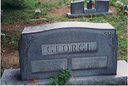
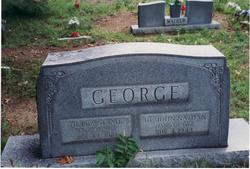
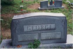
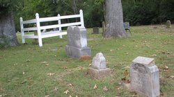
May Hulda Strait George
| Birth | : | 3 Oct 1881 Alpha, Yell County, Arkansas, USA |
| Death | : | 14 Jan 1974 Danville, Yell County, Arkansas, USA |
| Burial | : | Friendship Baptist Church Cemetery, Malone, Jackson County, USA |
| Coordinate | : | 30.9651909, -85.2013702 |
| Description | : | Mary "Hulda" Strait was the daughter of Powhatan "Bud" N. Strait and Olive (Whatley) Strait. Mary "Hulda" Strait married Dr. John Nathan George on 26 MAY 1901 in Yell County, Arkansas. |
frequently asked questions (FAQ):
-
Where is May Hulda Strait George's memorial?
May Hulda Strait George's memorial is located at: Friendship Baptist Church Cemetery, Malone, Jackson County, USA.
-
When did May Hulda Strait George death?
May Hulda Strait George death on 14 Jan 1974 in Danville, Yell County, Arkansas, USA
-
Where are the coordinates of the May Hulda Strait George's memorial?
Latitude: 30.9651909
Longitude: -85.2013702
Family Members:
Parent
Spouse
Siblings
Children
Flowers:
Nearby Cemetories:
1. Collins Chapel Cemetery
Malone, Jackson County, USA
Coordinate: 30.9647330, -85.1771900
2. Mount Zion Missionary Baptist Cemetery
Malone, Jackson County, USA
Coordinate: 30.9577200, -85.2401000
3. Snow Hill Cemetery
Malone, Jackson County, USA
Coordinate: 30.9786670, -85.1605610
4. Greater Saint Luke AME Church Cemetery
Malone, Jackson County, USA
Coordinate: 30.9528320, -85.1557000
5. Family Harvest Worship Center Cemetery
Grangeburg, Houston County, USA
Coordinate: 31.0085800, -85.2106400
6. McChapel AME Church Cemetery
Marianna, Jackson County, USA
Coordinate: 30.9273990, -85.2359410
7. Antioch Assembly of God Church Cemetery
Cottonwood, Houston County, USA
Coordinate: 31.0098991, -85.2246704
8. Rocky Grove Cemetery
Malone, Jackson County, USA
Coordinate: 30.9338890, -85.1504170
9. Pleasant Ridge Cemetery
Malone, Jackson County, USA
Coordinate: 30.9655080, -85.2663357
10. Hays Cemetery
Jackson County, USA
Coordinate: 30.9122009, -85.2281036
11. Bascom Assembly of God Church Cemetery
Bascom, Jackson County, USA
Coordinate: 30.9279790, -85.1339610
12. Coonrod Cemetery
Malone, Jackson County, USA
Coordinate: 30.9981003, -85.1288986
13. New Harmony Freewill Baptist Church Cemetery
Cottonwood, Houston County, USA
Coordinate: 31.0247580, -85.2452860
14. Triumph Church Cemetery
Grangeburg, Houston County, USA
Coordinate: 31.0241810, -85.1509600
15. Hickory Grove Cemetery
Malone, Jackson County, USA
Coordinate: 30.9821020, -85.1096140
16. Liberty Hill Church Cemetery
Bascom, Jackson County, USA
Coordinate: 30.9455710, -85.1094480
17. Bascom Baptist Cemetery
Bascom, Jackson County, USA
Coordinate: 30.9238900, -85.1193990
18. McNeally Cemetery
Jackson County, USA
Coordinate: 30.8924999, -85.2450027
19. Bascom Methodist Cemetery
Bascom, Jackson County, USA
Coordinate: 30.9239710, -85.1181330
20. Friendship United Methodist Church Cemetery
Grangeburg, Houston County, USA
Coordinate: 31.0203600, -85.1251700
21. Clayton Church Cemetery
Houston County, USA
Coordinate: 31.0513859, -85.2175293
22. Rogers Family Cemetery
Marianna, Jackson County, USA
Coordinate: 30.8999400, -85.1318700
23. Bethlehem Assembly of God Cemetery
Gordon, Houston County, USA
Coordinate: 31.0555400, -85.1904400
24. Pilgrims Rest Baptist Church Cemetery #2
Houston County, USA
Coordinate: 31.0259991, -85.1220016

