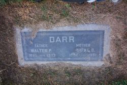
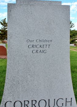
| Birth | : | 28 Mar 1887 Missouri, USA |
| Death | : | 31 Oct 1967 Kirksville, Adair County, Missouri, USA |
| Burial | : | Oak Hill Cemetery, Carrollton, Carroll County, USA |
| Coordinate | : | 39.3527985, -93.5111008 |
| Inscription | : | daughter of the rev war |
frequently asked questions (FAQ):
-
Where is Mayme Byrd Darr Craig's memorial?
Mayme Byrd Darr Craig's memorial is located at: Oak Hill Cemetery, Carrollton, Carroll County, USA.
-
When did Mayme Byrd Darr Craig death?
Mayme Byrd Darr Craig death on 31 Oct 1967 in Kirksville, Adair County, Missouri, USA
-
Where are the coordinates of the Mayme Byrd Darr Craig's memorial?
Latitude: 39.3527985
Longitude: -93.5111008
Family Members:
Parent
Spouse
Siblings
Children
Flowers:
Nearby Cemetories:
1. Oak Hill Cemetery
Carrollton, Carroll County, USA
Coordinate: 39.3527985, -93.5111008
2. Unnamed Cemetery #94
Carroll County, USA
Coordinate: 39.3541985, -93.5298004
3. Carroll Memory Gardens
Carrollton, Carroll County, USA
Coordinate: 39.3729430, -93.5092060
4. Saint Marys Cemetery
Carrollton, Carroll County, USA
Coordinate: 39.3835983, -93.4856033
5. McCandless Cemetery
Carroll County, USA
Coordinate: 39.3691000, -93.4656000
6. Campbell Cemetery
Carroll County, USA
Coordinate: 39.3908997, -93.5307999
7. Trotter Cemetery
Carrollton, Carroll County, USA
Coordinate: 39.3793983, -93.5569000
8. Unnamed Cemetery #58
Carroll County, USA
Coordinate: 39.3613014, -93.4466019
9. Smart Cemetery
Carroll County, USA
Coordinate: 39.3698997, -93.4355011
10. Willis Chapel Cemetery
Carrollton, Carroll County, USA
Coordinate: 39.3560982, -93.4293976
11. Powell Cemetery
Carroll County, USA
Coordinate: 39.4094000, -93.5544000
12. Cary Cemetery
Wakenda, Carroll County, USA
Coordinate: 39.3226800, -93.4207500
13. Thomas Cemetery
Carroll County, USA
Coordinate: 39.3658981, -93.4123001
14. Staton Family Cemetery
Carroll County, USA
Coordinate: 39.3764992, -93.4130020
15. Mount Zion Cemetery
Bogard, Carroll County, USA
Coordinate: 39.4352989, -93.5214005
16. Unnamed Cemetery #51
Carroll County, USA
Coordinate: 39.4334984, -93.5492020
17. McCroskie Creek Baptist Church Cemetery
Carroll County, USA
Coordinate: 39.3840179, -93.6199951
18. Unnamed Cemetery #93
Carroll County, USA
Coordinate: 39.2584991, -93.5141983
19. Williams Cemetery
Carroll County, USA
Coordinate: 39.2770000, -93.5860000
20. Austin Cemetery
Carroll County, USA
Coordinate: 39.2771988, -93.5864029
21. Hancock Cemetery
Carroll County, USA
Coordinate: 39.4295006, -93.4374008
22. Bethlehem Baptist Cemetery
Carroll County, USA
Coordinate: 39.4200000, -93.4220000
23. James Staton Cemetery
Carroll County, USA
Coordinate: 39.3485985, -93.3832016
24. Unnamed Cemetery #85
Carroll County, USA
Coordinate: 39.2863998, -93.6071014


