
| Memorials | : | 4 |
| Location | : | Carroll County, USA |
| Coordinate | : | 39.3840179, -93.6199951 |
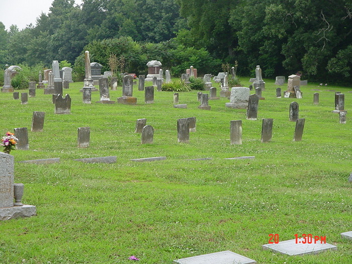
| Description | : | located on the land adjacent to (west of) the McCroskie Creek Baptist Church Cemetery in Trotter Township |
frequently asked questions (FAQ):
-
Where is McCroskie Creek Baptist Church Cemetery?
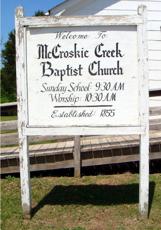
McCroskie Creek Baptist Church Cemetery is located at Carroll County ,Missouri ,USA.
-
McCroskie Creek Baptist Church Cemetery cemetery's updated grave count on graveviews.com?
2 memorials
-
Where are the coordinates of the McCroskie Creek Baptist Church Cemetery?
Latitude: 39.3840179
Longitude: -93.6199951

Nearby Cemetories:
1. Unnamed Cemetery #47
Carroll County, USA
Coordinate: 39.3558998, -93.6673965
2. German Methodist Cemetery
Norborne, Carroll County, USA
Coordinate: 39.3428001, -93.6500015
3. Trotter Cemetery
Carrollton, Carroll County, USA
Coordinate: 39.3793983, -93.5569000
4. Clowdis Cemetery
Carroll County, USA
Coordinate: 39.3386700, -93.6573500
5. Powell Cemetery
Carroll County, USA
Coordinate: 39.4094000, -93.5544000
6. Antioch Cemetery
Norborne, Carroll County, USA
Coordinate: 39.4083519, -93.7010498
7. Campbell Cemetery
Carroll County, USA
Coordinate: 39.3908997, -93.5307999
8. Kasriek Cemetery
Carroll County, USA
Coordinate: 39.4556999, -93.5977020
9. Unnamed Cemetery #51
Carroll County, USA
Coordinate: 39.4334984, -93.5492020
10. Trinity Lutheran Cemetery
Norborne, Carroll County, USA
Coordinate: 39.3293991, -93.6844025
11. Stempel Cemetery
Norborne, Carroll County, USA
Coordinate: 39.3270780, -93.6829730
12. Unnamed Cemetery #94
Carroll County, USA
Coordinate: 39.3541985, -93.5298004
13. Street Cemetery
Bogard, Carroll County, USA
Coordinate: 39.4606018, -93.5969009
14. Providence Cemetery
Norborne, Carroll County, USA
Coordinate: 39.3511009, -93.7230988
15. Carroll Memory Gardens
Carrollton, Carroll County, USA
Coordinate: 39.3729430, -93.5092060
16. Oak Hill Cemetery
Carrollton, Carroll County, USA
Coordinate: 39.3527985, -93.5111008
17. Union Baptist Church Cemetery
Roads, Carroll County, USA
Coordinate: 39.4486008, -93.7021027
18. Mount Zion Cemetery
Bogard, Carroll County, USA
Coordinate: 39.4352989, -93.5214005
19. Sacred Heart Cemetery
Norborne, Carroll County, USA
Coordinate: 39.2914009, -93.6247025
20. Ebenezer Cemetery
Bogard, Carroll County, USA
Coordinate: 39.4692001, -93.5691986
21. Smith Cemetery
Carroll County, USA
Coordinate: 39.4813995, -93.6205978
22. Unnamed Cemetery #85
Carroll County, USA
Coordinate: 39.2863998, -93.6071014
23. Unnamed Cemetery #26
Carroll County, USA
Coordinate: 39.4808006, -93.5985031
24. Fairhaven Cemetery
Norborne, Carroll County, USA
Coordinate: 39.2991982, -93.6903000