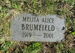
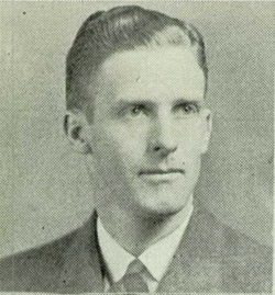
Melita Alice Snair Brumfield
| Birth | : | 21 Jun 1919 Black Point, Halifax County, Nova Scotia, Canada |
| Death | : | 13 Oct 2001 Beckley, Raleigh County, West Virginia, USA |
| Burial | : | St. Michael's Burial Ground, Bath, Bath and North East Somerset Unitary Authority, England |
| Coordinate | : | 51.3838810, -2.3594090 |
| Description | : | (Oct 14, 2001) MELITA ALICE BRUMFIELD, 82, of Frankford, formerly of Huntington, widow of Millard Otis Brumfield, died Saturday in Beckley Appalachian Regional Hospital. She was owner of Brumfield Flower Shop, Huntington. Survivors include two sons, Dr. James Otis Brumfield of Huntington and Dr. Mike Brumfield of Frankford; and one brother, Sidney James Snair of Palm Harbor, Fla. Funeral 2 p.m. Tuesday at Beard Mortuary, Huntington; burial in Spring Hill Cemetery, Huntington. Friends may call from noon to 2 p.m. Tuesday at the mortuary |
frequently asked questions (FAQ):
-
Where is Melita Alice Snair Brumfield's memorial?
Melita Alice Snair Brumfield's memorial is located at: St. Michael's Burial Ground, Bath, Bath and North East Somerset Unitary Authority, England.
-
When did Melita Alice Snair Brumfield death?
Melita Alice Snair Brumfield death on 13 Oct 2001 in Beckley, Raleigh County, West Virginia, USA
-
Where are the coordinates of the Melita Alice Snair Brumfield's memorial?
Latitude: 51.3838810
Longitude: -2.3594090
Family Members:
Parent
Spouse
Siblings
Children
Flowers:
Nearby Cemetories:
1. St. Michael's Burial Ground
Bath, Bath and North East Somerset Unitary Authority, England
Coordinate: 51.3838810, -2.3594090
2. Ss Michael & Paul Churchyard
Bath, Bath and North East Somerset Unitary Authority, England
Coordinate: 51.3834970, -2.3596980
3. Quaker Meeting House
Bath, Bath and North East Somerset Unitary Authority, England
Coordinate: 51.3823280, -2.3604380
4. Bath General Hospital Burial Ground
Bath and North East Somerset Unitary Authority, England
Coordinate: 51.3824715, -2.3614742
5. Bath Abbey
Bath, Bath and North East Somerset Unitary Authority, England
Coordinate: 51.3815310, -2.3586640
6. St. Mary de Stall Churchyard (Defunct)
Bath, Bath and North East Somerset Unitary Authority, England
Coordinate: 51.3813350, -2.3600353
7. St Mary's Chapel, Queens Square
Bath, Bath and North East Somerset Unitary Authority, England
Coordinate: 51.3827790, -2.3649790
8. Old Orchard Street Catholic Burial Vault
Bath, Bath and North East Somerset Unitary Authority, England
Coordinate: 51.3800370, -2.3579910
9. St James Old Burial Ground
Bath, Bath and North East Somerset Unitary Authority, England
Coordinate: 51.3798600, -2.3610100
10. St. Swithin Churchyard
Bath, Bath and North East Somerset Unitary Authority, England
Coordinate: 51.3885480, -2.3594500
11. St. Mary's Churchyard
Bathwick, Bath and North East Somerset Unitary Authority, England
Coordinate: 51.3876120, -2.3543540
12. St. John the Baptist Churchyard
Bathwick, Bath and North East Somerset Unitary Authority, England
Coordinate: 51.3886890, -2.3547030
13. Walcot Methodist Chapel Burial Ground
Bath, Bath and North East Somerset Unitary Authority, England
Coordinate: 51.3897080, -2.3579610
14. Saint Mark's Churchyard
Widcombe, Bath and North East Somerset Unitary Authority, England
Coordinate: 51.3766660, -2.3588010
15. Baptist Burial Ground
Widcombe, Bath and North East Somerset Unitary Authority, England
Coordinate: 51.3764216, -2.3556947
16. St Mary Magdalen Chapel
Widcombe, Bath and North East Somerset Unitary Authority, England
Coordinate: 51.3760486, -2.3643405
17. St. James' Cemetery
Bath, Bath and North East Somerset Unitary Authority, England
Coordinate: 51.3802000, -2.3722200
18. Old Baptist Burial Ground
Walcot, Bath and North East Somerset Unitary Authority, England
Coordinate: 51.3755070, -2.3544360
19. Abbey & St James' Graveyard for the Poor
Widcombe, Bath and North East Somerset Unitary Authority, England
Coordinate: 51.3753550, -2.3545640
20. Independent Burial Ground Argyle Chapel
Bath, Bath and North East Somerset Unitary Authority, England
Coordinate: 51.3925420, -2.3536920
21. Quaker Burial Ground
Widcombe, Bath and North East Somerset Unitary Authority, England
Coordinate: 51.3744350, -2.3498460
22. Smallcombe Vale Cemetery
Bathwick, Bath and North East Somerset Unitary Authority, England
Coordinate: 51.3757400, -2.3429400
23. St Thomas à Becket's Church
Widcombe, Bath and North East Somerset Unitary Authority, England
Coordinate: 51.3734250, -2.3465560
24. St. Mary The Virgin Churchyard
Bathwick, Bath and North East Somerset Unitary Authority, England
Coordinate: 51.3759930, -2.3411930


